河道沿岸区域国土空间管控问题探讨
2021-09-03闵皓
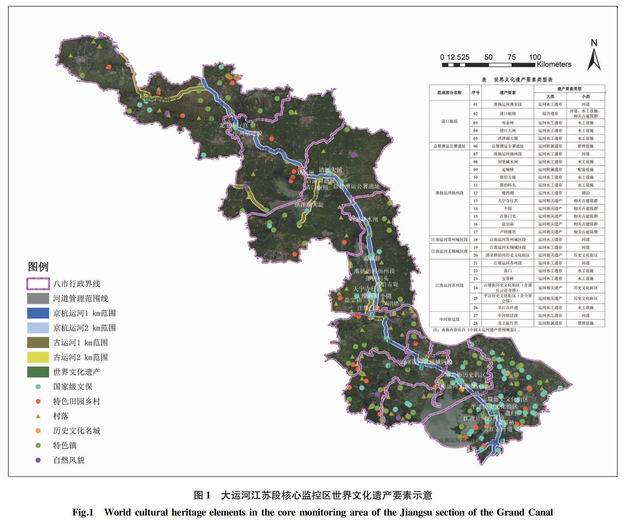
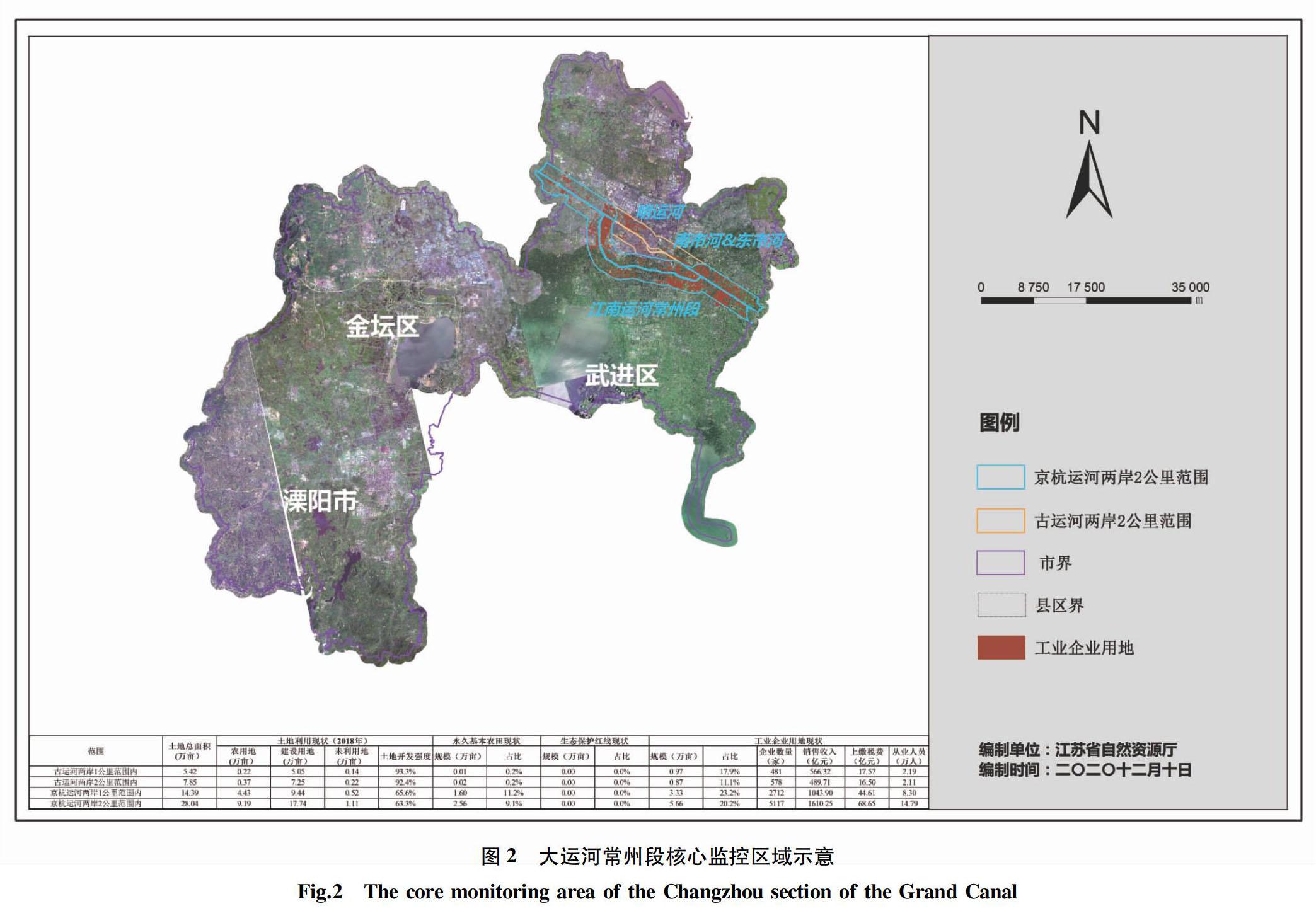
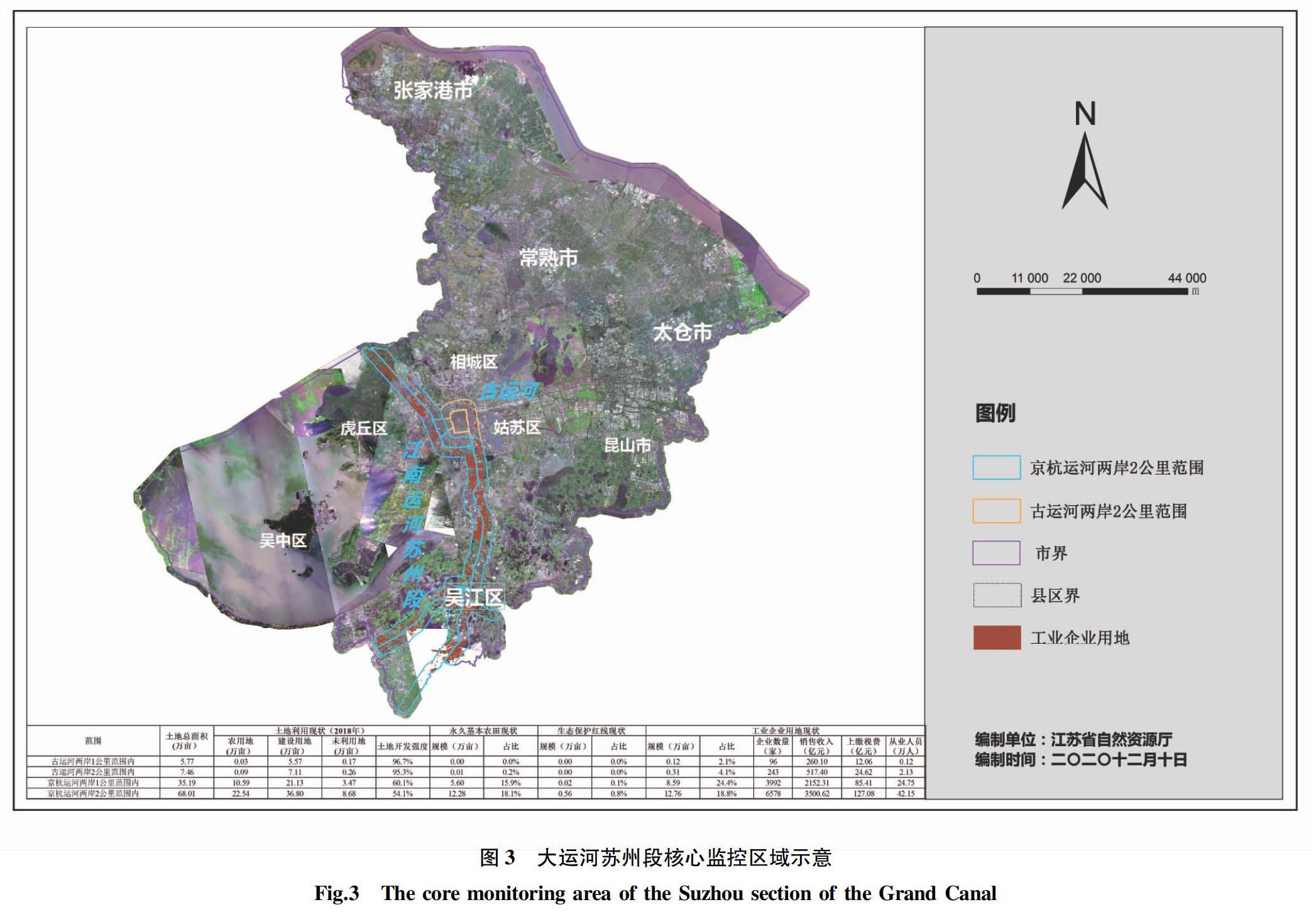
摘要 随着国家生态文明建设理念的发展与落实,以牺牲生态环境换取经济发展带来的一系列问题亟待解决。以大运河江苏段核心监控区为例,通过现状分析深入研究其河道沿岸区域国土空间管控存在的问题和可能产生的影响,结合相关国土空间规划的原则,针对性地提出一些建议。
关键词 河道沿岸;国土空间;管控问题;大运河
中图分类号 TU 984.18 文献标识码 A
文章编号 0517-6611(2021)14-0076-04
Abstract With the development and implementation of the concept of national ecological civilization in China, a series of problems brought by sacrificing ecological environment for economic development need to be solved urgently. This article took the core monitoring area of the Jiangsu section of the Grand Canal River as an example, based on the analysis of the current situation, this paper made a deep study on the existing problems and possible impacts of the territorial space control in the region along the river channel. Combined with the principles of relevant land and space planning, this article put forward some suggestions.
Key words Riverbanks; Territorial space; Control problems; Grand Canal
作者簡介 闵皓(1986—),男,江苏南京人,硕士,从事国土空间用途管制方面研究。
收稿日期 2021-06-11
习近平总书记提出:“大运河是祖先留给我们的宝贵遗产,是流动的文化,要统筹保护好、传承好、利用好”。为贯彻落实习总书记的重要提示,中办、国办印发《大运河文化保护传承利用规划纲要》,要求运河沿线各地抓住大保护,不搞大开发,着力加强生态环境保护修复。同时,不仅要治理大运河沿岸区域的空间,而且有更多的河道沿岸区域国土空间需要被管控治理[1]。笔者以大运河江苏段核心监控区为例,研究其沿岸现状、存在的问题和可能产生的影响,结合国土空间规划的原则,对大运河江苏段核心监控区域管控措施提出一些建议,以期帮助规范和引导河道沿岸区域建设的风貌[2]以及空间形态、优化提升大运河两岸的生态空间质量。
1 现状分析
大运河江苏段核心监控区国土空间现状具有如下特征:①开发强度高。城河相依共生,核心监控区内(含古运河)土地开发强度约38.5%,沿河1 km范围内约41.8%。……
