北京市大兴地区一次雨夹雪、冰粒、霰、雪的过程分析
2020-05-19薛禄宇赵晨王璐
薛禄宇 赵晨 王璐
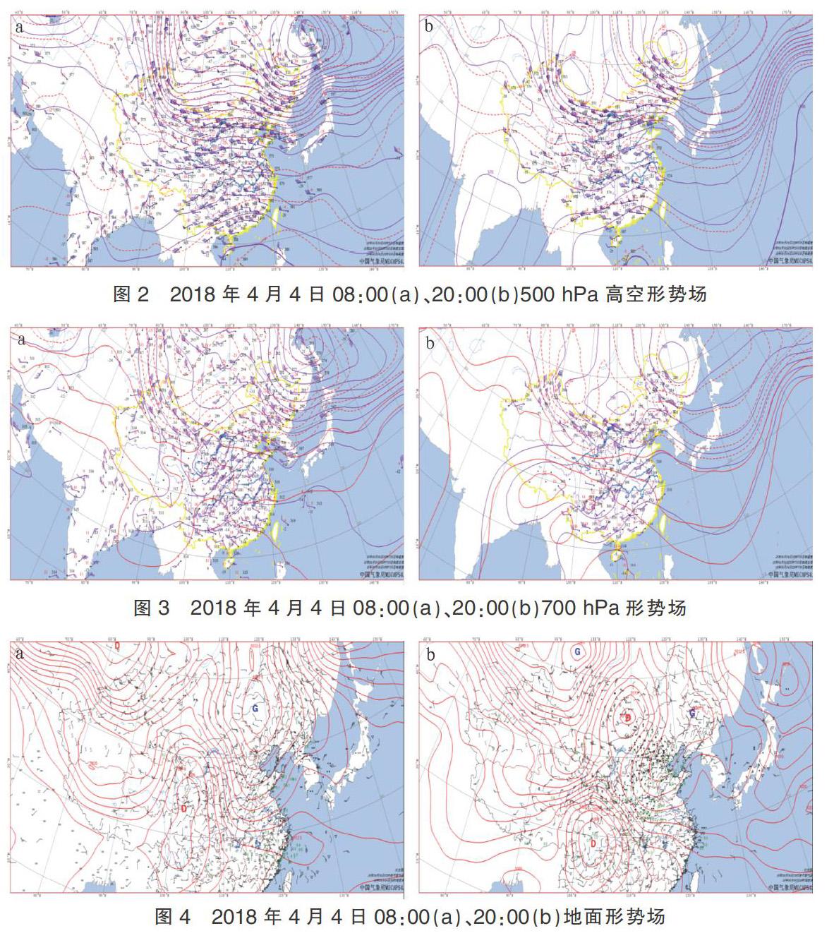
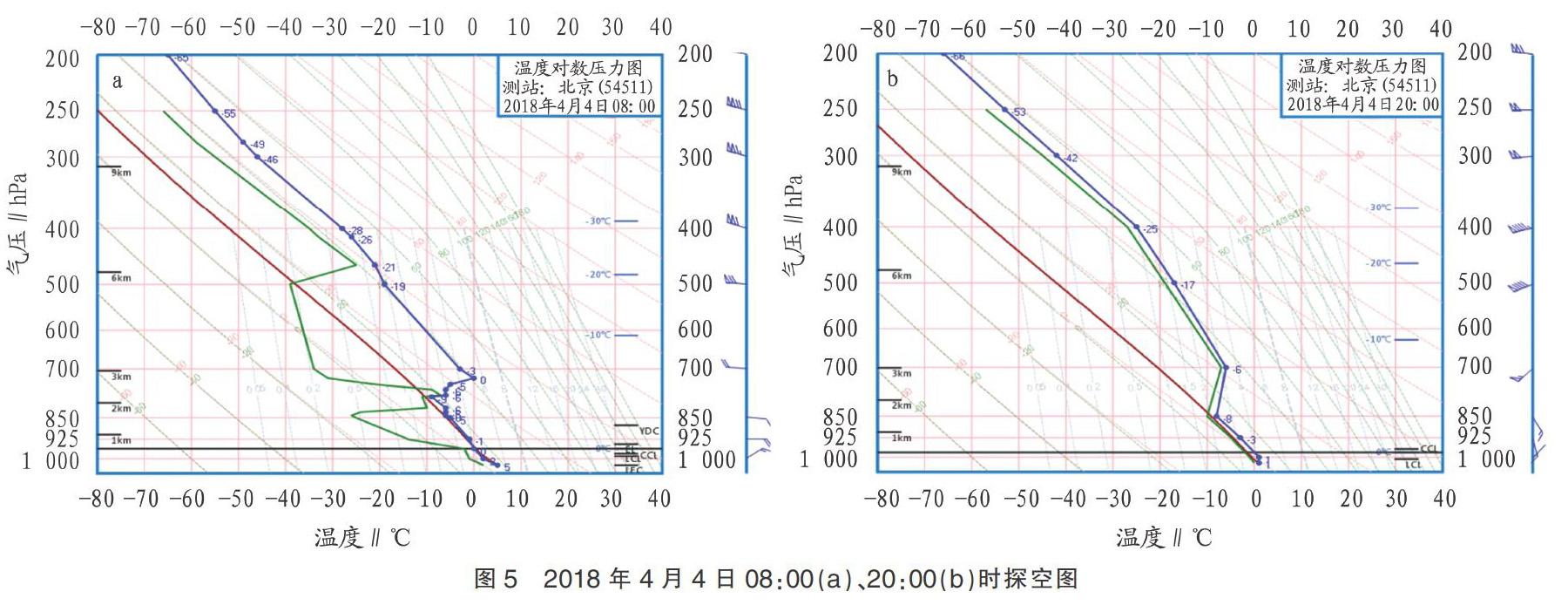
摘要 利用常规探测资料对2018年4月4—5日北京大兴地区一次回流降水天气过程中先后雨夹雪、冰粒、霰、雪的过程出现进行诊断分析。结果表明,此次过程是在高空短波槽、700 hPa切变线和急流、地面冷空气回流的共同作用下产生的;700 hPa上存在逆温,对流层中上层存在不稳定能量,是造成多相态降水发生的重要因素。
关键词 暴雪;回流;急流;霰;雨滴谱
中图分类号:P458 文献标识码:A 文章编号:2095-3305(2020)02-059-02
DOI: 10.19383/j.cnki.nyzhyj.2020.02.023
Analysis of a Multiphase Precipitation Process with Sleet,Ice Pallets,Graupels and Snow in Daxing District of Beijing
XUE Lu-yu et al(Meteorological Bureau of Daxing District,Beijing 102600)
Abstract Using routine detection data,the diagnostic analysis of sleet,ice pallets,graupels and snow in a circumfluence precipitation process in Daxing District of Beijing on April 4-5,2018 was carried out. The results showed that the process was caused by the combined action of short wave upper trough,shear line on 700 hPa,jet and surface cold air circumfluence. The most important factors for the occurrence of multiphase precipitation were the inversion layer on 700 hPa and the unstable energy in the upper and middle troposphere.
Key words Heavy snow;Circumfluence;Jet;Graupels;Raindrop size distribution
北京位于華北平原西北部,东临渤海湾,西临太行山,北倚燕山,地势自西北向东南倾斜,形成一个背山面海的特殊地形。大兴地处北京南部,全景为永定河冲击平原,地势平缓。在11月至翌年3月的冬半年冷空气活动频繁,常常带来大风、降温、扬沙等天气。因西南暖湿气流活动受限,空中大尺度的水汽输送难以形成,降水量一般不大,仅占全年降水量的4%左右。
1 降水情况及雨滴谱特征
2018年4月4日14:00后,北京自西南向东北出现雨雪,累计降雪量为大雪,全市平均降水量10.6 mm,超过1/3的站点达暴雪量级。大兴地区平均降水量8.8 mm。累计降水量最大值出现在大兴区旧宫镇,为10.8 mm。
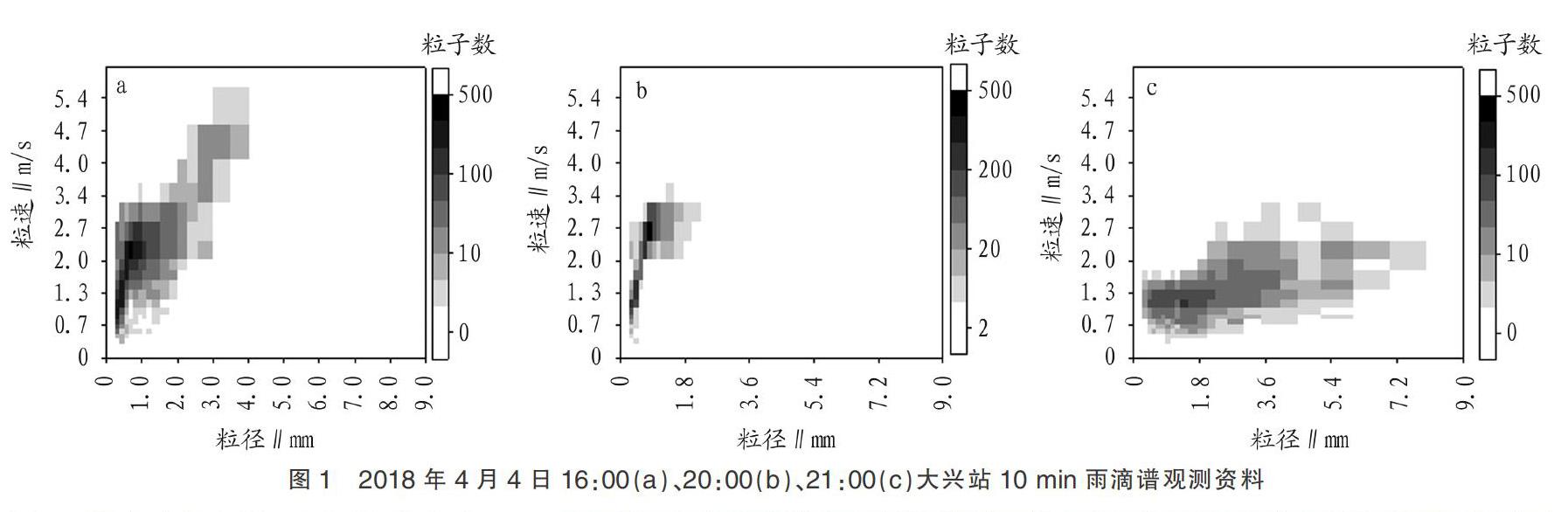
4日16:00,大兴区还出现了雷暴天气。且此次过程相态复杂,先后出现了雨夹雪、冰粒、霰、阵型雨夹雪、雪。从图1大兴站的雨滴谱观测资料也能看到,4日16:00,降水粒子多,且直径稍大,速度最快,呈霰的特征。20:00,降水粒子明显少于16:00,且直径小,速度稍慢于16:00,呈雨夹雪特征。21:00后降水粒子进一步减少,但粒子较16:00、20:00直径大,速度明显偏慢,呈雪的特征。……