2019年2月20—21日三明市强对流天气过程分析
2020-05-19潘志玲王丹平
潘志玲 王丹平
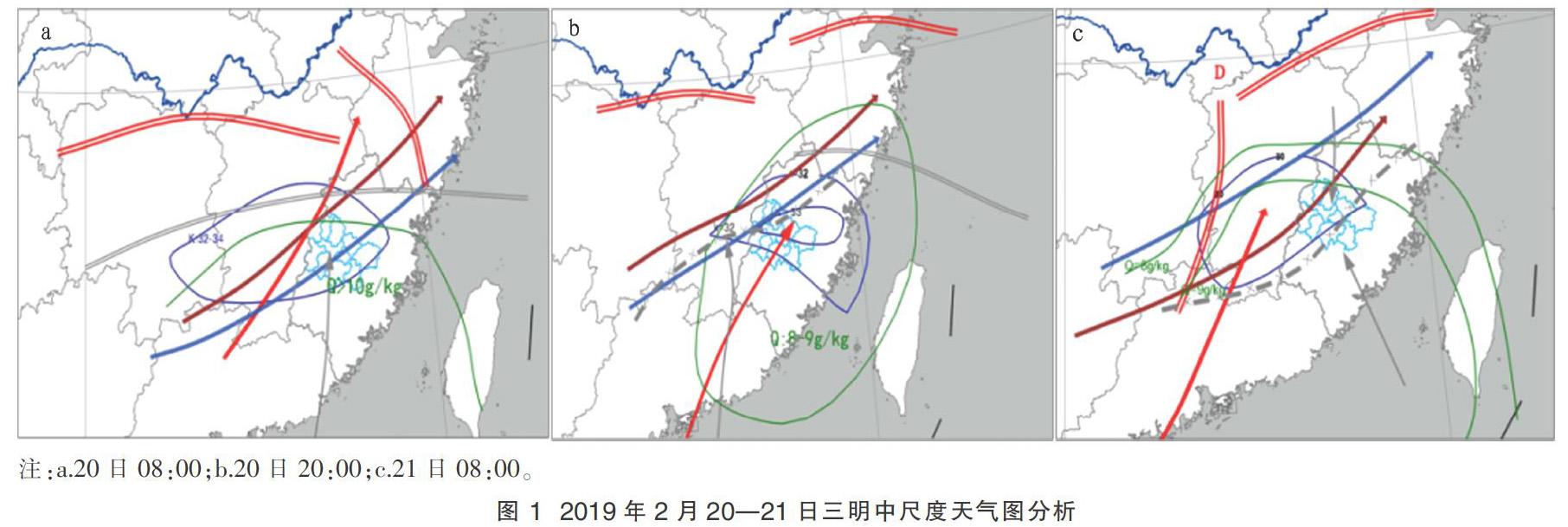
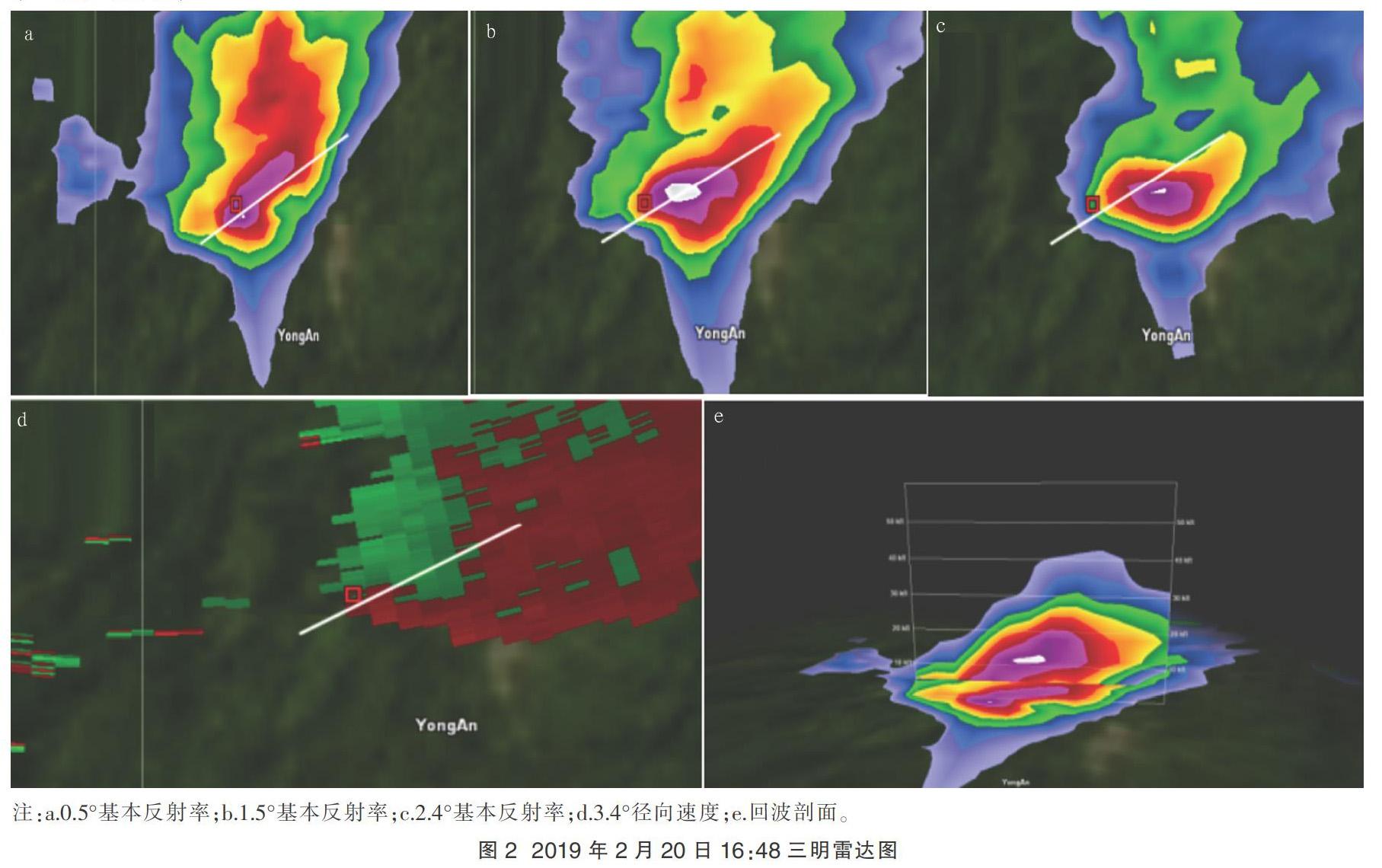
摘要 利用常规气象观测资料、多普勒雷达资料对2019年2月20—21日福建省三明市强对流天气过程形成机制进行分析。结果表明,此次强对流天气过程以雷雨大风和冰雹为主,属于暖区降水,降雹类型为暖平流强迫型。西南急流为此次强对流过程提供水汽、不稳定能量,低层辐合系统对强对流触发和维持有重要指示作用。对流云团回波特征明显,出现钩状回波、“V”型缺口和三体散射长钉。此次风暴单体强质心位于0℃与-20℃高度,利于雹胚发展,但对大冰雹增长不利。
关键词 强对流天气;冰雹;雷达
中图分类号:P458.1 文献标识码:A 文章编号:2095-3305(2020)02-117-02
DOI: 10.19383/j.cnki.nyzhyj.2020.02.046
Analysis of Severe Convective Weather Process in Sanming from February 20 to 21,2019
PAN Zhi-ling et al(Meteorological Bureau of Taining County,Taining,Fujian 354400)
Abstract The formation mechanism of severe convective weather process in Sanming City of Fujian Province from February 20 to 21,2019 was analyzed by using conventional meteorological observation data and Doppler radar data. The results showed that the strong convective weather process was mainly thunderstorm,gale and hail,which belonged to warm precipitation,and the hail type was warm advection forced type.The southwest jet provided water vapor and unstable energy for the strong convection process,and the low level convergence system played an important role in triggering and maintaining the strong convection.The echo characteristics of convective clouds were obvious,such as hook echo,V?-notch and three body scatter spike.The strong centroid of the storm cell was at the height of 0℃ and -20℃,which was beneficial to the development of hail embryo,but unfavorable to the growth of large hail.
Key words Severe convective weather;Hail;Radar
強对流天气是由中小尺度天气系统产生的灾害性天气,每年春夏季是我国强对流频发时段。近年来随着卫星、雷达及数值预报技术的发展,强对流研究、预报有了极大进步,但其突发性和落区不确定性仍是预报业务难点。国内外许多学者都对强对流天气作了大量分析研究。Schultz等利用闪电跃增算法监测和区分对流系统是普通对流还是强对流[1]。许爱华等归纳我国中东部地区强对流主要分为冷平流强迫类、暖平流强迫类、斜压锋生类、准正压类、高架对流类5种类型[2]。由于地区差异往往造成强对流天气复杂性,并且在2月出现强对流概率也较小。2019年2月20日08:00至21日08:00三明市出现一次强对流天气过程,伴有雷电、冰雹、短时强降水、6~8级大风。此次强对流造成全市烟叶受损58 hm2,对农业生产造成严重影响。笔者对2019年2月20—21日发生在福建三明的强对流过程进行综合分析,为本地化强对流天气预报和服务作贡献。……