基于激光扫描数据正交投影分析的建筑物提取研究
2017-05-11娄静谊
娄静谊
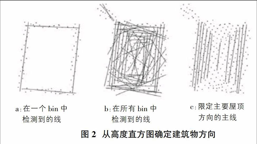
摘要: 激光扫描点云数据可以利用特定直观程序进行投影,帮助理解理数据中的建筑物结构。这类程序已经被广泛应用到自动建筑物模型建模中。该方法从高度直方图面元的分析中导出建筑物方位,并利用该方位产生点云的正交二维投影,其中屋顶平面作为点云的线。通过线跟踪算法提取表示这些平面的线段。在随后的处理步骤中,对线段进行延伸刨平,并且平面被用于分析与矩形形状的偏差。将两个或更多相邻平面分组以生成三维建筑模型。现有二维GIS数据可以用于该过程中以提供机载激光扫描数据集的可靠分割并且支持生成实际建筑物建模的假设。
Abstract: Laser scanning point cloud data can be projected using a specific intuitive program to help understand the structure of the data in the building. Such procedures have been widely used in automated building modeling. The method derives a building orientation from the analysis of a high-degree histogram bin and uses the azimuth to generate an orthogonally two-dimensional projection of the point cloud, where the roof plane is the line of the point cloud. The line segments representing these planes are extracted by a line tracking algorithm. In the subsequent processing steps, the line segments are stretched and the plane is used to analyze deviations from the rectangular shape. Two or more adjacent planes are grouped to generate a three-dimensional building model. Existing 2D GIS data can be used in this process to provide reliable partitioning of the onboard laser scan dataset and generate hypotheses that support realistic building modeling.
关键词: LiDAR;点云数据;分割;建筑模型建模
Key words: LiDAR; point cloud data;segmentation;building model reconstruction
中图分类号:TP391.4 文献标识码:A 文章编号:1006-4311(2017)14-0147-03
0 引言
激光雷达Lidar在最近十年间崭露头角并逐渐进入主流的一种遥感技术,它实用性强,比如用于DEM提取和三维建模等。甚至国外已经用Lidar实现了城市三维模型建立。Lidar直接测得带有地理坐标的密集点云,并不能直观地给人们描述其所需要认识的研究对象,为此往往需要对点云进行一系列的处理,然后方能提取出人们想要得到的信息。
目前,关于点云的处理已经有多种的流程和框架,其中点云分割技术就是期间重要的一步。通常只有在完成点云分割技术处理之后才能再进行建模、三维建模。本研究中涉及的点云数据的建筑物重建技术,从高度直方图面元的分析中导出建筑物方位,并利用该方位产生点云的正交二维投影,其中屋顶平面作为点云的线。……