万水河多年景观生态变化分析
2015-07-21韩泽治
韩泽治
抚顺市环境科学研究院 辽宁抚顺 113006
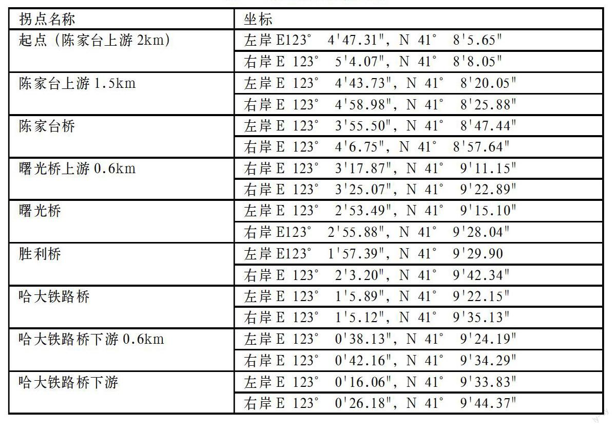
摘要: 2013年鞍山市政府对万水河立山段进行了生态综合整治,拟从景观生态学分析万水河立山段多年来的景观生态学指标的变化情况。研究纵向范围选择在万水河陈家台断面上游2km至哈大铁路桥下游1km,横向范围选择在河流水道中心两侧各200m。应用地理空间信息数据,在GIS软件平台采用目视解译的方式,对河流廊道内的景观类型斑块、单个斑块进行分类和信息提取,利用景观优势度的分析方法对提取的数据进行初步运算后,将万水河的生态斑块变化特征进行数据统计,结合河流的生态属性变化进行分析。多年来河道两侧研究范围内的景观由城市下垫面占优势变为以河岸绿地及河道植物绿地占据优势,由上述分析可以得出,万水河立山段的河道生态整治初见成效,万水河河道生态总体正在向良好方向发展转变。
关键词: 万水河 景观生态 优势度
中图分类号:X171文献标识码:A 文章编号:1672-3791(2015)06(a)-0000-00
Analysis of Wanshui river landscape ecological changes
Han Zezhi
Fushun Research Institute of Environmental Science Fushun, Liaoning 113006
Abstract: Anshan government implemented a comprehensive ecological remediation to Lishan reach of Wanshui River in 2013, and made a study on the changes of landscape ecology index over the years using the landscape ecology method. The longitudinal range of this study, from the Wanshui river Chenjiatai reach upstream within the scope of 2km to the Harbin-Dalian railway bridge downstream within the scope of 1km, is selected as a study area, and the transverse range covers 200m of the river channel center. Based on the geographic information data and visual interpretation method by the platform of GIS software, analyses including landscape type patch, single patch and information extract, has been conducted. Moreover, the integrated analysis of landscape superiority, and ecological patch changes, and river ecological attributes has been also analyzed. The results of this study shows that 1) landscape dominant has been transferred from urban underlying surface to riparian green space, and to greenbelt with riparian plants; 2) the ecological restoration of the Lishan reach of Wanshui River have achieved initial success, and the ecological environment is developing to in the good direction.
Keywords: Wanshui River, landscape ecology, landscape superiority
万水河原名南沙河,发源于千山仙人台,南与海城河相邻,东为汤河。它是流经鞍山市城区的最大河流,上游有大孤山、千山、眼前山、胡家庙、金家岭和风水沟等6条较大支流,于陈家台桥上游先后汇入主流,其中千山溪流是主河道。流域面积458km2,立山水文站以上属山丘区,流域面积330km2,占全流域的72%,立山水文站以下为平原区,流域面积128km2,河道全长67km,在鞍山境内41km,市区立山段河长13km,于辽阳县南坨子汇入太子河,河宽一般80~100m。……
