柬埔寨的洞里萨湖:干扰性水利工程与传统生态知识之间的迭代
2022-03-22比利时布鲁诺梅尔德比利时凯莉香农贾绿媛王晞月
著:(比利时)布鲁诺·德·梅尔德 (比利时)凯莉·香农 译:贾绿媛 校:王晞月
1 自然水文过程干预工程
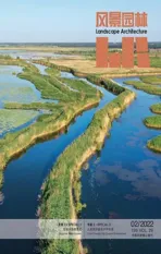
洞里萨湖(Tonle Sap Lake)是东南亚最大的永久性淡水湖和湿地生态系统(图1)。它位于1 000年前“柬埔寨平台”(Cambodia platform)沉降所形成的西北—东南地质断层带上,发源于湄公河的支流洞里萨河并汇聚众多区域径流,平均海拔15~20 m[1]31,[2]46。洞里萨湖95%的汇水区位于柬埔寨,5%位于泰国[3]1723。水动力学模型表明,该湖的大部分水源(53.5%)来自湄公河干流,34%来源于支流,还有12.5%来源于降水[3]1729。洞里萨湖是湄公河三角洲的重要组成部分,作为天然的蓄水池,洞里萨湖在湿润西南季风为主导的时期(5—10月)发挥着区域防洪功能,在旱季(11月—次年4月)又为下游广大地区提供水源(图2),因此享有“跳动的心脏”的美誉。此外,洞里萨湖还因为一个特别的现象而声名远扬:在季风季节(即雨季)湄公河水量大涨注入洞里萨河后,湖面会从2 300 km2扩大至5 000 km2,湖水深度由1.44 m增至10.30 m[4]1415(图3)。洞里萨湖旱季(最低水线)和雨季(最高水线)的水线相差10 km,这里的“水线”(waterline)是一个相对性的术语,指湖水水平边缘线,因为湖水水平边缘有一种微妙的湿度梯度,它可能延伸到很多公里外,也可能在某一范围内徘徊[5]8(图4)。
洞里萨湖洪泛区包含5种生境群:1)开放水域(1年中12个月都处于水下);2)廊道森林(每年被洪水淹没9个月);3)以灌木丛和草地为主的季节性淹没区(每年被洪水淹没5~8个月);4)过渡区,以废弃耕地、稻田和低地草原为主(每年被洪水淹没1~5个月);5)雨水灌溉区,主要包括雨季稻田和村庄(每年被洪水淹没时间少于1个月)[1-3]。丰沛的水量和广泛的冲积区为多样的物种创造了有利的生长环境,这使得洞里萨湖成为世界上最高产的淡水生态系统之一。季节性的水文动力将陆地营养物质带入水中,滞洪区的廊道森林和灌木丛为自湄公河洄游而来的鱼类提供了丰富的产卵、孵化、栖息和摄取营养的场所[4]1415。洞里萨湖的鱼类等水产品约供给了目前柬埔寨蛋白质总摄取量的80%[6]5427。
高棉人(Khmer)有超过1 200年历史传统水管理方式,他们建立的水利设施之全面、精妙和复杂,令人难以置信。吉蔑族(Mon-Khmer)的早期聚居点位于湄公河中下游流域带有防御性堤坝和护城河的圆形土丘上,并散布在被农田包围和森林分割的土地上。他们构筑了房屋,通过社区(人)建立和管理的人工运河(高棉语:prek,位于天然河流河岸后面的运河水渠)和池塘(高棉语:beng),在旱季将雨季蓄积的洪水排入农田,灌溉后汇入河流[1]3-4,[7]45。人们环湖居住于被称作Kampong(马来语,意为“登陆点”)的聚居区内,这些聚居区布局井然有序,与地势较高的村庄(种植水稻)相互依存。如今洞里萨湖区共生活着170多万人[6]5423,有不少城市和较大的村庄紧临5号和6号国道,国道与堤坝共同发挥着控制洞里萨湖泛洪区扩张的作用(图5)。
在吴哥帝国时期(802—1432年),历代国王在建造了一系列无与伦比的寺庙的同时,还修建了复杂的灌溉系统,将东北部的库伦山(Kulen Hills)与湖泊相连(图6)。吴哥帝国位于洞里萨湖一个较小的一个洪泛区内,城市规划“整合山、城市和水,形成了有序且富有象征意义的系统”[1]14。这个庞大且高度工程化的农业–城市景观在前工业化时期堪称举世无双[8]。到了13世纪,吴哥的城市核心区面积达35 km2,城区总面积达1 000 km2[8]。庞大而精巧的水系统是其构建农业–城市景观的基础,其中,植被也发挥了重要作用,因为除宗教建筑外,包括皇宫在内的所有建筑都由木头或茅草建造而成。吴哥的城市景观由城市建设与景观工程结合而成,使地区在人口不断扩张的情况下仍然能够保持稳定的农业用地和食物产量[8]。高棉人精心修建了由运河、水坝、人工建造的蓄水池(高棉语:baray,由堤坝围合,与自然河流相通,可提供灌溉用水)和挖掘的池塘(高棉语:trapeang,用于收集雨水,供家庭生活用水和小规模农业浇灌用水)构成的水调蓄网络(图7)。人工蓄水池在雨季储蓄雨水,旱季用于灌溉。现在已经干涸的东池(East Baray,于890年建成)就是一个大型的人工湖(1.8 km×7.5 km),由暹粒河(Siem Reap River)提供水源,东池东部有4~5 m高的挡土墙(图8)。几个世纪后,出现了西池(West Baray,2.1 km×7.8 km)。此外,在这个水系统中,还有一系列规模较小的人工蓄水池。为了纪念神灵和祖先,高棉人修建了一系列的圣殿山(有些圣殿山位于人工蓄水池中)作为各个国王的陵墓,旨在展示高棉帝国的至高无上(图9)。吴哥城的面积远远超过了由护城河所环绕的寺庙区以及网格状街区所划分的城内和城外区域的面积[8]。在吴哥帝国的全盛时期,吴哥城人口近75万人。


图9 西巴莱湖规模宏大的护城河The majestically-scaled moat of the West Baray
几个世纪以来,高棉人的农业–城市景观逐步完善,但始终是一个有着强烈几何秩序的高度工程化的系统,并且形成了一个复杂的、以水为基础的农业–城市网络。红色高棉统治时期(1970—1979年)完成了工程的重要一步,建成了一个百年的全国性农业骨干工程,包括350多个大型水库(水坝)和众多水渠、运河水网(其中主运河长达7 000 km、宽度超过10 m,每隔100 m就为一系列小的运河和沟渠提供水源)。这些小规模的水利基础设施占据了数万平方公里的土地,并通过水系将这里划分成1 km×1 km的网格[9]。运河水网支撑了作为国家经济发展基础产业——水稻种植业的规模扩张,并推进了森林和农业平衡发展的新人居环境模式的形成。种植区主要集中在洞里萨湖周边的平原,尤其是西北部(Sisophon市附近)。
上述大规模水利设施的运营是建立在“对水资源全面、细致的计算方法上的”[10]104。区域内地貌特征和水文条件的差异使得不同区域的灌溉方式不同,这既反映出人们在建造过程中对场地的深入了解,又体现了当时对中国工程技术的学习。区域内有6种类型、规模不一的水资源管理方式:内部水管理、外部水管理、连通性水管理、水存储、地形控制系统及运河水管理[10]1114。这些水利基础设施提供的空间载荷力,能够锚固更多的人居环境体系。
2 基于水的生计活动与公共资源的管理
湄公河下游流域系统的生态,包括洞里萨湖在内,都与柬埔寨人民的经济、文化和自我认知密不可分[11-12]。洞里萨湖独特的水位变化维系着当地各种以水为基础的生计活动。反过来,这些生计活动通常又可支撑相关副业的生产活动,进而引发大规模人口和村庄的季节性迁徙[13]。社会的职业活动反映了洞里萨湖的物态多样性,湖泊是大量高棉人及暹粒–高棉人(Sino-Khmer)、占族(Cham,高棉伊斯兰教)和越南人(被认定为合法的外来人)等民族的家园。每个群体都占据着一个“文化生态位”[14]。信奉佛教的高棉人主要从事自给自足的水稻种植,并在洪水淹没期在稻田里开展小规模的渔业活动。虽然讲高棉语的暹粒–高棉人在该地区的农业活动最少,但他们凭借传统贸易商的身份以及资本获取渠道,成为当地特许的商业渔民。自1471年以来,湄公河三角洲的占族穆斯林开始从事农业和渔业。而后,在洞里萨湖附近又聚居了大量的越南人。
如今,洞里萨湖的年捕鱼量位居世界商业捕鱼量的第4位,年产量超70万吨[15]2。湖中设置有各种各样的竹篱和捕鱼器,包括传统的箭形篱笆捕鱼系统,以及近些年出现的捕鱼效果显著但会破坏生态环境的电捕鱼系统、尼龙网和刺网等。洞里萨湖以其物种多样性而闻名,湖中已被识别的物种超过200种,其中有100种是捕捞中经常出现的物种[2]85。生物学家将湖中的鱼分为“白鱼”(white fish)和“黑鱼”(black fish)。白鱼大部分时间生活在水流较快的“白水”(white water)中,每年都有漫长的洄游和产卵期(将卵和幼虫带到洪泛区),生理周期与洪水周期同步,雨季时其在营养丰富的洪泛区觅食。黑鱼的游动距离较短,全年集中在洪泛区活动,在湖边的廊道森林(淡水红树林)和灌木丛中产卵[2]。在法国殖民之前,洞里萨湖以及柬埔寨的所有自然资源(包括森林和土地)都属于国王,但管理松散,按照惯例,人们可以通过开垦土地的方式获得土地权并定居,森林和水域是开放可进入的。法国殖民后一定程度上变更、破坏并取缔了这一制度。在诺罗敦(Norodom)国王统治时期(1864—1904年)①,制定的新法规对渔具、捕鱼器的大小和类型做出规定并对渔场进行分类。国王还通过向中国大亨出售许可证的方式谋取利润[16]。

按照发展生产增加税收的理念,法国殖民者制定了一系列促进私有化的法律使非正式的活动合法化,涉及1884年的土地改革、1889年的林业局建立和1908年颁布的渔业法。吸引投资的商业性捕鱼区取代了传统的鱼类养殖和捕捞区,许多当地渔民被迫放弃捕捞。各种竞争下形成了复杂的管理系统,如在1911年成立了第一个旨在控制和管理商业性捕鱼区的渔业协会。到了20世纪20年代,人们意识到洪泛区的廊道森林作为鱼类的产卵地具有重要的生态价值,因而,在洞里萨湖洪泛范围内出现了保护区。“保护”在当时被理解为:必须限制对自然的开发,坚决恢复和保护生态。在红色高棉统治时期,商业性捕鱼基本废弃,捕鱼业整体停滞,只有少量捕鱼区可用于向领导层供鱼和向中国出口[15]270。由于红色高棉时期的重点是发展农业,当地鱼类资源因人类干扰的减少而蓬勃发展。
20世纪80年代,渔业的恢复被重新提上日程,1987年颁布的《渔业法》将渔业划分成3个层次:家庭渔业(基本生计)、中等规模渔业(个体经营)和大规模渔业(工业、商业)。全年准许家庭渔业的捕捞,而其他2类捕捞只在11月至次年6月开放。捕鱼区每半年进行一次拍卖,卖给价高者[2,15]。随着腐败、侵占和偷猎活动的出现,人们的争议和不满逐渐加大。2012年,政府废除了给私人租赁捕鱼区的规定,将捕鱼区分给社区用于渔业生产,并划定了17个保护区(面积相当于之前租赁区面积的35%),使禁捕区达到25个[17]453(图10)。虽 然 与Wilson[18]提 出 的“平分地球原则”(half-earth principle,保护地球50%的领土不被人类占用)崇高目标相去甚远,但确实限制了人类的过度开发。
人们早就认识到了洞里萨湖与河流、山林生态之间的相互依存关系。即使在红色高棉时期,人们也意识到了城市化发展与森林、水生态之间密不可分的关系。Pol Pot说:“……森林是可以伐除的,但我们必须设定一个限度。如果我们砍尽了洞里萨湖周围所有的森林,10年后的洞里萨湖就会干涸;我们将没有水源,也没有鱼。并且当湄公河河水不再流入洞里萨湖时,洞里萨湖就会面临干涸,而湄公河下游的金边及周边地区将全部被湄公河淹没。”[9]132今天共同水资源管理的成功得益于政府管控和洞里萨河周边社区及其上游居民的集体行动。
柬埔寨环境部(1994年根据皇家法令成立)负责“保护”水和森林,而农林渔业部则负责管理这些资源的开发利用。尽管有书面形式的法规条文,但现实却与法规要求格格不入。当地森林中不仅有非法开发的道路,还存在大量的非法砍伐和猎杀野生动物的行为。此外,还有大面积森林被伐除后用于土地倒卖。森林砍伐造成了当地气温上升,洪水、土壤侵蚀和淤积量增加。1997年,联合国教科文组织宣布将洞里萨湖划为生物圈保护区。此外,柬埔寨有5个被公约认定的拉姆萨尔湿地(Ramsar site),具有国际保护意义,其中有3个湿地位于洞里萨湖,即:1)西北上游地区的普列托尔鸟类保护区(Prek Toal,21 342 hm2,2015年列入);2)中东部地区的Boeng Chhmar野生动物保护区以及周边河流水系和洪泛区(28 000 hm2,1999年列入);3)洞里萨湖、斯登森河(Stung Sen)和湄公河三水交汇处附近的斯登森区域(9 293 hm2,2018年列入)[19]。根据柬埔寨法律规定,这3个核心区属于“严格保护区”,禁止任何自然资源开发活动[19]750。

最后,了解柬埔寨的历法和节气非常必要,因为其与生计休戚相关。受洪水和鱼类洄游影响,洞里萨湖的鱼类在11月—次年4月的旱季最为丰富;到了雨季,鱼类大幅度减少,水稻种植成为首要的经济活动,以捕鱼为生的村民可进行渔具制作,并通过晾晒、熏制、发酵等对鱼类进行加工。高棉人的新年在每年的4月中旬(以当地公历计)。在作物收割后,人们焚烧放牧地块并期盼5月季风和降雨的到来。在陆地的水稻种植区,只要土壤中有足够的水分将土壤软化,就可以建立苗床,再在7—8月将幼苗移栽到田间。深水水稻(水稻在生长季内至少1个月淹没深度超过50 cm)[2]可在2月开始整地,5月—6月中旬(取决于降水情况)进行耕作和播种。浮水水稻种植在水深大于100 cm的地区,不进行移栽,也不使用化肥(很少使用杀虫剂),长达5~6 m的空心茎使得水稻在丰水期可浮在水面上,在1—2月由人工用镰刀收割,但浮水水稻的产量较低。传统的高茎水稻凭借其高度和长茎可在浅水区茁壮生长。深水水稻的2个变种在柬埔寨都有悠久的种植历史,早在13世纪就有记载。在20世纪30年代,水稻种植面积达540 000 hm2,而到了1960年,种植面积减少到70 000 hm2[2]54。如今,水稻种植区主要集中在磅同省(Kampong Thom)附近,这里散布着1 600 km2的季节性草原。由于该地区每年有6个月不适合居住,人们每年1月开始迁徙。
3 适应性特征
尽管这里有大量村庄迁徙,但仍有不少村民常年居住在洞里萨湖上或周边地区,他们的住宅具有与水的动态变化高度适应的结构。房子都是木结构(木材是柬埔寨传统建房材料,石料只用于寺庙),因为在当地人的认知里,生命起源于木制的摇篮,而后到木制的房屋,最后是木制的棺材或是用于火葬的木盒。建筑与木材关系密切,木材不仅是材料,还是领域标识。树木和森林是高棉文化的核心内容。“柬埔寨人非常信仰来自祖先灵魂(Neak ta)的无形力量”[20]41,他们相信这些力量栖息在高大的树木上。这一信仰,对人们选择木材、村庄布局与空间组织等方面都有影响。此外,村庄和房屋的选址与关于“荒野”环境的描述有关,人们通常会选址在能躲避“荒野”的安全区域,以确保免受栖息在野外的无形力量的伤害。“森林是荒野的、未知的,而村庄是人和神灵和谐相处的地方”[20]48。对于生活在湖面或湖畔的村民来说,雨季持续不断的季风会让洞里萨湖变得“可怕、充满野性和恐怖”,季节性变化的湖水强化了森林的“荒野”特征[20]48。
人类的定居不可避免地会导致砍伐上述的“荒野”森林。在5号和6号国道内侧的水上渔村和湖畔高脚屋呈环状围绕于堤坝(位于历史上经常性淹没的洪泛区边缘,图11)。大约有8万人居住在水上渔村[20]44,这些村庄随水的动态变化而不断调整形态:在旱季多排布成分散而离心的线型,在雨季则倾向于集中式、向心的组合方式。实际上,水上渔村的移动更多地展现了人们对自然环境变化的响应。在旱季,“宽阔而平静的洞里萨湖面”[20]48聚集了大量水上渔村,而在雨季,这些渔村都退至较安宁的河口以躲避变化的湖水。村庄的选址和布局是与湖泊的两个极端水量环境动态适应的结果,景观和聚落相辅相成。水上渔村的房屋居住面积较小,通常建在浮桶支撑的木平台上,由竹子和水生植物建成,方便移动(图12、13)。
住宅以及公共设施(商业建筑、学校、寺庙、清真寺等)的类型与湖水水位变化相适应。水上渔村和高脚屋均采用梁柱结构,针对雨季水位的快速上升,高脚屋还设有结构支撑系统。高脚屋的形成较早,已有数代的居住历史,多分布于廊道森林附近,并通过水渠或溪流与湖水相连。20世纪40年代以来,传统生态知识(traditional ecological knowledge,TEK)使住在高脚屋的诸多长者养成了森林保护的思想,并积极抵制农业的扩张。在湖区的6个省中,班迭棉吉省(Bantay Meanchey)、暹粒省(Siem Reap)和磅清扬省(Kampong Chhnang)3个省内尤其流行使用高脚屋[21]3。高脚屋的支柱(多由细长的木条制成)有6~7 m高。在旱季,高脚屋的村庄以土路为中心,房屋在路两侧排列;在雨季,所有的房屋只能通过水路进出。房屋通常由木头和茅草制成,但随着居民财力的增加,会使用瓦片和瓦楞金属板作屋顶。这些房屋宽3~8 m,长6~20 m,具体规模取决于居民的富裕程度[22]8。在最干旱的月份里,许多村民养殖猪、鸭、鸡和鳄鱼(养在鱼笼上方的浮笼中,用风信子和从湖中收获的鱼养殖,牲畜的排泄物又为水中的鱼类提供营养和食物),并进行家庭园艺。此外,有些家庭会迁移到开阔的湖面上,在那里建立临时住房,以便于养殖和捕鱼(图14、15)。高棉人房屋的内部一般是单开间,“与其他文化群体(越南人、占族穆斯林和中国人)房屋空间单元截然不同”[20]49。

图13 水上渔村的村落形态随湖水的变化而变化,在雨季,单从水面形态上看高脚屋也变成了水上渔村The morphology of the floating village changes with the flood pulse of the lake as the elevated dwellings become only water-based during the monsoon season

图14 甘邦鲁浮村的高脚屋村落沿Rolous河的一条路(14-1),该路在雨季需乘船进入(14-2)The stand-stilt village of Kampong Phluk along the Rolous River and an earthen road(14-1) becomes only accessible by boat in the monsoon season (14-2)
4 大型水利工程与TEK之间的迭代
洞里萨湖在区域、流域、国家和地方层面都有着重要的生态、社会和政治意义。历史上的洞里萨湖一直是可调节下游水量的大型水库和拥有极丰富水生生物资源、承载大量社会活动的大型内陆渔业区。然而,由于自然资源受到不同程度的开发,导致与社会之间冲突不断,湖泊许多方面的丰富性受到威胁。能源和全球变暖是洞里萨湖功能转变的主要因素。湄公河流域已有的和待建的水电大坝对洞里萨湖的水文环境有很大影响。根据2032—2042年预测模型显示,水电站大坝的运行将导致旱季水位升高(估计比目前的水位提高0.5~0.9 m,湖水的蓄水面积将增加18~31%)、洪峰值降低,这将导致湖水的水位波动曲线变缓,洪泛区面积缩小(至少减少75%)。然而,关于气候变化是否会影响洞里萨河的汛期水位,结果不得而知(原因是大气环流模型和流域排放水平之间有差异)[6]5422。此外,“最近的地质活动”显示,整个盆地正在下沉,西北地区的下沉程度低于南部地区,导致盆地向南倾斜(并形成了大面积的可淹没的廊道森林)[1]48。新的洪水模式将对洪泛区的生境产生不利影响(破坏鱼类产卵、鸟类和其他物种觅食和繁殖所需的廊道森林、灌木丛和草地);当地的水产能力也会下降,进而造成重大的社会和经济危机。淹没区廊道森林的消亡以及上游大规模的森林砍伐,将对河水流量以及侵蚀、沉淀和淤积等过程产生显著影响。虽然上游洪泛区的农业面积很可能会增加,但鱼类资源的减少将不可避免地导致区域自给自足能力下降,这一变化,会加大该地区对于粮食进口的依赖。
此外,生态旅游及与之相关的不同类型、规模的基础设施建设(包括暹粒国际机场)也会受到影响,因为大部分的生态核心区会被永久淹没[1]5427。众多新建的基础设施(带来大规模生态破坏的同时加重了国家财政负担)将面临闲置和废弃的境地。与此同时,在过去20年里,爆炸式的旅游开发严重破坏了该地区的生态健康,成群结队的游客踩踏在吴哥遗址上,造成了明显破坏。显然,众多考古遗迹(如历史上的伊卡利亚水利工程)被植物大幅度吞噬,大自然正在以毫不过分的方式,对人类古代遗迹进行报复。红色高棉时期的水利工程、殖民时期的基础设施也在遭受同样的命运。有意思的是,人类的侵占活动仍在这些巨大废墟的阴影中继续着。虽然人类的行为情有可原(以至于法国殖民者曾声称自己发现了遗址),但我们事后认识到,人类的行为并未改写或改造自然,人类只不过是在尊重自然建构的逻辑的基础上重复进行自我刻画而已。

图15 高脚屋高高的立柱保护村庄结构在雨季不受洪水侵袭,并创造了一个依赖于水的生活环境The tall stilts protect the village’s structures during the monsoon season and create a water-only based living environment
近些年,TEK在生物多样性保护方面发挥着重要作用。总体而言,当地居民通过努力扩大领土,企图占有更多类型的场地,增加可用资源,减少单一资源波动所带来的风险。传统的管理方式不断演变,“传统知识的‘传统’不在于它的古老性,而是在于它获取和使用的方式”(注:原文强调的重点)[23]22。数千年来,最初的管理者是部族长者和知名人士,并组织当地居民开展水资源管理的集体活动[1]10。平原上的灌溉系统,包括吴哥城的人工蓄水池,已经年久失修,也许最终可以像Molyvann提议的那样被重新利用。这种再利用显然不是单纯地对高棉帝国的伊卡利亚水利工程进行恢复性重建,而是在人与自然的反复调和下,形成一种新的设施,使之更好地适应当下需求并具有可持续性。对艺术品进行保护是生态恢复的手段[24],也可支持农业和聚落的复兴,在这一点上,可能没有比吴哥城更有说服力的例子了。与此同时,应注重森林、水岸植被与水系统之间的依存关系。以社区为单位的林业和渔业管理成为当地资源管理的具体手段,表明人们意识到了自殖民主义以来砍伐式资源猎取方式的弊端,并在过去几十年间的新自由主义时期,向着保护性开发的方向发展。
不过,TEK是否能够解决人口激增、气候变化和极度贫困所带来的危机,还有待探索。对这些传统知识的重新运用意味着,自19世纪后,随着新自由主义政策的实施和持续的私有化方案和运动的开展,土地使用权极端不平等的情况有所缓解。几个世纪以来,各种尊重自然的活动在这片土地上正在持续发生,从高棉帝国大规模水利工程的修建到红色高棉时期的反城市化战略,再到法国殖民时期的掠夺活动和公共土地私有化,以及新自由主义所带来的土地开垦活动,再到军事行动和游击队内战,最后到不同程度上强制要求的保护理念。由此可见,TEK引导各族民众以传统信念支撑社会实践,由此建立起与自然环境相适应的人居空间,构建了人、自然和聚居地和谐共生的环境,居民将自己锚固而不是凌驾于这些建筑物之上,因此,他们更像是在模仿自然,在不承担过多传承职责的基础上营建新的传统。在Henneghan的理解中,恢复是建立在过去的状态之上的,而不是对过去状态的重建[24]。
世界范围内,TEK被广泛应用于现实生活、历史复兴等方面,为人们寻找以尊重自然资源为前提、建立符合地域文化和特殊语境的人居环境方法提供了替代性的解决方案。因而,TEK在德语中具有双重含义:即指导性(在政策或治理模式中)和使命性(在行动、计划、愿景等方面)。TEK理念的兴起,意味着对自然和文化、现代和传统、工程建设和生态等提出了挑战。这些知识揭示了古代工程及管理模式蕴含的智慧,是长期发展过程中,人类不断适应自然、人口变化及整治环境所形成的。面对全球气候危机,TEK更是为人类建设用地和非建设用地的生态修复提供了现实而有效的解决方案。乡土营建技术和TEK揭示了土地利用的复杂关系,其中大部分内容是反对新自由主义的发展模式,并倾向于公众。TEK向西方科学生态知识(scientific ecological knowledge, SEK)发出挑战,前者所包含的世界观和道德观更受人们的推崇。笔者对洞里萨湖的研究揭示了什么是TEK,揭示了历史上大型工程建设和生态环境反复迭代中人们是如何在一个特定的环境(自然环境或其附近)中定居的,并且,这一体系还能支持自殖民主义以来自相矛盾的资源开发和自给自足的多种发展模式。
注释:
① 法国殖民统治时期(1863—1953年)任命的第一位君王。
图片来源:
图1、9、11©凯 莉·香 农;图2、3、5、7、8、10、12~15由本文作者基于实地调查、湄公河三角洲区域计划和柬埔寨开放发展信息的RUA 2021绘制;图4、6来源于艾克斯省国家海洋档案馆(编号为:OF-TOL-17010983,OF-TOL-17010974)
(编辑/李清清)
Cambodia’s Tonle Sap Lake: Iterating Between Disruptive Water Engineering and TEK
Authors: (BEL) Bruno De Meulder, (BEL) Kelly Shannon
Translator: JIA Lyuyuan Proofreader: WANG Xiyue
1 Natural Hydrology Engineered
The Tonle Sap Lake is the largest permanent freshwater lake and wetland ecosystem in Southeast Asia. The environs of the lake host numerous productive landscapes and settlements (Fig. 1). It lies on a northwest-southeast geological fault line and was created by subsidence of the “Cambodian platform”millennia ago; it occupies an area with an average altitude of 15-20 meters above sea level[1]31,[2]46.It is fed by the Tonle Sap River, a tributary of the Mekong and runoff of numerous catchments;95% percent of the Tonle Sap Lake catchment is in Cambodia, while 5% is in Thailand[3]1723. A hydrodynamic model found that majority (53.5%)of the lake’s water originates from the Mekong mainstream, while the lake’s tributaries contribute 34% of the annual flow and 12.5% is derived from precipitation[3]1729. The lake is an important component of the Mekong River Delta, often referred to as its “beating heart” since as a natural floodwater reservoir it performs as flood protection in the wet southwest monsoon season (May-October) and assures dry season flows (November-April) to vast areas downstream (Fig. 2). It is renowned for a remarkable phenomenon where during the monsoon season the massively increased flows from the Mekong reverses the direction of the Tonle Sap River and the lake’s coverage expands from 2,300-15,000 square kilometers and from 1.44-10.30 meters depth[4]1415(Fig. 3). The distance of the maximum and minimum waterlines is approximately 10 kilometers, although “waterline”is a relative term since the edge of the lake is a subtle gradation of wetness that stretches for many more kilometers that is continuously moving back and forth[5]8. For millennia, there has been an interplay of natural and engineered systems for the area’s complex water management (Fig. 4).
The Tonle Sap floodplain is divided into five distinct habitat groups: 1) open water (under water 12 months a year); 2) gallery forest (annual flood duration of 9 months); 3) seasonally flooded habitats dominated by shrublands and grasslands(flooded 5-8 months); 4) transitional habitats,nowadays dominated by abandoned agricultural fields, receding rice/floating rice, and lowland grasslands (flooded 1-5 months); 5) rainfed habitats,consisting mainly of wet season rice fields and village crops (flood duration less than 1 month)[1-3].The rich alluvial fans and immense inundation host an extremely high level of biodiversity. The Tonle Sap is among the most productive freshwater ecosystems in the world. The dynamic hydrology of the seasonal inflow flood pulse transfers terrestrial nutrients into the aquatic system and the flood plain’s gallery forest and scrublands offer rich grounds for the water-flow migration of eggs, fry and fish from the Mekong River[4]1415. The lake’s fisheries and aquaculture account for approximately 80% of the current protein consumption of Cambodia[6]5427.
Traditional water management regimes of the Khmer are more than 1,200 years old and always have been astonishingly comprehensive, drastic and sophisticated. Early settlements of the Mon-Khmer were located along the middle and lower valley of the Mekong and were dominated by a circular geometry of mounds with defensive embankments and moats. They were dispersed across the territory,surrounded by agriculture fields and separated from one another by forests. They had raised houses and an ingenious system of communally built and managed man-made prek (canals located behind the natural embankments of riverbanks) and beng(ponds), a system that choreographed flood water into the fields and back towards the river at the dry season[1]3-4,[7]45. Around the lake, people lived in villages called kampong (“landing place” in Malay);they operated as a constellation and were interdependent on the slightly higher-land rice-growing villages. Altogether, the Tonle Sap has more than 1.7 million people[6]5423. Today there are a number of cities and larger villages directly adjacent to national roads 5 and 6 which function as a continuous dike,constraining the flood plain around the lake (Fig. 5).
During the Khmer Empire of Angkor(802-1432), successive kings built not only a collection of unrivalled temple precincts, but also a complex irrigation system — connecting the Kulen Hills in the northeast to the lake (Fig. 6). Angkor is located on one of the narrowest and steepest parts of the Tonle Sap floodplain. Its urban planning“integrates the mountain, the city, and water into an ordered and productive symbolic system”[1]14.The enormous, highly engineered and essentially an agro-urban landscape was without parallel in the preindustrial world[8]. Already by the 13thcentury,merely the urban core of Angkor encompassed 35 km2while the extensive urban complex stretched over 1,000 km2[8]. The ingenious water system formed the backbone of the agro-urban landscape,in which also forestry no doubt played a role since,except for the religious buildings, all construction was, even the royal palaces, in wood or thatch. The urban landscapes in Greater Angkor combined urban intensification and landscape engineering in which a very large population “was highly dependent on the delivery of consistent agricultural yields from an extended agro-urban landscape”[8].The Khmers development of a carefully engineered network of canals, dams, barays (artificial reservoirs connected to the natural river regime made by embankments or dykes that were a means of both irrigation and transport) and trapeang (excavated ponds for collecting rainwater used by households for drinking, bathing, watering animals, small-scale hydro-agriculture, etc., Fig. 7). The barays stored water during the torrential monsoons to be used for irrigation in the dry season (Fig. 8). The now dry East Baray (completed in 890) was a monumental artificial lake, fed by the Siem Reap River,measuring 1.8 km by 7.5 km; its eastern retaining walls are 4~5m high. The enormous West Baray(2.1 km by 7.8 km) came centuries later (Fig. 9).A collection of smaller barays complemented the water supply system. A series of Temple Mountains were built (sometimes as islands within the barays) to honour gods and ancestors, serve as mausoleums for the various kings and display the Khmer Empire’s omnipotence. Urban space continued far beyond the moated precincts of the temples and rectilinear grids encompassed intramural as well as extramural areas[8]. In its heyday, the urban landscape of Angkor may have supported a population approaching 750,000.
The Khmer agro-urban landscape was gradually defined over centuries, but always as a highly engineered system with a strong geometrical order and converging into the complex, water based,agro-urban net. A last significant step in radical engineering came during the reign of the Khmer Rouge (1970–1979) that created a major rural engineering project for almost the whole country,with the construction of more than 350 large water reservoirs (dams), numerous dykes and an extensive net of canals (at least 7,000 km main canals of at least 10 meters wide that fed series of perpendicular smaller canals or ditches, evenly spaced, every 100 meters). These smaller scale features account for up to tens of thousands of kilometers that then often fit into one-by-one kilometer grids of larger canals[9]. This supported a massive expansion of rice culture that was envisioned as base for the national economy as well as for a new form of settlement in which forests and agriculture where to remain in balance. The plains around the Tonle Sap were the main areas of intervention with a concentration in the Northwest Zone (around Sisophon).
The massive operation was the result of a “deliberate, comprehensive and calculated approach to water-management”[10]104. Distinct geomorphological and hydrological conditions across the territory led to significant geographic and functional variations among the applied irrigation schemes, that resonate both nuanced local knowledge and the widely employed Chinese engineering and technical assistance of the time. Six different types of water-management were adopted with varying sizes (external, internal, linked and segregated storage besides topographically controlled systems and largescale canal systems)[10]1114. This water infrastructure delivered a spatial register on which the new settlement system would be anchored.
2 Water-Based Livelihoods and Common Resource Management
The ecology of the lower Mekong River system,including the Tonle Sap Lake, is inextricably tied to the economy, culture and identity of the Cambodian people[11-12]. The exceptional pulse system of the lake supports a wide variety of water-based livelihoods based on locational assets. In turn, livelihoods are commonly supported by a diversity of secondary occupations and there is extensive seasonal migration of both people and actual villages[13]. The physical diversity of the lake is reflected in social aspects of occupation. The lake is home to a large Khmer population as well as other ethnic groups, including Sino-Khmer, Cham (Khmer Islam) and Vietnamese(who are considered legal aliens). Each of the groups occupy a “eco-cultural niche”[14]. The Buddhist Khmer are predominately involved as subsistence rice farmers and practice small-scale fishing in the paddy fields during periods of inundation. The Khmer-speaking Sino-Khmer are the least visible in the region, but due to their heritage as traders and with access to capital, are important actors as commercial fishing concessionaires. The Muslim Cham, in the Mekong Delta since 1471, are active in both farming and fishing. Finally, there are relatively large populations of Vietnamese in the vicinity of the Tonle Sap.
Today, the Tonle Sap’s annual catch is the fourth most productive captive fishery in the world,with more than 700,000 metric tons per year[15]2.The lake hosts a wide array of bamboo fences and assorted fish traps, including traditional systems of extensive sequences of fence-arrow traps as well as a more recent proliferation of more efficient,yet ecologically destructive, electro-fishing, nylon monofilament and gill-nets. The lake is renowned for its species diversity, with more than 200 identified species, 100 of which regularly occur in catches[2]85. Biologists classify the lake’s fish into“white fish” and “black fish”. The white fish spend the large proportion of their lives in fast-flowing“white water” with annual, lengthy migrations and spawning (bring eggs and larvae flowing into the floodplain) synchronized with the flood cycle. In the wet season, the white fish fatten themselves in the nutrient-rich inundated floodplain. Black fish only migrate short distances and remain in the floodplain throughout the year. They spawn in the lake’s gallery forest and scrublands[2]. Prior to French colonialism,the lake — and for that matter all of Cambodia’s natural resources, including forests and land —belonged to the king and were loosely managed. As in many customary systems, people can claim rights and settle land by clearing it, while forest and water are open access. Colonialism partially distorts and disrupts, as well as partially replaces these systems.During King Norodom’s reign (1864–1904)①new regulations were introduced. The size and types of fishing gear and traps were regulated and fishing lots were classified. The king also profited from the Tonle Sap by selling licenses to Chinese tycoons[16].
In keeping with the notion extractive practices and generation of revenue from taxes, the French formalized informal practices through various privatization laws, including land reform in 1884,creation of a forest service in 1889 and a fisheries law in 1908. Traditional fishing and fish-farming were replaced by a system of commercial fishing lots(that were intended to attract investors) and many local fishermen were expelled. Various contestations led to a complex management system which includes fishery associations (the first established in 1911) to control and manage lots. By the 1920s, conservation areas began to appear in the Tonle Sap, since the importance of flooded forests was recognized for their vital role in preserving fish stocks as spawning sites. Conservation results from the understanding that exploitation of nature must be restrained, with explicit ecologies restored or safeguarded. During the Khmer Rouge era the fishing lots system was largely abandoned, since fishing largely forbidden;a small number of fishing units were maintained solely to provide fish to the leadership and for export to China[15]270. Due to the Khmer Rouge focus on agriculture, the fishery resources had a period of non-human intervention and thrived. In the 1980s, fishing recovered its importance and a 1987 Fishery Law defined three levels of fisheries:family (subsistence), medium-scale (artisanal) and large-scale (industrial/ commercial). Subsistence fishing is allowed year-round, while the other two are only permitted in the open season (November-June). Fishing lots were auctioned bi-annually to highest bidders[2,15]. Contestations continued to rise with grievances over corruption, encroachment and poaching. In 2012, the government abolished the private leasehold fishing lots and instead allocated lots as community fishing grounds while simultaneously reserving areas for 17 new conservation areas (equivalent to 35% of the former leasehold areas), bringing the total to 25 areas where fishing was prohibited[17]453(Fig. 10).It is far from the noble “half-earth principle” of preserving fifty percent the earth’s territory from humankind’s occupation proposed by Wilson[18]but has resulted from the absolute necessity to reverse overexploitation.
The recognition of the interdependency of the Tonle Sap’s water and the lake and mountain forest ecologies has long been established. Even during the Khmer Rouge period, the intimate relation of forest and water ecologies and urbanism was recognized. According to Pol Pot, “… forest(s)must be cleared, but we must set a limit. Because if we clear all the forests around the Tonle Sap, in ten years’ time the Tonle Sap will have dried up; we will have no water source and no fish. Moreover, when the water coming down the Mekong stops flowing into the Tonle Sap, the Tonle Sap will dry up. Water from the Mekong enters the belly of the Tonle Sap.If the Mekong water does not enter the Tonle Sap,the area around Phnom Penh and the riverbanks downstream will be all submerged by the flooding Mekong”[9]132. Today, the successful management of the common pool resources is dependent on collective action of various lake-side communities and upstream inhabitants, as well as governmental regulations for use.
Cambodia’s Ministry of the Environment(established by royal decree in 1994) “protects”a number of water and forest entities while the Ministry of Agriculture, Forest and Fisheries is responsible for their managed use. However, despite intentions and decrees on paper, reality on the ground is quite different. In the forests, there is extensive logging and wildlife hunting in addition to the development of illegal access roads. There is also massive forest clearing for land speculation.Deforestation is, of course, linked to increased floods, temperatures, soil erosion and siltation. The lake was declared a UNESCO biosphere reserve in 1997 and Cambodia has five UNESCO Ramsar site designations, indicating wetlands of international importance; three are in the Tonle Sap: Prek Toal in the northwest upstream area (21,342 hectares,inscribed in 2015), Boeng Chhmar and associated river system and floodplain in the central eastern area (28,000 hectares, inscribed in 1999), Stung Sen in the south near the confluence of the lake, Stung Sen and Mekong rivers (9,293 hectares, inscribed in 2018)[19]. According to Cambodian law, the three core zones are as well “strictly protected areas” where any exploitation of natural resources is prohibited[19]750.
Finally, it is important to understand that the Cambodian calendar is tied to seasons and livelihoods. Due to the dynamics of flooding and fish migration, fish in the Tonle Sap are abundant in the 4-month dry season and decreases sharply during the rainy season, when rice cultivation becomes the chief economic activity. Inhabitants of the lake use the period to repair fishing gear and processing their catch, through developed methods of drying and smoking as well as a fermented fish paste. The Khmer New Year is in mid-April(following the solar calendar as in other parts of the region), at the end of the harvesting season when grazing land is burned and all eagerly await the May monsoon rains. For land-based rice farming, soil is plowed once there is enough water that has softened it and seedbeds are established. In July and August,seedlings are transferred to fields. For deep-water rice — defined as growing in areas flooded deeper than 50 centimeters for at least one month during the growing season[2]— land preparation begins in February with ploughing and seeding between May to mid-June (depending on rainfall). Floating rice grows in areas where the water depth is greater than 100 centimeters, it is never transplanted and never uses fertilizers (and rarely pesticides); its hollow stem grows up to 5-6 meters as the water rises and floats on the water’s surface. Its relatively lowyield harvesting occurs in January and February and done with hand sickles. Traditional rice grows in shallower areas where it thrives due to its height and long stalks. Both variants of deepwater rice have long traditions in Cambodia are mentioned in records of Angkor already in the 13thcentury. In the 1930s, the area of deep-water rice was estimated at 540,000 hectares, while by the 1960 it had been reduced to a mere 70,000 hectares[2]54. Today it primarily exists near Kampong Thom where it is interspersed among 1,600 square kilometers of flooded grasslands. Since the area is largely uninhabitable for six months of the year,people begin annual migration in January.
3 Adaptive Typologies
Although some villagers migrate, others remain year-round near or on the Tonle Sap. The highly adaptive settlement structure of housing around the lake is noteworthy. The houses are all wood(traditionally in Cambodia stone was only used for temples) — and it is commonly said that life starts with a wooden cradle, then a wooden house and as its close a wooden coffin and cubic meter of firewood for the cremation. The relationship between housing and villages and wood as both a material and as a domain is important. In Khmer culture, trees have a central role, as do forests. “Cambodian people have a great respect for the invisible powers called Neak ta (ancestral spirits)”[20]41that are believed to inhabit large trees. This has impacts on all scale levels, from the choice of trees for timber to spatial organization and location of villages, a choice always made with care. The choosing of village and house siting goes hand in hand with delineating the “wild” as unsafe from the domesticated. Villagers have to be protected from the invisible forces that inhabit the wild. “While the forest is wild and unknown, the village is where people and spirits live in harmony”[20]48. Interestingly for communities living along or on the lake, the lake’s waters seasonally complement the forest as the “wild” during the wet season when incessant monsoons render the Tonle Sap “formidable, wild and claustrophobic”[20]48.
Settling inevitably implies a clearing of the forest that remains to be seen as the “wild” for villages outside of the floodplain, or for those who migrate during the wet season towards the more tranquil edges of the lake or — as a last option —staying somehow at the edge of the lake as floating or stand-stilt villages within the floodplain. There is an array of floating and stand-stilt villages that are within national roads 5 and 6 which encircle the lake as dykes (and that actually are situated on the (historic) edge of the (average inundation)floodplain (Fig. 11). There are approximately 80,000 people living[20]44in floating villages,which adapt their morphology in relation to the intensity of water dynamics: organized as linear rows and dispersed and centrifugal during the dry season versus a more concentrated and centripetal configuration organization in the monsoon season.Village movements literally respond to the shifting landscape conditions and in the dry season conquer the vast water surface that is “conducive of expansive, calm vistas on Tonle Sap”[20]48and shelter from the turbulent and agitated water body by retreating into more tranquil river mouths during the wet season. The seasonal shifts in village location and configurations are adaptations to the radical two faces of the lake as landscape.Relationships between landscape and settlement are reciprocal and mutually assertive. Floating fishing villages have quite small houses built on platforms (of barrels) and are constructed of bamboo and aquatic plants, which allows for easy mobility (Fig. 12-13).
Housing, as well as collective facilities(commerce, school, temples, mosques, etc.),typologies work with the remarkable variation of the lake’s water level. Both the stand-stilt and floating houses are built with a post-beam system.The stand-stilt houses also have a structural bracing system so that they can withstand the rapid water level rise in the monsoon period. The stand-stilt villages have existed already for several generations and are located on or near patches of inundated gallery forest (with freshwater mangroves) and linked to the lake via a channel or stream. Since in 1940s, traditional ecological knowledge (TEK) led many elders of the stand-stilt villages to protect the forests and actively resist the expansion of agriculture. The stand-stilt villages are prevalent in three of the lake’s six provinces: Bantay Meanchey,Siem Reap and Kampong Chhnang[21]3. Houses have high, 6-7-meter stilts (primarily made of long small trees), and in the dry season are centered on an earthen road with rows of houses facing one another; in the wet season all is only accessible via water. The houses are typically made of wood and thatch, although as wealth increases tiled or corrugated metal roofs proliferate. The houses range from 3-8 meters wide by 6-20 meters long depending on the inhabitants’ affluence[22]8. During the driest months, a number of villagers practice pig,duck, chicken and crocodile-raising (in floating cages over fish cages, fed hyacinths and fish harvested from the lake, with their waste providing fish food)and home gardening. As well, there is a migration of some families onto the open lake where they establish temporary housing where it is easier to care for cages of fish or crocodiles as well as daily fishing(Fig. 14-15). Khmer house plans are generally characterized by a single interior partition “and clearly established the fundamental unit plan for all the structures of the remaining cultural groups(Vietnamese, Cham Muslims, and Chinese)”[20]49.
4 Iterating Between Disruptive Water Engineering and TEK
The Tonle Sap Lake is ecologically, socially and politically important at the regional, basinwide, national and local scales. Historically, the lake has been a great reservoir which tempers flooding pulses downstream. It also has an exceptionally rich aquatic biodiversity, operates as a tremendous inland fishing resource and accommodates significant societal diversity. However, the richness of the lake is threatened on numerous fronts as conflicts between natural resource exploitation arise across scales and communities. Energy and global warming are the primary transboundary drivers that have impacts on the Tonle Sap. Existing and planned hydropower dam development in the Greater Mekong River Basin will significantly impact the Tonle Sap’s hydrology. According to models which analyzed projected changes from 2032—2042, the operation of planned hydropower dams will flatten the hydrograph (flood pulse) by causing higher dry season water levels (estimated at 0.5-0.9 meters above current levels, increasing the permanent surface of the late by 18-31%) and lower flood peaks(which would minimally reduce the floodplain area by a drastic 75%). At the same time, modelling was inconclusive (due to differences in the GCMs —general circulation models — and levels of emissions in the basin) with regards to whether climate change will increase or decrease the flood season water level in the Tonle Sap[6]5422. As well, “relatively recent geological activities” has revealed that the entire basin is sinking, with the northwestern part sinking less than the southern area — resulting in the basin’s slanting towards the south (and the creation of large pockets of flooded forests)[1]48. The new flood regime will adversely affect floodplain habitats (the destruction of gallery forests, scrub and grasslands where fish spawn and birds and other species feed and breed); aquatic productivity will be reduced which will, in turn, lead to significant social and economic impacts. The demise of flooded forests,in addition to large-scale upstream deforestation would have a notable impact on flow amplitudes,erosion, sedimentation and siltation processes.There will most likely be increases in agricultural areas in the upper floodplain, but the expected reduction of fish stocks will inevitably lead to decreased self-sufficiency and increased dependency on food imports.
Additionally, ecotourism — the rise of which is causing the development of infrastructures of all kinds and all scales (the international airport of Siem Reap included) — would suffer since large parts of current core conservation areas would be permanently submerged[1]5427. Large parts of the relatively new infrastructure (that already triggers substantial ecological disturbances and increases financial burdens of the country) will become useless or redundant. In parallel, the overwhelming mass-tourism development of the last two decades is eroding the territory’s ecological healthiness. The literal overwhelming of Angkor’s archaeological sites by hordes of tourists is only an obvious sign in this respect. One can evidently also see the archeological sites, monumentally taken over by vegetation,as indications of how nature takes revenge without any unduly respect for the Icarian water engineering endeavors of the past. A substantial part of the massive water works of the Khmer Rouge are undergoing the same fate, as are colonial infrastructures. Interestingly, human occupation continues in the shadow of the majestic ruins. It has done this without unduly respect (to such a point that the French colonizers once claimed discovery of the sites), but in hindsight in a way that is not so much rewriting and re-engineering nature, but rather inscribing itself again within and respecting the logics of this constructed nature.
Recently, there has been a resurgence in the importance of TEK in relation to conserving biological diversity. On the whole, indigenous peoples strove to increase their territories’ biological diversity in order to both increase resources at their disposal and reduce risks associated with fluctuations in the abundance of individual species. Customary management practices evolved over time and “what is ‘traditional’ about traditional knowledge is not its antiquity, but the way in which it is acquired and used” (emphasis in original)[23]22. For millennia, there has been collective resource management of the basin — originally with collective labor of local water management organized by elders and notables[1]10.A number of the local irrigation systems in the plains, including the large barays of Angkor, has fallen into disrepair and could perhaps be eventually reutilized as Molyvann proposed. This reuse clearly could not be a pure reconstruction of the Icarian water engineering system of the Khmer Empire,but a recuperation of elements that can sustainably function as a neo-natural structure, a result of the iterative constructions of nature and man. There is probably a no more telling example than Angkor of where art conservation techniques can literally be the means of ecological restoration[24], while simultaneously supporting agricultural and settlement redevelopment. As well, the interdependency of forests and riparian vegetation to the healthy functioning of the water system must be prioritized.The return of broad-based resource stewardship in community forestry and fisheries management is clearly indicated as a reversal of merely extractive practices, which were primarily induced since colonialism and re-emphasized with the neoliberal turn of the last decades.
It remains a question if the systemic reactivation of TEK suffices to deal with the contemporary impressive challenges arising from strong demographic growth, the consequences of climate change and severe poverty. The systemic re-activation of TEK implies de-activation of the extreme inequality of access rights through the successive privatization programs and campaigns and other privileges that liberal policies have enforced since the late 19thcentury. As such, various concepts of nature have been forcefully projected and imprinted on the Cambodian landscape over centuries, ranging from massive engineering by the Khmer Empire to the Khmer Rouge’s drastic deurbanization strategies to widespread scars resulting from colonial extractive operations and privatization of common land and its neoliberal successors, to the exploits of military war operations and civil war guerrillas and finally, also to various protection, preservation and conservation concepts that are enforced to various degrees. It seems that various ethnic groups whose traditional beliefs steer social practices towards the establishment of harmony between people, nature and the spirits of the village, anchor themselves rather freely upon these imposed and disruptive structures. As such,they seem to mimic nature, which constructs itself without too many duties or respect to its own new succession. In Henneghan’s understanding,restoration is that that inevitably builds upon rather than literally reconstructs a past state[24].
The growing recognition, lived realities and reinvigoration of TEK in many parts of the globe point to the acute necessity of alternative methods of engaging humankind’s settling with and in the world — ways to very specifically engage with locational assets — natural resources in the first place — culture and the particularities of context.As such TEK offers a leitbild in the double meaning of this German notion: a guiding image (as in a policy strategy or in a governance model) as well as a mission statement (the vision that defines actions,plans, programs). The resurgence of interest in TEK challenges notions of nature and culture, modern and traditional, hard-engineered and ecologicalengendered. It reveals the wisdom of age-old systems of environmental stewardship prompted by successive experiences over long periods of time and encounters with various circumstances, possible sustainable livelihoods, and restorative justice. In the context of the global warming crisis, TEK offers a tangible and inspirational opening to renewed forms of environmental ethics and responsibility for healing massive disturbances of human and non-human habitats. Indigenous science and TEK reveals complex and sophisticated relationships to land, much of which actively resists the neoliberal development paradigm, while embracing commons. TEK is a welcomed set of worldviews and ethics to challenge Western Scientific Ecological Knowledge (SEK). The case study of the Tonle Sap demonstrates how TEK defined and continues to define settlement (as settling with and settling in nature) in a particular context that historically iterated between monumental engineering and ecological embeddedness, and, which since colonialism, accommodates contradictory extractive and self-sufficient oriented models of development.
Note:
① the first monarch installed during the French colonial administration (1863—1953).
Sources of Figures:
Fig. 1, 9, 11 © K. Shannon ;Fig. 2, 3, 5, 7, 8, 10, 12~15 are drawn by the authors based on 2021 fieldwork, Mekong Delta Regional Plan and Open Development Cambodia information;Fig. 4, 6 © Archives Nationales d’Outre Mer,Aix-en-Provence, OF-TOL-17010983, OF-TOL-17010974.
(Editor / LI Qingqing)