基于HEC-RAS软件的山区河道水面线计算研究
2021-11-28淡仓吴欧俣王春明
淡仓 吴欧俣 王春明

摘 要:中小河流治理项目规划设计的基础工作是河道水面线推求。对于山区底坡较陡的河道和多跨河建筑物河道,常采用HEC-RAS软件进行水面线推求。通过对实际工程水面线推求过程的应用分析,介绍山区天然河道水面线推求的方法,并根据计算结果和实际应用经验得出了治理河段不满足防洪要求的结论,同时提出了软件使用的几点建议。
关键词:HEC-RAS;河道治理;水面线
中图分类号:TV122文献标识码:A文章编号:1003-5168(2021)16-0068-03
Abstract: The basic work of design planning of Middle-size and small-scale river regulation is to determine the water surface profile. The software of HEC-RAS is often used to infer the water surface profile for river courses with steep bottom slope and many cross-river buildings in mountainous areas. Based on the application analysis of the water surface profile in practical engineering, The article details the method of the water surface profile in natural river course in mountainous area, and according to the calculation results and practical application experience, puts forward the conclusion that the treated river reach does not meet the flood control requirements and some suggestions on the application of software.
Keywords: HEC-RAS;river regulation;water surface profile
河道水面线推求是中小河流治理项目规划设计最主要的内容,直接影响工程的规模和治理措施的制定。目前,推求河(渠)道水面线常用的方法有谢才公式法、一维能量方程法以及一维圣维南方程法等。通常采用的计算软件有MIKE11软件、SOBEK-RURAL软件以及HEC-RAS软件等。对于底坡较陡的山区河道,多采用HEC-RAS软件进行推求[1-2]。
1 HEC-RAS软件简介
USACE开发的HEC-RAS软件可直接计算并生成河道各横断面、纵断面的水面线图形以及河道三维水面透视图等分析图表,给水面线推求带来了极大便利[3-4]。运用HEC-RAS软件进行天然河道水面线推求主要包括5个步骤,即新建工程项目、输入河网几何资料、设定流量及边界水位、执行程序计算水面线以及查看导出计算结果。
1.1 新建工程項目
①选择主菜单“Options”→“Unit system”,在弹出界面修改单位系统为国际单位(Metric)系统;②选择主菜单“File”→“New Project”,在弹出界面新建工程项目。
1.2 输入河网几何资料
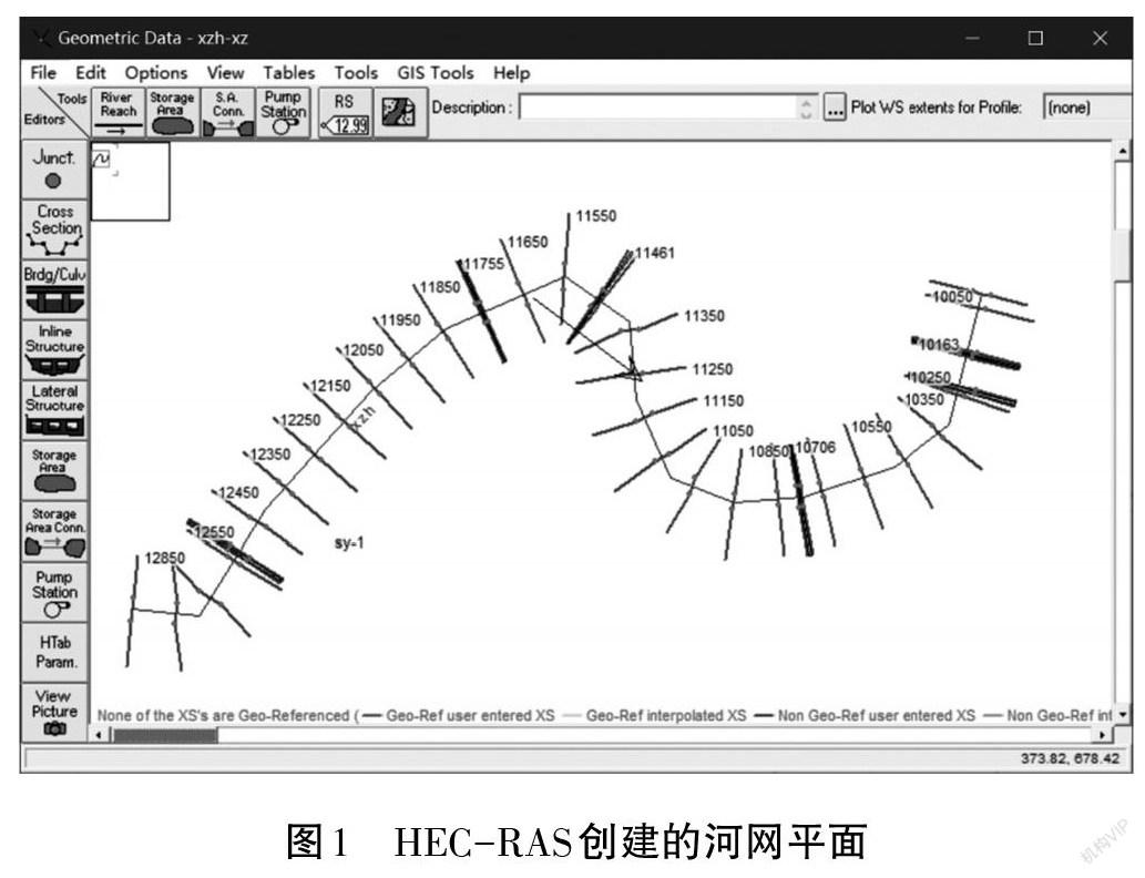
①选择主菜单“Edit”→“Geometric Data”,调出几何资料输入窗口;②添加背景图片描绘河网并给各河……
