GNSS监测数据在滑坡预警中的处理与应用
2021-11-06张新伟徐兴全刘俊明付晨
张新伟 徐兴全 刘俊明 付晨
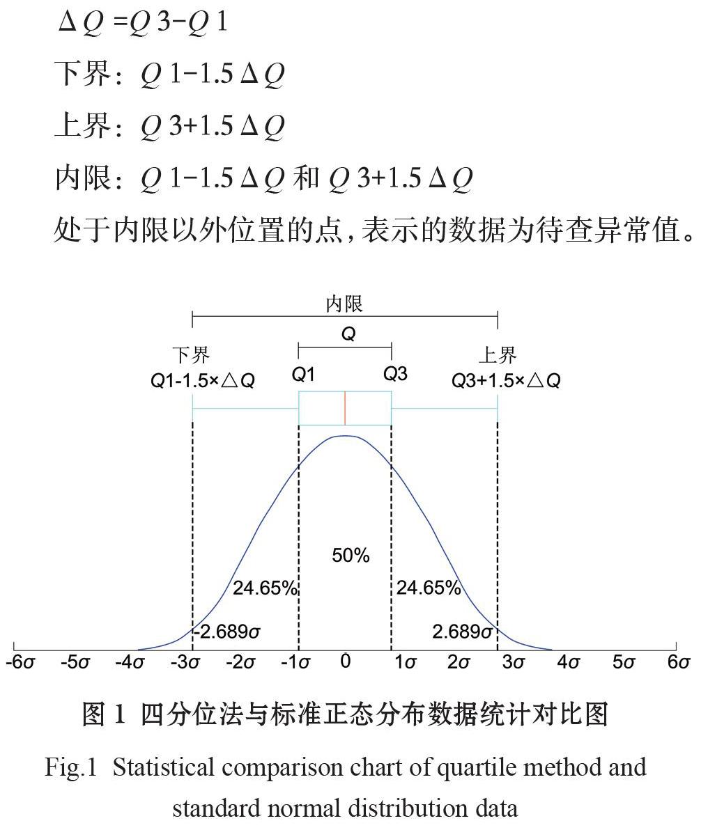
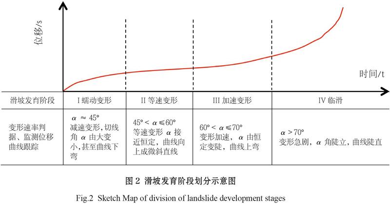
摘 要:由于受外界因素的影响,GNSS自动化监测设备在滑坡位移监测应用中监测数据存在波动性,采用未经检验、处理的监测数据进行滑坡趋势分析会产生偏差影响,因此采用“四分位数法”对GNSS监测数据进行整理,划分内限,“甄别”异常值后,将进一步降噪后的GNSS监测数据进行处理、曲线拟合,进行长期趋势项与周期性趋势分析,并将拟合长期趋势函数曲线与规范变形曲线进行对比,进而判断滑坡体处于的变形阶段,而且通过对比不同GNSS监测数据的周期性函数曲线,可用以判断同一区域周期性影响因素对GNSS监测数据变化情况是否存在相似性,有助于提高监测预警分析的准确性。通过实例验证,通过上述方法对GNSS监测数据进行处理、曲线拟合,综合分析出滑坡体的变形趋势与周期因素的影响情况,取得不错的效果,为后续监测分析提供了参考价值。
关键词:滑坡区;监测数据;四分位数法;数据拟合
Abstract: Affected by external factors, the monitoring data of the GNSS automatic monitoring equipment fluctuates in the application of landslide displacement monitoring, therefore, “quartile method” is adopted to sort out GNSS monitoring data. After dividing inner limit and identifying outliers, the denoised monitoring data is processed and curve fitting is performed to analyze long-term and periodic trends. By comparing the long-term-trend function curves with the standard deformation ones, the landslide deformation stage can be determined. Besides, the comparison among the periodic function curves of different GNSS monitoring data can tell whether there are similarities in the periodic factors' influence on the data in the same area, which helps improve the accuracy of monitoring and early warning analysis. Practice shows that GNSS monitoring data processing and curve fitting applied with the above methods have achieved sound results in the comprehensive analysis of the deformation trend of landslide body, as well as periodic factor influence, thus providing a useful reference for subsequent monitoring and analysis.
Keywords: landslide area; monitoring data; quartile method; data fitting
近年,随着我国北斗卫星的成功发射及组网成功,极大加快了我国定位设备的发展步伐,使得GNSS(Global Navigation Satellite System)自动监测在滑坡乃至地质灾害监测领域得到广泛应用与拓展(喻小等,2019)。熊寻安等(2018)利用GNSS自动化、连续监测的特点对茜坑水库表面变形进行监控并验证了监测系统具有监测毫米级精度变形的能力。侯金武等(2009)通过建设地质灾害监测预警示范基地,采用GNSS多种自动化监测设备探索有效的地质灾害监测预警和防灾减灾机制,带动全国地质灾害监测预警体系的建设。……