基于生态安全格局识别的国土空间生态修复分区:以浏阳市为例
2021-08-05刘彦文灵芝
刘彦 文灵芝

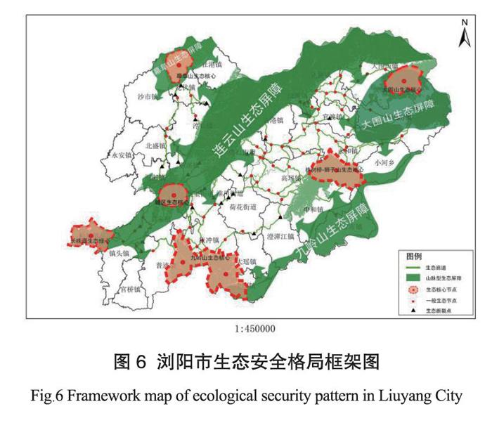

摘 要 本文以浏阳市为研究范围,基于景观生态学,运用InVEST模型中的生境质量、遥感指数分析以及自然保护地范围识别生态源地,结合坡度、高程及景观阻力面构建生态阻力面,以此识别生态廊道,形成网络状生态安全格局的基本框架。在此基础上进行生态修复分区,并针对各区域提出对应的措施与对策。
关键词 生态源地;生态廊道;生态安全格局;生态修复分区
中图分类号:P951 文献标志码:A
Regionalization of Land Spatial Ecological Restoration Based on Ecological Security Pattern Identification:
Taking Liuyang as an example
Liu Yan , Wen Lingzhi
(Third Surveying and Mapping Institute of Hunan Province, Changsha Hunan 410118)
Abstract: Liuyang City was the scope of the study area in the paper. Based on landscape ecology, habitat quality, remote sensing index analysis and natural protection area were used to identify ecological source land in InVEST model. Ecological resistance surface with slope, elevation and landscape resistance surface was constructed to identify ecological corridor and the basic framework of network ecological security pattern was formed. On this basis, ecological restoration zoning was divided, and corresponding measures and countermeasures were put forward for each region.
Keywords: ecological source area; ecological corridor; ecological security pattern; ecological restoration regionalization
国土空间生态修复是国家的重大战略,构建生态安全格局对维护区域生态安全和推进生态修复具有重要意义。当前国土空间生态保护修复研究主要侧重于矿山废弃地复垦与生态修复、重金属污染场地修复和水土流失治理等。而基于“源地—生态廊道—生态节点及断裂点”的模式,构建生态安全格局和确定生态修复分区等方面研究较少。
随着浏阳市城镇化、工业化快速发展,城市绿色空间减少。浏阳市采矿业历史悠久,开采矿种丰富,以往开采方式较为传统,使矿山地质环境破坏相对严重,遗留了较为突出的矿山生态环境问题。同时,市域生境类型不断趋于简单化,生态环境自我修复能力不断减弱,因此,如何准确识别浏阳市生态保护修复关键区域,提出相应的生态修复方式与策略是生态修复工作的重点。
1 数据来源及研究方法
1.1 研究区概况
浏阳市地处湘赣边界、湖南省东部、罗霄山脉北段,位于北纬27°5120”~28°3406”、东经113°1024”~114°1458”,境内以山地丘陵为主,地势从东北向西南递降,全市土地总面积4997.70 km2。……