基于GIS保德煤矿8煤层底板突水危险性评价
2021-07-19周露刘启蒙
周露 刘启蒙
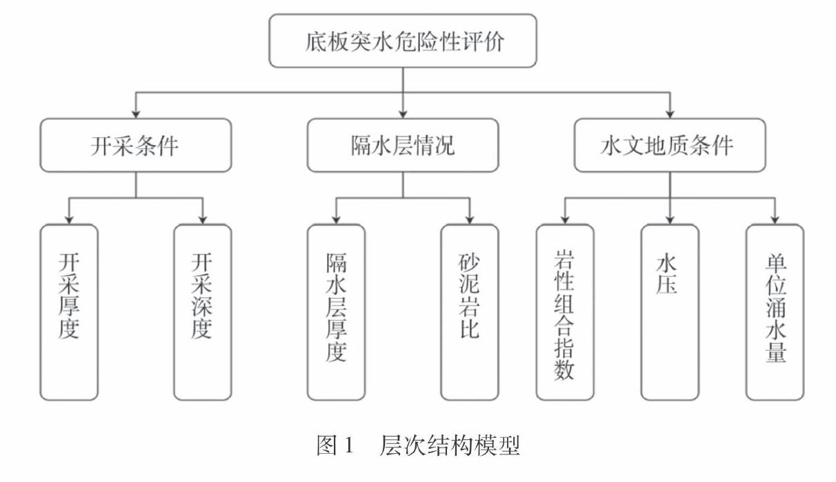
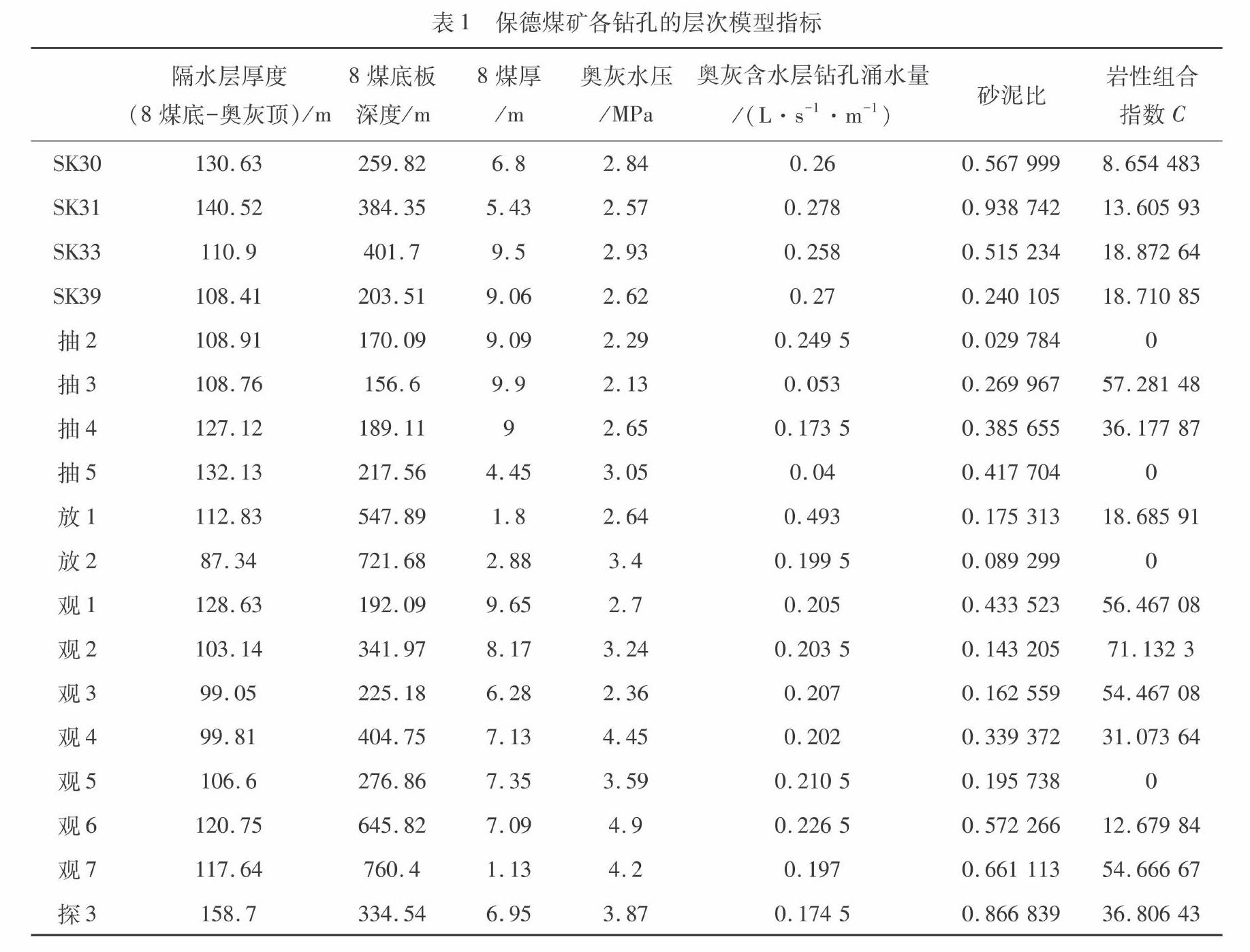
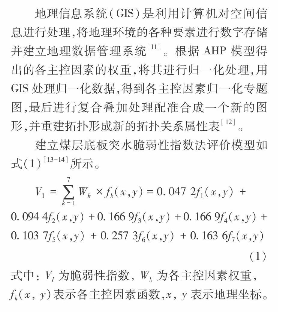
摘 要:为了准确评价保德煤矿下组煤煤层底板奥灰水突水危险程度,以8煤层开采为例,分析确定了煤层底板突水的各主控因素,通过建立AHP模型计算得出各主控因素权重。并在此基础上得到基于GIS的脆弱性评价模型,对8煤层底板突水危险性做出评价并分区,然后与传统的突水系数法进行比较分析。结果表明,相对于传统的突水系数法只考虑了水压和隔水层厚度两个影响因素,基于GIS的脆弱性指数法更能反映不同区域的相对脆弱情况,更加符合实际情况。
关键词:底板突水;层次分析法;GIS;脆弱性指数法
中图分类号: TD741文献标志码:A
文章编号:1672-1098(2021)02-0057-05
收稿日期:2020-08-03
作者简介:周露(1995-),女,重庆合川人,在读硕士,研究方向:矿井水害与防治。
Risk Assessment of Floor Water Inrush in NO.8 Coal Seam of Baode Coal Mine Based on GIS
ZHOU Lu, LIU Qimeng
(School of Earth and Environment, Anhui University of Science and Technology, Huainan Anhui 232001, China)
Abstract:In order to accurately evaluate the risk degree of Ordovician limestone water inrush in the lower coal seam floor of Baode coal mine, taking the mining of NO.8 coal seam as an example, the main control factors of water inrush from coal seam floor were analyzed and determined, and the weight of each main control factor was calculated by establishing AHP model. And then, the vulnerability evaluation model based on GIS was obtained, with which, the risk of water inrush from the floor of NO.8 coal seam was evaluated, partitioned and then compared with the traditional water inrush coefficient method. The results show that, compared with the traditional water inrush coefficient method, which only considers the water pressure and the thickness of aquiclude, the vulnerability index method based on GIS can better reflect the relative vulnerability of different regions in line with the actual situation better.
Key words:floor water inrush; AHP; GIS; vulnerability index method
近年來,随着采掘活动的不断进行,浅部煤炭资源逐渐枯竭,大多数采掘活动转向深部。由于开采深度增加,地质条件更复杂,且煤层距离太原组灰岩或奥陶系灰岩的距离减少导致水压增大,底板突水机率增加,采掘难度增大[1]。以往的突水评价理论已经不能解决这种条件下的底板突水评价问题,因此众多学者提出了多种底板突水评价理论和方法。文献[2]为解决底板突水预测预报的难题,提出了脆弱性指数法;又在此基础上,以开滦东欢坨矿北部采区煤层底板突水为研究对象,应用新提出的基于GIS的AHP型脆弱性指数法,且评价结果与实际拟合很好,效果理想[3]。文献[4]运用基于GIS和AHP耦合理论的脆弱性评价模型……