一种面向对象的人工草地遥感监测方法
2021-01-29陈艺华,陈振杰
陈艺华,陈振杰
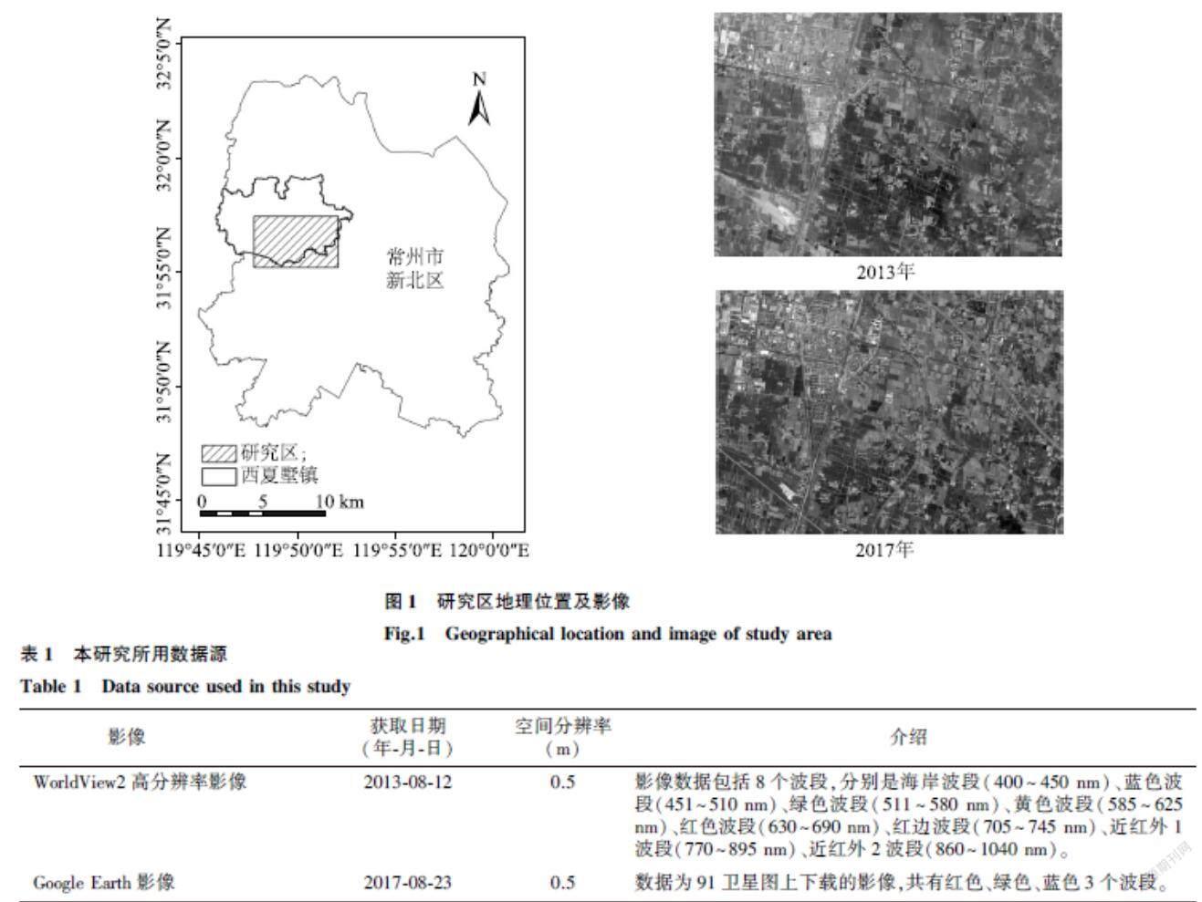
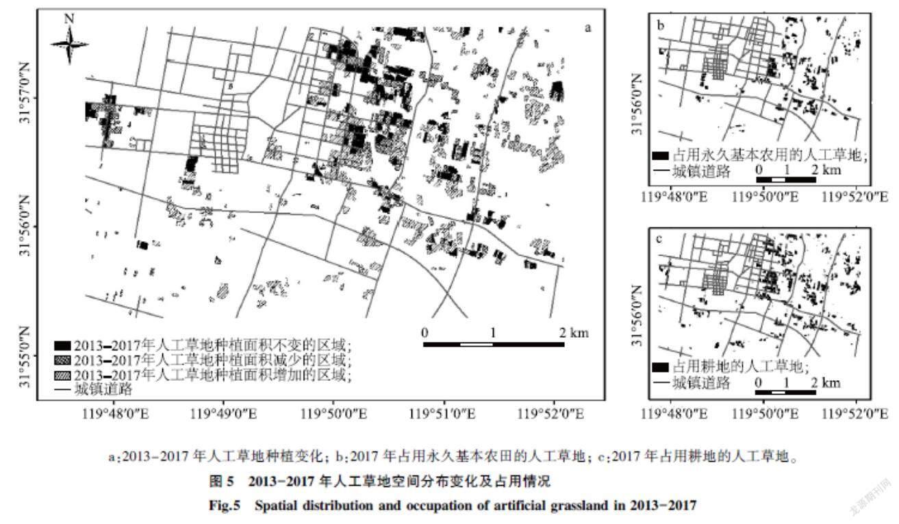
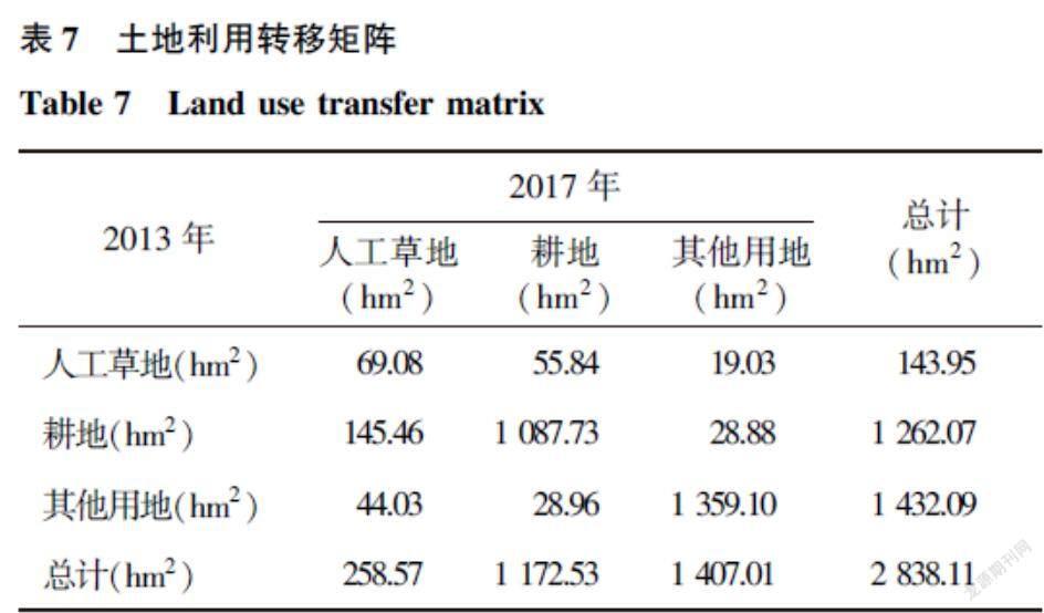
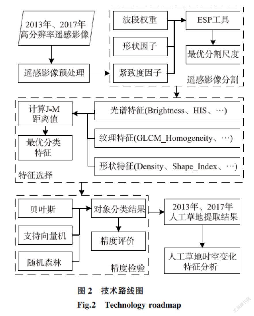
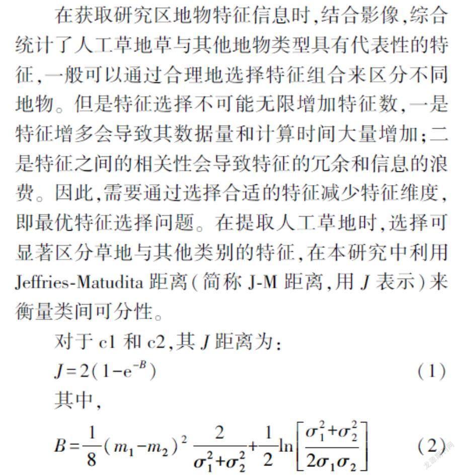
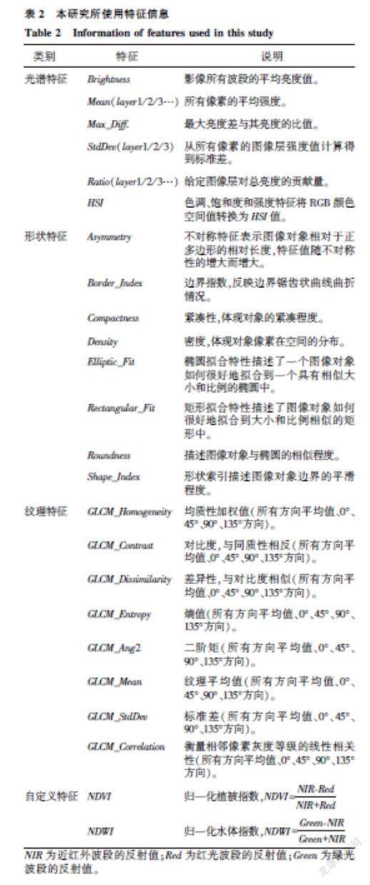
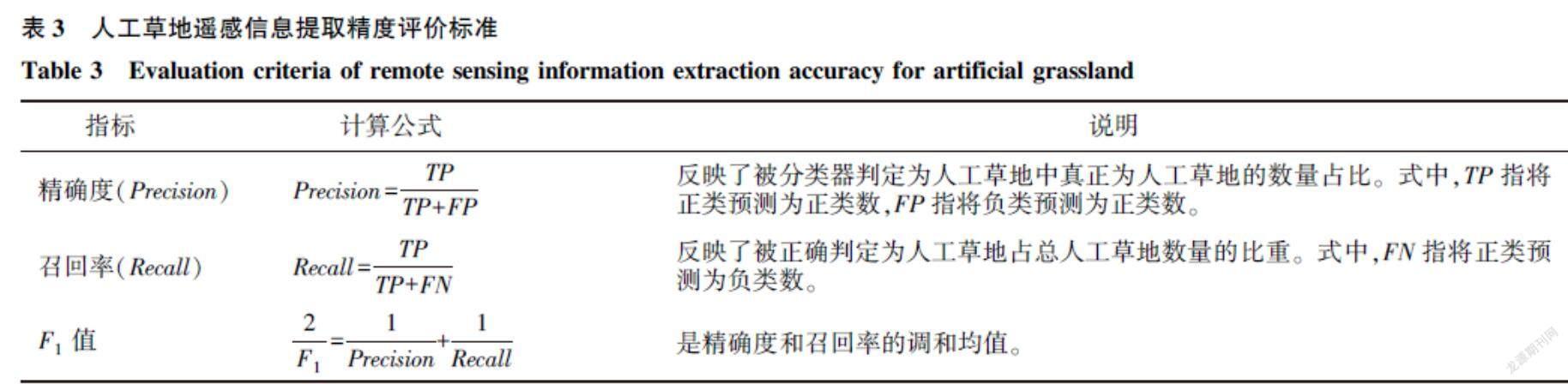
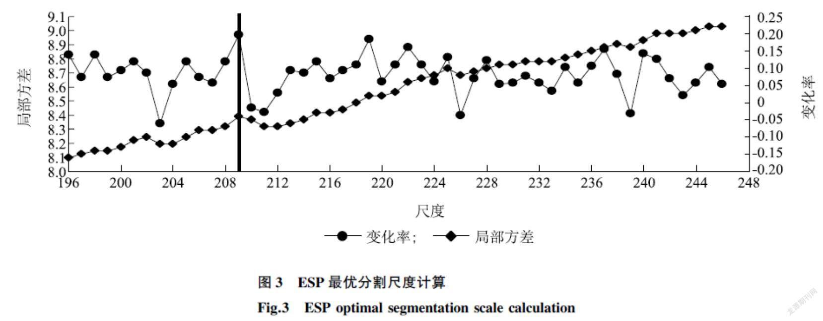
摘要:城市綠化带动人工草地草需求量增大和经济效益提升,部分种植主体会选择种植人工草地草替代传统粮食作物,种植人工草地草会严重损害耕地质量,快速有效地监测在耕地上种植人工草地草很有必要。本研究通过面向对象的方法,利用高分辨率遥感影像来获取江苏省常州市新北区西夏墅镇东南部人工草地信息,研究影像分割的最佳分割参数、最优特征选取和分类方法等问题。通过比较2013年和2017年的人工草地草种植范围,了解该地区人工草地草种植的变化情况。结果表明,(1)面向对象的高分遥感监测方法在提取人工草地信息时,能使提取的人工草地信息更加完整,获取的信息更加丰富;(2)最优分类特征选择对于面向对象遥感信息提取至关重要,验证了J-M距离对特征选择的有效性,该方法可以适用于不同影像,但所选的特征依赖于具体影像和待提取要素的特性;(3)试验区人工草地呈现团块状的集聚分布,主要分布在城镇周边,多沿道路分布。2013-2017年,人工草地草种植范围呈扩张趋势,增加的区域大部分来自耕地。
关键词:人工草地;遥感监测;面向对象分类;多尺度分割;特征选择
中图分类号:TP75文献标识码:A文章编号:1000-4440(2021)06-1545-09
An object-oriented remote sensing monitoring method for artificial grassland
CHEN Yi-hua1,2,CHEN Zhen-jie1,2
(1.School of Geography and Ocean Science, Nanjing University, Nanjing 210023, China;2.Jiangsu Provincial Key Laboratory of Geographic Information Science and Technology, Nanjing 210023, China)
Abstract:Urban afforestation promotes the demand and economic benefits of artificial grassland. Some farmer households will choose to plant artificial grassland instead of traditional food crops. In addition, planting artificial grassland will seriously damage the quality of cultivated land. So it is necessary to quickly and effectively monitor the area and intensity of artificial grassland planting on basic farmland. In this study, high-resolution remote sensing images were used to obtain artificial grassland information in the southeast area of Xixiashu town, Xinbei district, Changzhou city, Jiangsu province. By using the object-oriented approach, the problems of the best segmentation parameters, the best feature selection and the classification method of the image were studied. The planting range of artificial grassland in 2013 and 2017 was compared to understand the changes of artificial grassland planting in this area. The results showed that using the object-oriented high-resolution remote sensing monitoring method to extract the artificial grassland information could make the extracted artificial grassland infarmation more complete and obtain more abundant information. The selection of optimal classification features was significant for the extraction of object-oriented remote sensing information. The validity of J-M distance to feature selection was verified. The method could be applied to different images, but the selected features depended on specific images and characteristics of the elements to be extracted. The artificial grassland presented a cluster of lump-like distribution, mainly distributed around the town and along the road. From 2013 to 2017, the planting area of artificial grassland showed an expansion trend, and most of the increased areas came from cultivated land.
Key words:artificial grassland;remote sensing monitoring;object-oriented classification;multi-scale segmentation;feature selection
在優质耕地不断减少及人口持续增长的背景下,中国耕地保护面临严峻的挑战[1-3]。相关调查结果表明,农业产业结构调整、种粮经济效益低、劳动力生产资料价格的提升等因素,导致中国耕地“非粮化”现象呈现逐步扩大趋势[4-5]。……
