2016年4月长沙机场一次飑线天气过程综合分析
2020-08-25王廷毅
王廷毅
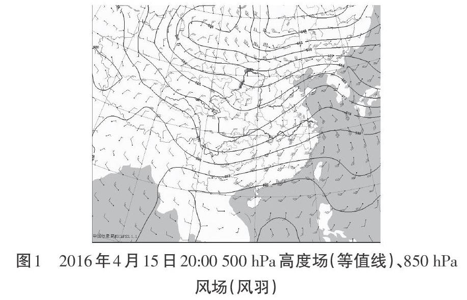
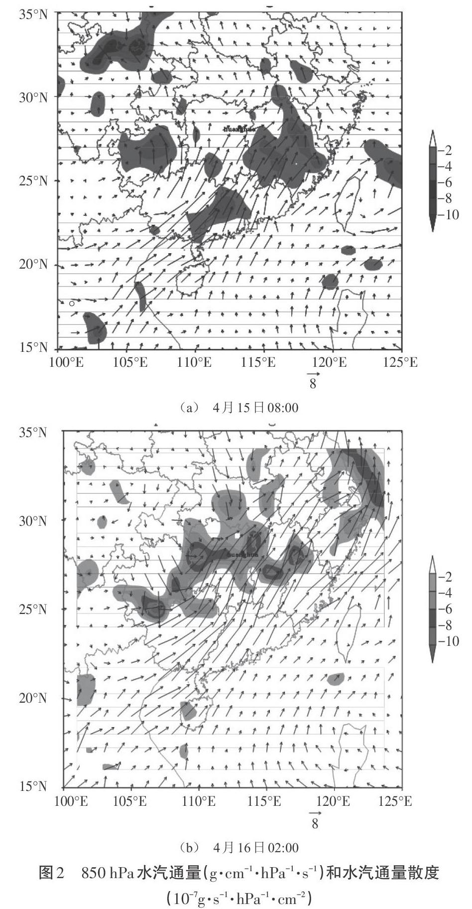
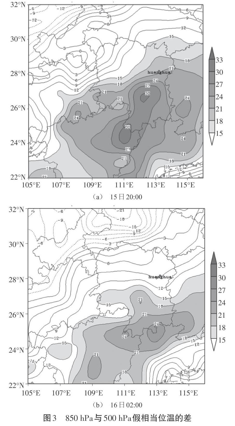
摘 要:利用常规气象资料、NCEP 1°×1°格点再分析资料和多普勒气象雷达对2016年4月16日长沙机场发生的一次飑线天气过程进行诊断分析和雷达分析。结果表明:此次飑线天气过程发生于500 hPa浅槽和低层切变线的高低层有利配置下,低层的强辐合触发了强对流天气;这次过程的暖湿不稳定能量主要通过低层西南急流的输送,受前期多阴雨的影响,太阳辐射提供的能量偏少,强盛的西南暖湿急流对流发生发展提供了有利条件;低层强烈的辐合上升,高层强的辐散,有利于“抽吸作用”,再加上高层辐散强度高于低层辐合强度,都使垂直上升运动得到了发展和加强,引起水汽、热量和动量的垂直输送;这次飑线回波除了具有线状分布、移速较快等特点外,反射率最大值和径向速度最大值长时间相伴,这也是识别飑线的一个重要指标。
关键词:飑线;诊断分析;雷达分析
中图分类号:P445文献标识码:A文章编号:1003-5168(2020)19-0143-06
Abstract: Using conventional meteorological data, NCEP 1°×1° grid reanalysis data and Doppler weather radar, a Squall Line Weather Process at Changsha airport on April 16th 2016 was diagnosed and radar analyzed. The result shows that this squall line weather process occurres in the favorable configuration of 500 hPa shallow trough and low-level shear line. The strong convergence of the low-level triggered the strong convective weather. The warm and wet unstable energy of this process was mainly transmitted through the southwest low-level jet stream .The solar radiation provided less energy due to the influence of the overcast rain in the early stage. The strong southwest warm and humid jet convection provides favorable conditions for its occurrence and development. Strong convergence and rise in the lower layer and strong divergence in the upper layer are beneficial to "suction action". The high-level divergence is higher than the convergence in the lower layer, which will develop and strengthen the vertical upward movement and cause the vertical transportation of steam, heat and momentum. In addition to the linear distribution and fast moving speed, this squall line echo has the maximum reflectivity and radial direction, the maximum velocity is accompanied by a long time, which is also an important index to identify squall line.
Keywords: squall line;diagnostic analysis;radar analysis
1 研究背景
颮线是多个活跃的雷暴单体排列成线状或带状的中尺度对流系统,发生时常伴有冰雹、大风、暴雨等灾害性天气[1-2]。随着探测手段的发展,雷达、闪电定位等先进仪器的应用使人们对强对流天气临近时表现出来的征兆、特征等认识不断加深。对已出现的飑线天气过程,有专家学者从其形成的环境条件、中尺度特征等方面进行了较多有益研究。例如,王秀明等[3]、梁建宇等[4]、孙虎林等[5]深入分析了2009年6月3—4日黄淮地区强飑线大风过程,认为高层冷空气侵入、低层增暖是其大尺度条件,低层和地面辐合、干线是其触发条件,大风由高空水平风动量下传、强下沉气流辐散和冷池密度流造成;飑线系统在地面存在明显的雷暴高压、冷池、出流边界、尾流低压等特征。……