沃菲尔德风土图记 XX
2020-03-06
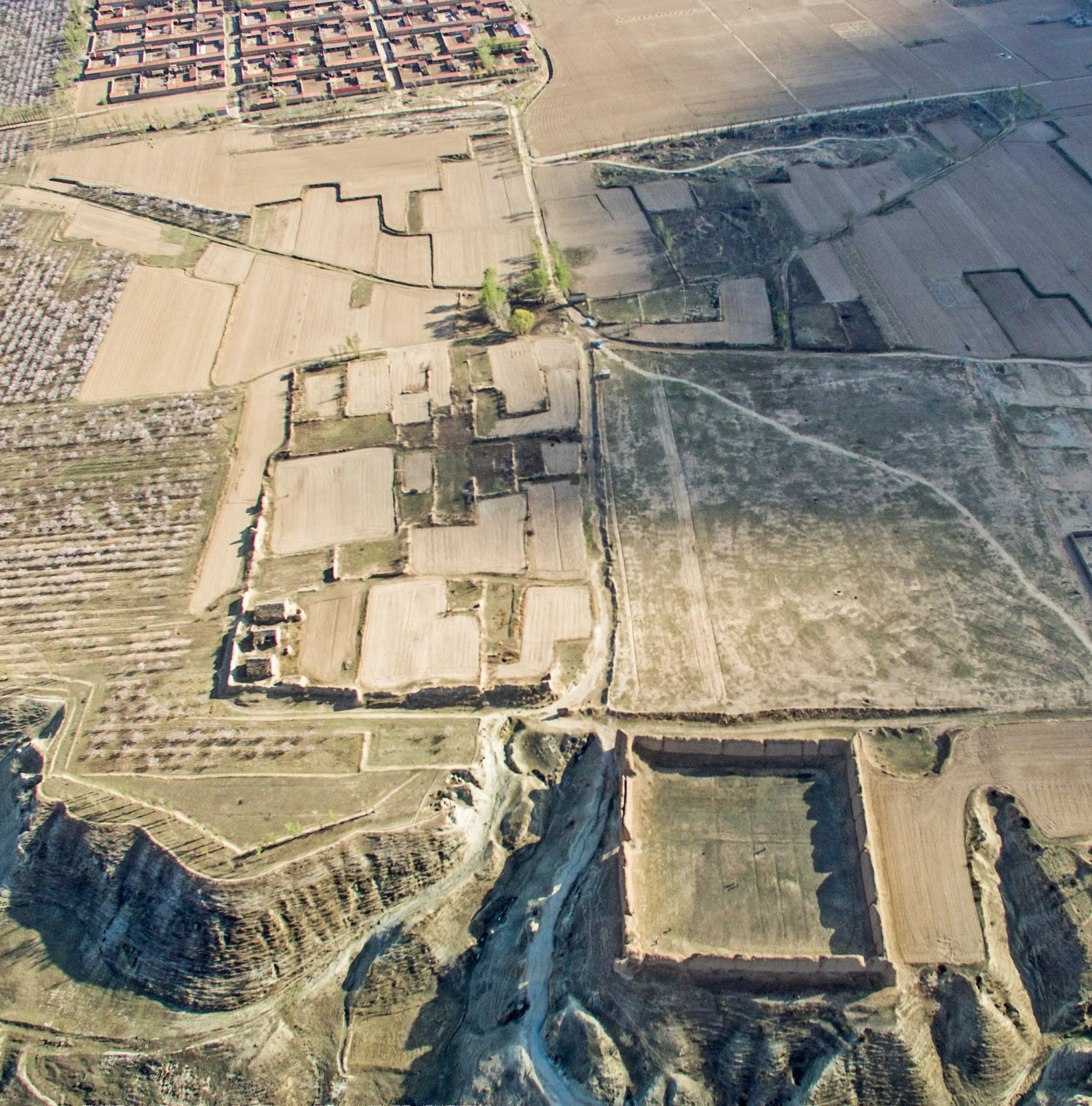
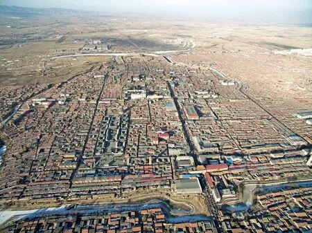
蔚县凤凰台北边缘的任家庄村(北朝南),自右下至左上依次为军堡、旧村废墟和新村Bird’s eye view of Renjiazhuang Village on the north edge of Fenghuang Platform of Yu County (viewed from north to south). From the bottom right corner to the top left are the military fortress, the old village’s ruins, and the new village
蔚县——遗忘的塞上
丁垚
党晟
谭镭 译
李颖春 译校
Yu County: The Lost FrontierDing Yao
Dang Sheng
Translated by Lui Tam
Proofread by Li Yingchun
中图分类号:K928.5;TU-88;J42
文献标志码:E
文章编号:2095-7289(2020)04-0096-20
DOI:10.19673/j.cnki.ha.2020.04.010
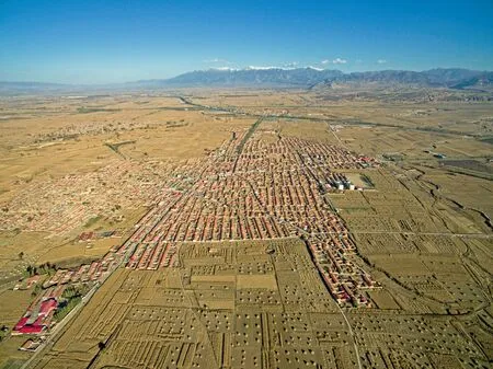
蔚县位于河北省张家口市的南端,首尾相接的太行与燕山两大山脉横亘在它和华北平原之间。蔚县之地最初进入汉语的历史书写,是作为一个以畜牧为主,与中原地区保持着密切关系的小国,称作“代国”。公元前5 世纪上半叶,代国被位居其南的赵国吞并,公元前4 世纪后半,赵国在此设置代郡,公元前3 世纪,秦灭六国,将疆土划分为三十六郡,代郡为其一。后经朝代更迭,代郡的范围屡有变化,直到6 世纪,它作为北魏帝国北部边疆的一部分在戍边将士的起义战争中被彻底摧毁。8 世纪初,荒凉了近两百年之后,这里迎来了处于鼎盛时期的唐王朝的驻军,地名也从代郡变成了蔚州。直到20 世纪初,蔚州改为县,即今天的蔚县。两千五百余年里,不论是作为代郡还是蔚州,这片土地长期处于北方游牧族群和中原王朝之间,常常因南北势力的消长,摇摆于长城内外——北齐长城(6 世纪)建在它南边的山脊上,而赵、秦长城(公元前4-3世纪)和明长城(14 世纪)则在北边百余公里之外穿过——因此站在中原王朝的角度,这里又有一个诗意的名字——塞上。
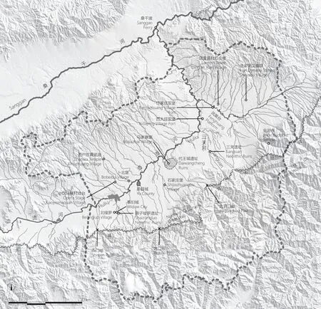
本文提到的地点在蔚县县域的位置The location of the sites mentioned in this article within Yu County
笼统地说,蔚县位于 “农牧交错地带”,或是“长城地带”,因自然、地理的具体条件和历史因缘,又有一些自身的特点。目前的中国学界,各学科如历史学、社会学、人类学等,针对某一县域这样中观空间尺度上的研究方兴未艾,时间跨度虽互有参差,按材料的丰富程度,又普遍集中在明清两代(14 世纪中到20 世纪初),蔚县的情况也是如此,学者们关注到了它作为明帝国的北部边疆而展开的村堡建设运动和“军事-民政”双轨管理体制,作为清帝国的腹地而呈现的军民合流和商业繁荣,今天蔚县的空间格局,很大程度上仍然是明清时代塑造的。回顾历史,这种军事化到非军事化的结构性转变,其实是反复发生的。这幅宏大画卷的早期残片,如今散落在山水之间,埋藏在耕土之下。我们在蔚县的工作,最初将考察古建筑(多为明清之物)作为出发点,也因为身临其境后无法对它壮美的山河和古老的传统视而不见,而开始关注更广阔的城乡空间和更绵长的历史时段。
离开喧嚣的都市,走在蔚县空旷的原野,不免感到身处塞上的孤寂,幸而有过往那些伟大的“旅行者”相伴:赵国王子(赵襄子)曾“从常山上而临代”,俯瞰这片志在必得的土地;西汉史家(司马迁)随武帝出巡 “自代而还”,搜访上古久已失落的传说;曹魏黄须将军(曹彰)跃马桑干渡口,大破桀骜不驯的乌桓;北魏居官学者(郦道元)亲历河溪婉曲,寻找遗失的东代故城;唐代高僧(一行)穿越八千里路的日影测量,蔚州军镇为其一站;契丹皇帝(圣宗、道宗)亲临金河名刹,助北国的佛学中心与五台圣地抗礼;金末真人(丘处机)西游万里归来,设醮三关河畔为幸存于乱世的百姓祈福;明代大儒(顾炎武)登上九宫山口外的高丘,诊视天下郡国地形之利病;清季守臣(庆之金)遍访遗碣考证山川,纂为代蔚最完备的地方史乘。当然还有当代那些或曾结伴同行,或暂擦肩而过的学人和爱好者们的记录和辨证,让我们得以怀着温热之心在这久被遗忘的塞上之地按图索骥, 重新审视或猝然发现一个又一个惊奇。
本文图片由中国建筑、聚落与景观考古中心提供。
Yu County is located south of Zhangjiakou Municipality, Hebei Province. It connects with the Taihang and Yanshan mountain ranges, which separate it from the North China Plain. The first Chinese historical records of the land of Yu County was related to Dai State, a country whose livelihood depended on pastoral farming and had close ties with the Central Plains. In the first half of the 5th century BC, Dai State was annexed by its southern neighbour Zhao State. In the second half of the 4th century BC, Zhao State established Dai Commandery here. In the 3rd century BC, the Qin Dynasty defeated and united the six states, dividing the territory into 36 commanderies, one of which was Dai Commandery. Throughout the subsequent dynasties, Dai County’s area varied slightly, but its name remained the same until the 6th century AD when the northern border of the Northern Wei Dynasty (386–534 AD) was destroyed entirely by its rebellious border troupes. At the beginning of the 8th century AD, after about two hundred years of the ‘Dark Age’, troupes of the prosperous Tang Dynasty started to be stationed here. The place was named Yuzhou (Yu Prefecture), which was used until the early 20th century when the County System replaced the Prefecture System, and Yuzhou became Yuxian (Yu County). Whether as a commandery or a prefecture, it had always been in a tug of war between the northern nomads and the Central Plains dynasties. The Great Walls built in the Northern Qi Dynasty (550–577 AD) goes along the border between the mountain and the plain just south of Yu County, while those from Zhao State and Qin Dynasty (3rd–4th century BC) and Ming Dynasty (14th century) are located about 100 km north of the county. People in the central dynasties also gave this place a poetic name— Sai Shang (On the Frontier).
In general, Yu County is in an agro-pastoral zone, also called ‘the Great-Wall zone’. It bears some distinctive characteristics due to specific natural, geographical, and historical contexts. At present, research from Chinese scholarships that focuses on a particular county on a mesoscale in disciplines such as history, sociology, and anthropology has only just started to emerge. Although covering various periods, most of the materials are concentrated on the Ming and Qing dynasties (mid-14th century to early 20th century), as is Yu County’s case. Scholars have noted that it was part of the mass construction of village fortresses along the empire’s northern border in the Ming Dynasty and was governed under the military–civic double administrative system. They have also addressed various changes as the Qing Dynasty’s hinterland during the merge of the military and civilian population. The layout of today’s Yu County is mostly the result of Ming and Qing dynasties’ construction. Looking back, such structural change of demilitarisation was indeed a recurring phenomenon throughout history. The early fragments of the grand scroll of history now scatter among the mountains and rivers, buried underneath the agricultural fields. Despite the initial focus on surveying its architectural heritage (mostly from the Ming and Qing dynasties), our work in Yu County was redirected towards its grandiose landscape and graceful arts after we arrived. We were compelled to expand our horizon to the entirety of its urban and rural space, covering elements such as a single spring, a pine tree, an ancient tomb, or a ruined stele.
Although one may feel an inevitable sense of solitude on the frontier while walking among the vast open fields, one is fortunate to have those great travellers from the past as company. Zhao Xiangzi (?–425 BC), the Zhao State prince, standing on top of the Chang Mountain, beheld the sight of this aspired land. Historian Sima Qian (145 BC–?) of the Western Han Dynasty (202 BC–ca. 8 AD) came to this land accompanying Emperor Wu (156–87 BC) in search of lost legends from the past. General Cao Zhang (189–223 AD) of the Wei Dynasty (220–266 AD) defeated the arrogant Wuhuan People at the Sanggan River’s crossing. The travelling scholar Li Daoyuan (ca. 466–527 AD) from the Northern Wei Dynasty followed the winding creeks searching for the forgotten East Dai City. The Buddhist monk astronomer Yixing (683–727 AD) from Tang Dynasty who travelled 8,000 miles to measure the sun’s shadow lengths also passed by the military town of Yu Prefecture. The Khitan Emperors Shengzong (972–1031 AD) and Daozong (1032–1101) visited the famous Jinhe Temple in person supporting the Buddhist centre in the North competing with the sacred land in Wutai Mountain. The late-Jin-Dynasty Daoist priest Qiu Chuji (1148–1227) came to the riverbank of Sanguan River to pray for the survivors of wars after his journey to the West. The Ming scholar Gu Yanwu (1613–1682) inspected the counties’ pros and cons from the top of a high mount outside of the Jiugong Mountain Pass. The Qing Dynasty official Qing Zhijin (1815–1877) scoured the ruins, mountains, and valleys of Yu County and wrote the most comprehensive record of its local history. There are also records and debates from contemporary scholars, volunteers, or amateurs who might have accompanied or passed by each other. They have provided valuable traces for us, swelled by our earnest interest in this lost frontier, to re-inspect and encounter serendipitous discoveries.
Photo by Archaeology Center for Architecture, Settlement and Landscape.
作者简介:丁垚,天津大学建筑学院(天津300072)副教授
党晟,九州大学人间环境学府(福冈 8190395)学术协力研究员
收稿日期:2020-10-05
Biography:Ding Yao, Associate Professor at the School of Architecture, Tianjin University (Tianjin 300072)
Da ng Sheng, Aca d em ic Co op e r at ive Researcher at the Graduate School of Human-Environment Studies, Kyushu University (Fukuoka 8190395)
Received date:5 October, 2020
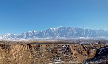
远眺冬季的小五台山(北朝南)A distant view of the Minor Wutai Mountain in the winter (viewed from north to south)
蔚县县域南半是山区,北半是盆地,盆地中大河自西向东流过,县城就坐落在南岸。地质年代标尺下,山地的隆起是极迅速的,在盆地边缘立起一道屏障,这岩石之潮,到东端掀起了数朵浪花,便是小五台山,它的最高峰海拔达2 882 m,山顶积雪春秋不化。辽代以前,它被称作 “倒喇山”,最早被北魏旅行家郦道元记录下来。“倒喇”是中国北部尤其是燕山南北地区古老而独特的山水名,上至古代传说中黄帝定都的“涿鹿(亦作浊鹿、独鹿)之阿”,下至依然矗立在燕山南麓的唐辽巨刹“独乐寺”,读音都很接近。唐代时,这里传说是普贤菩萨示现的圣山,吸引着巡礼五台山的僧俗前来,在10 到12 世纪多国并存于东亚的时代,它作为辽国的建立者契丹人着力营造的佛学中心,与北宋境内的五台山相比肩而亦称五台,鼎盛时期有“金河十寺”错落其间。宋辽的对抗早已结束,小五台的名号却沿用至今。这片山峦无疑是蔚县乃至整个塞上地区地质和文化景观上的双重地标。
The southern part of today’s Yu County is mountainous, and the northern part is a basin. A large river runs across the basin. According to the geological chronology, the bulging of the mountains was rapid, setting up a natural screen on the edge of the basin. This wave of rocks has five tips on the east end, which is the Minor Wutai Mountain, with its highest peak reaching 2,882 m above the sea, snow-capped even during springs and autumns. Before the Liao Dynasty (916–1125 AD), it was called Daola Mountain, according to the records of the Northern Wei Dynasty travelling scholar Li Daoyuan. Daola is an ancient and unique place name in Northern China, especially in the Yan Mountain areas. It could be traced as far back as the legendary Yellow Emperor’s capital ‘Zhuolu (Dulu) city’, and as recent as the large Dule Temple from the Tang and Liao dynasties, both of which have a similar pronunciation to Daola. Legends from the Tang Dynasty stated that this is the sacred mountain where Samantabhadra revealed his true self. During the 10th–12th centuries when multiple nations coexisted in East Asia, 10 temples were said to scatter along the Jin River. The Khitans endeavoured to establish it as a centre for promoting Buddhism, comparable to the Wutai Mountain in the Han-ruled Northern Song territory and therefore, it also gained the name of Wutai. The contention between the Song and Liao dynasties has long finished, but Minor Wutai’s name has remained till today. In this sense, the Minor Wutai Mountain is undoubtedly both a geological and a cultural landmark of Yu County, and even the entire Saishang area.
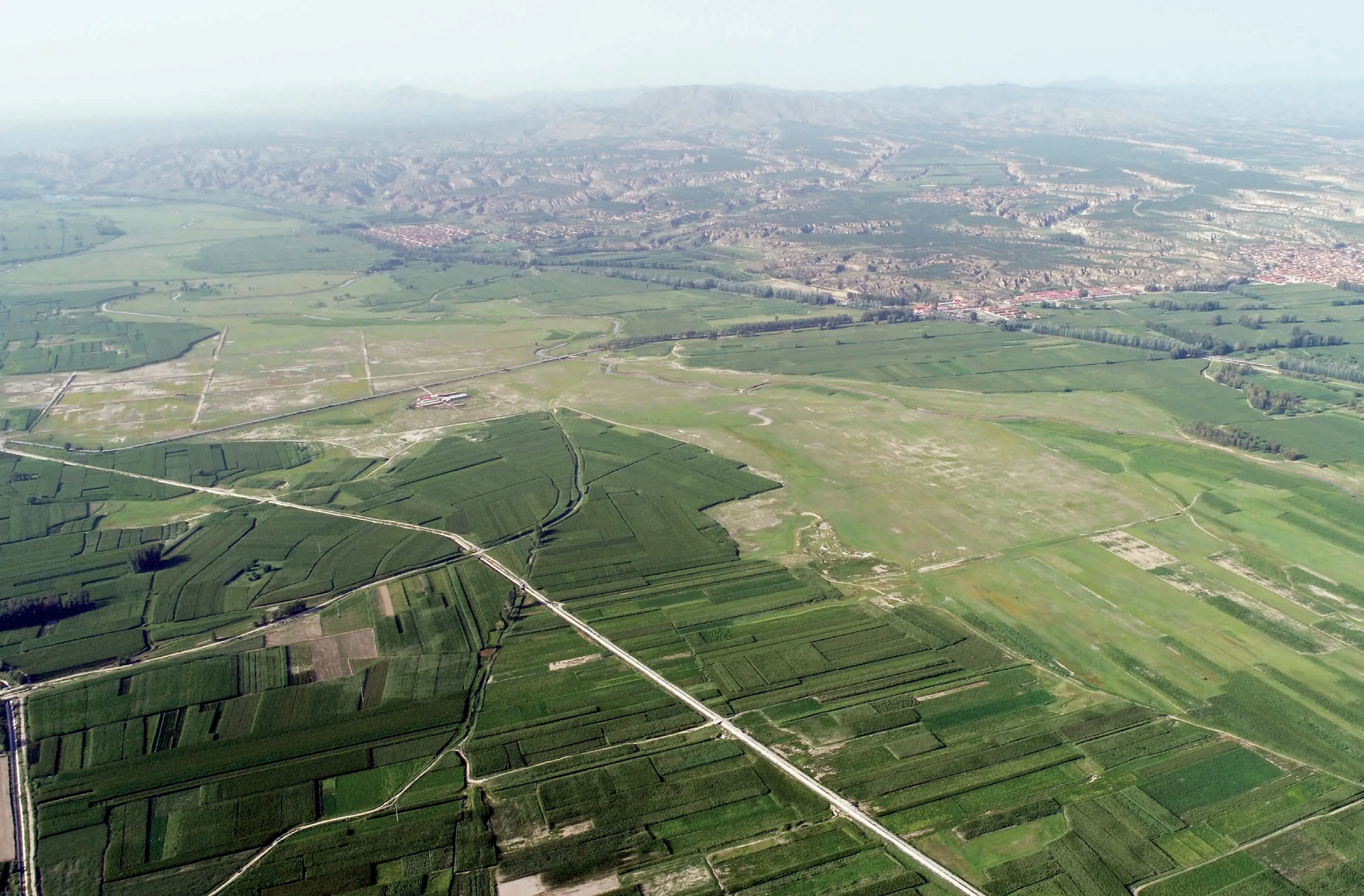
俯瞰夏季的壶流河北流段(西南朝东北)Bird’s eye view of Huliu River flowing northward in the summer (viewed from southwest to northeast)
县域北部的盆地群山环绕,壶流河从其西端发源,向东沿着大地的断层奔流,又向北切穿了一片低山,汇入桑干河。郦道元的时代,这条河名叫“祁夷”,隋唐以后,则以北方颇常见的水名“葫芦”见称,也就是今天的“壶流”。仅就蔚县盆地来说,壶流河分开的南北两岸,正是局部的农牧分界线:北岸地层抬升,溪涧下切,无灌溉之利,惟天雨是赖,适合放牧;南岸地层下沉,南山汇水在地表形成一连串的泉眼,浇灌之余,更可改善土质,利于农耕。因此新石器时代以后的早期定居遗迹,多分布在南岸。壶流河与桑干河交汇的渡口,正是三国时代曹彰曾经征伐乌桓之处,东汉、曹魏帝国境内的代郡北部之所以成为像乌桓这样的游牧民族生息的家园,除了自然条件的适宜,更重要的是彼时朝廷主动吸纳游牧人群内迁,可以缓解边疆地区的军事压力。
The basin in the northern part of Yu County is surrounded by mountains. Huliu River originates from its western end and runs eastward along the earth’s fault, cutting through the lower hills in the northeast before joining Sanggan River. During Li Daoyuan’s time, this river was named Qiyi. After Sui and Tang dynasties, it became ‘Hulu’, a typical river name in the north, which then became today’s Huliu. Huliu River separates the Yu County Basin into two halves, which coincides with the separation of agriculture and pastoral farming. The raised land on the north bank is crisscrossed by creeks and not suitable for irrigation. The sunken south bank collects the water coming from the southern mountains and creates a series of springs. It is beneficial for irrigation and helps improve the quality of the earth for agricultural activities. Therefore, most of the traces of settlements since the Neolithic period are found on the south bank. The ferry crossing at the confluence between the two rivers was where Cao Zhang defeated the Wuhuan people. Besides the suitable natural environment, the northern part of Dai County during the Eastern Han and Wei Dynasties became the home of nomadic tribes such as Wuhuan because the central government allowed the nomadic peoples who submitted to move inwards, relieving some of the military pressure along the border.
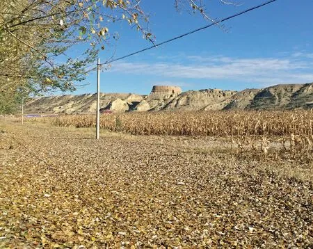
秋天的凤凰台和它西边缘的西大坪村军堡(西南朝东北)The Fenghuang Platform in the autumn and the military fortress of Xidaping Village on its west edge (viewed from southwest to northeast)
壶流河在北流的一段与盆地东端发源的定安河交汇,两河夹出一片三角形台地,兀自高出河滩几十米。断崖在阳光下呈现出白色和灰绿色的层带——这是湖相沉积物的特征,是曾经盘踞盆地中央的古代大湖的痕迹——台顶平旷,农民耕作依靠的只有风积在湖床上的薄薄一层黄土。但这台地恰好坐落在盆地内四方交通的十字路口,历来为兵家所必争。完成吞并代国功业的赵襄子死后,其子赵桓子曾自立于代。按郦道元的记载,台地最初的名字,正是“桓都山”——顾名思义,即赵桓子所都之山。桓都山在明清时俗称“四十里坡”或“凤凰台”,为抵御蒙古部落的侵袭,明帝国的军人们沿台地边缘建起了七座城堡,或大或小,或方或圆,至今仍静静守卫、凝望着往来行旅。
The north-running part of Huliu River converges with Ding’an River, which originates from the basin’s east end. The two rivers carve out a triangular plateau, a few dozen metres higher than the riverbanks. The cliff appears white and grey-green under the sun, which are characteristics of fine lake sediments. The top of the plateau is flat and open. There is only a thin layer of aeolian yellow earth on top of the previous lakebed that can grow crops. This platform, however, has been a strategic crossroad guarding transportation of all directions within the basin. It had always been a crucial battleground in ancient times. After the death of Zhao Xiangzi, who achieved to annex Dai State, his son Zhao Huanzi claimed his throne as the king of Dai State. According to Li Daoyuan’s records, the earliest name for this plateau was indeed Huandushan—literally the mount where Zhao Huanzi established as his state’s capital. Huandushan was called the Sishili (40-lilong) Slope or Fenghuangtai (Platform of the Phoenix). In the Ming Dynasty, seven fortresses were set up by soldiers along the plateau’s edge to defend the central kingdom from Mongolia’s invasion. They are of various sizes, some square and others round. Nowadays, they are still standing guard in silence, gazing at passing travellers.
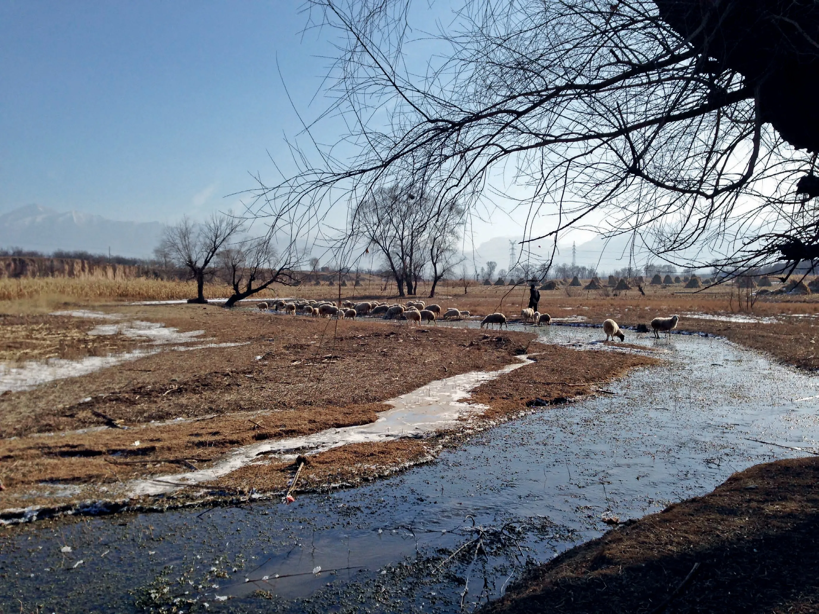
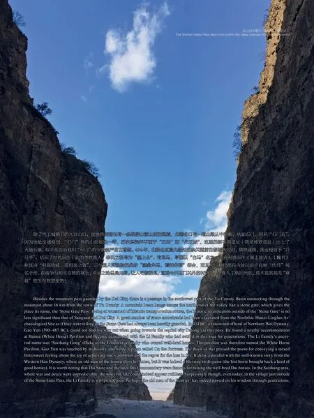
冬季的三关河畔(西北朝东南)Sanguan River in the winter (viewed from northwest to southeast)
凤凰台西南面的断崖下,有数股溪流汇集成一条小河,仿佛白练千匹,一时舞乱。当中靠西的一股,称作三关河。“三关”之名得自水畔的村落,这不起眼的小村,堡墙环绕,居高临下,也有几分神气。小河得益于山水的补给,又有地热的加温,经冬不冻,藻类常青,无怪这里从旧石器晚期开始,就已是人类的乐园。东岸新石器时代的“三关遗址”蜚声考古学界——上古时代,三关河畔就是各路考古学文化你方唱罢我登场的“三岔口”了。像三关河这样温婉的溪流在盆地南部并不鲜见,她们比起“沙寒水劲”的壶流河更称得上是蔚县的“母亲河”。“三关”在12 世纪时本作“三馆”,大概是临着大道的馆驿,还曾邀得长春真人丘处机亲登醮坛为民众祈福。此后或许因为驿道的北移,这里渐趋萧索,村名的原意也被忘却了。
At the foot of the Fenghuang Platform’s southwestern cliff, several creeks converge into a small river, with waves raging like thousands of pieces of dancing white silk. The west branch is called Sanguan River. The river was named after a village by the river. Although small and unremarkable, this village is surrounded by fortress walls and stands over its surroundings, projecting a sense of pride. The small river is fed by the water sources from the mountains and heated by terrestrial heat. Therefore, it does not freeze throughout the year and is home to evergreen water plants. It is then unsurprising that it has been a dreamland for human settlements since the late Palaeolithic period. The Neolithic Sanguan Archaeological Site on the east bank is a remarkable archaeological discovery. Indeed, since ancient times, this area has been the crossroads of various ancient cultures which flourished one after another. Gentle creeks like Sanguan River are common on the south bank of Huliu River. They deserve to be called the ‘mother rivers’ of Yu County more than the cold and raging Huliu river. Sanguān (three fortresses) used to be Sanguǎn (three taverns) in the 12th century, possibly referring to the taverns along the main road. The renowned Taoist priest Qiu Chuji was even believed to have been invited to perform ceremonies to bless the people here. Perhaps due to the subsequent move of the main road to the north, this area went into decline. The origin of the village’s name was also forgotten.
俯瞰代王城遗址(西朝东),右上角山谷即九宫口Bird’s eye view of the Daiwangcheng ruins. The valley at right top is Jiugongkou (viewed from west to east)
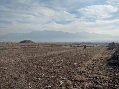
在“三关遗址”最上层留下青铜时代(商代)的农耕遗存以后,蔚县盆地开始被半游牧人群“戎狄”支配,此间考古发掘不见房舍,惟有墓葬,直到赵国势力北扩,带着先进的铁器农具和耕牛殖民于斯,跨时代的雄伟城池如同从天而降——这座椭圆形的“代王城”周长9.8 km,面积7.3 km2,设城门9 座——屹立在通往华北平原的一处山口(九宫口峪)之外,震慑着被征服的代人和一山之隔的敌国(中山国)。此后,这里作为统一帝国的代县县治,沿用至5 世纪方归于沉寂。今天的代王城城垣里泉流依旧,只是雄伟的宫室化作了农田里俯仰即是的残砖断瓦。
Above the top stratum of the Bronze Age (Shang Dynasty) sediments from agricultural activities at the Sanguan Archaeological Site, no trace of houses but tombs have been discovered, because the Yu County Basin was occupied by a semi-nomadic tribe Rongdi at the time. Only upon the expansion of the Zhao Kingdom towards the north, bringing advanced iron agricultural tools and cattle to colonise the area, grand cities suddenly appeared as if they were descended from heaven. This ancient oval-shape city had a circumference of 9.8 km and occupied an area of 7.3 km2. There were nine city gates standing tall and proud at a mountain pass towards the North China Plain, demonstrating formidability to the conquered Dai people and the enemy Zhongshan State across the mountain. Later, as the Dai County in a unified empire, it was occupied until the 5th century AD before it passed its heyday. Nowadays, only the two bold calligraphic characters ‘Ancient Dai’ on the fortress gate in Dai City and the old bricks and tiles scattered around the cornfields can testify its former glory.
小五台山映衬下,佘家堡汉墓群三座封土一字排开(西北朝东南)Three Han Dynasty tombs of Shejiabu Village line up against the backdrop of the Minor Wutai Mountain (viewed from northwest to southeast)
赵国的开拓只是序曲,蔚县盆地的经济社会发展在两汉达到了第一个高潮,数百年间积聚的物质财富和流变的生活形态集中体现在墓葬中。高大的汉墓封土三五成群地分布在蔚县田间,长久以来都是当地大地景观的一部分,被淳朴农人打趣为“谎粮堆”(意为假的粮食堆)。它们中出土的文物,是蔚县博物馆最引人注目的珍藏。西汉在塞上之地的经营军事化意味较浓,权势之家集中在城池;东汉则更多是庄园经济主导,豪富之族分散在乡间,这一点从两汉墓葬的空间分布中亦可得知:西汉墓集中在代王城周边,东汉墓零星见于河流两岸。
The development of this region during the Zhao State era was only a prelude. Agriculture in the Yu County Basin reached its first peak of development during the two Han Dynasties. The material wealth and evolution of lifestyles accumulated over several centuries are demonstrated intensely in burials. The towering mounts of Han tombs distribute in groups among the fields of Yu County, constituting part the area’s landscape. Farmers playfully call them ‘Huangliang Mounts (Pseudo Grain Mounts)’. The finds from these tombs are also the most impressive collections of the local museum. In the Western Han Dynasty, the military had a significant role in Yu County’s (then Dai Commandery’s) management, and therefore, families with high political powers congregated in the city. While in the Eastern Han Dynasty, the economy was led by the manors. Affluent families were spread out in rural areas. This part of the history is demonstrated by the Han tombs’ spatial arrangement: the ones from the Western Han Dynasty surround the Dai City while those from the Eastern Han Dynasty scatter along the river.
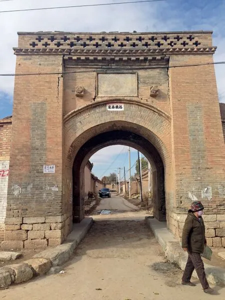
北绫罗村的堡门(东朝西)The gate of Beilingluo Village (viewed from east to west)
高允生活的4-5 世纪,仍是令人作世事无常,祸福相倚之叹的年代,匈奴、氐、鲜卑等族走马灯似的政权轮替和相互攻伐,令代郡的财富和辉煌夷为灰烬,代王城高峻的城墙也无法保护它的居民免于掳掠与迁徙。4 世纪末,鲜卑拓跋氏建立的北魏击败了慕容氏的后燕,强制迁移被俘的各色人口和手工业者约五十万人充实首都平城(今大同)周边的京畿地区(包括今天的蔚县),其中熟练于纺织的人口被编为“绫罗户”。多亏了郦道元的记录,我们知道石门关东北,曾有一片小湖叫做“绫罗泽”,或许正得名于“绫罗户”的村落。今天,“绫罗”的名字属于四个堡墙环绕的村庄,北绫罗堡那高大的堡门所矗立的位置,大概离那片已经消失的美丽湖泊不远吧。
Between the 4th and 5th centuries AD during Gao Yun’s lifetime, it was an unpredictable and turbulent period. The ‘barbarian tribes’ such as the Xiongnu People, the Di People and the Xianbei People, were fighting against each other and took the ruling power one after another. The previous wealth and glory of Dai Commandery were torched to ash. Even the tall city wall of Dai City could not protect its residents from being looted or displaced. At the end of the 4th century AD, the Northern West Dynasty, founded by the Tabgach tribe of the Xianbei People, defeated the Murong Family’s Later Yan Dynasty (384–407 or 409 AD). Approximately 500,000 captured people from various communities, including many craftsmen, were forced to move towards the Jingji area surrounding the capital Ping City (nowadays Datong). Those experienced in the textile making were labelled ‘Lingluo Hu’ (households of silk and satin). Thanks to Li Daoyuan’s records, we now know that there used to be a small lake named Lingluo Lake to the northeast of the Stone Gate Pass. Lingluo is also the name of four nearby walled villages today. The grand and towering fortress gate of the North Lingluo Fortress village is probably not far from the lost beautiful lake.
俯瞰北绫罗新村和“寡妇城”遗址(西朝东)Bird’s eye view of the new Beilingluo Village and the ‘Widow City’ archaeological site. (viewed from west to east)
随着北魏最终在北方的混战中胜出,秩序被重新建立起来,商业活动也随之复兴,在当时的商人群体里,来自中亚的粟特人是主角。北绫罗村东有一座方形的古城,俗名“寡妇城”。但由寡妇居住的传说,并不能使人信服。考诸史籍,我们认为“寡妇”实际上是“贾胡”的谐音,“贾胡”指的正是做生意的西域人。作为连通首都平城和被征服的华北平原之间主要通道上的一站,石门峪外的这座古城曾是一处骆马嘶鸣的商品集散地亦未可知。
As the Northern Wei Dynasty won the chaotic war in the north, an order was reinstated in the area, and commercial activities were revived. Among the community of merchants of the time, the Sogdians from Central Asia played a significant role. To the east of the North Lingluo Village, there is a square ancient city known as the ‘Widow City’. However, the legend that it was occupied by widows is not convincing. According to historical records, we suggest that ‘widow’ (guafu) could be a euphony ofguhu, which was a term for merchants from Central Asia. As a crucial stop on the route between the Capital Pingcheng (today’s Datong) and the North China Plain’s conquered land, this ancient city outside of the Shimen Valley was undoubtedly a bustling trading hub.
北魏在平城的经营接近百年(398-494),迁都洛阳以后,留守旧都的军人生活日渐困顿。他们在6 世纪上半叶发动“六镇起义”(524),迫使北魏朝廷将塞北的人口迁移到内地,代郡(时称东代郡,以示在平城以东)被废弃,蔚县盆地及其以北从此进入了“无政府状态”。继北魏、东魏而起的北齐几乎放弃了对这里的直接统治,而沿盆地南缘的山脊筑起了一道石砌的长城,这条收缩的防线,也曾是汉帝国对匈奴处于劣势时所依凭的,也只有在这种情况下,蔚县才是真正的“塞上”。经过千五百年的风吹日晒,这段长城已经残缺不全,但凭其叠石的锐利轮廓,还可以轻易地与夯土的秦汉长城和部分包砖的明长城区别开来。
The Northern Wei Dynasty managed Pingcheng as its capital for almost a century (398–494 AD). After the capital was moved to Luoyang, the soldiers left to guard the old capital were neglected. They staged the Liuzhen (Six-Garrison) Rebellion in the first half of the 6th century AD, forcing the Northern Wei Dynasty to move its population from north of its border into its mainland. The (East) Dai County was abandoned, and the Yu County Basin and the area to its north went into an anarchic state. Following the Northern and Eastern Wei Dynasties, the Northern Qi Dynasty gave up its direct rule of this area and built a stone Great Wall along the mountain ridge at the basin’s southern edge. This contracted line of defence was also previously used by the Han Dynasty when it was at a disadvantage to the Xiongnu People. Indeed, only during these times was Yu County truly a ‘land of the frontier’. After 500 years’ exposure to the natural elements, this Great Wall is in remnants. Nevertheless, its sharp contour formed by stacked stones distinguishes it easily with the rammed earth Great Walls of the Qin and Han Dynasties and the Ming Dynasty one partially cladded with bricks.
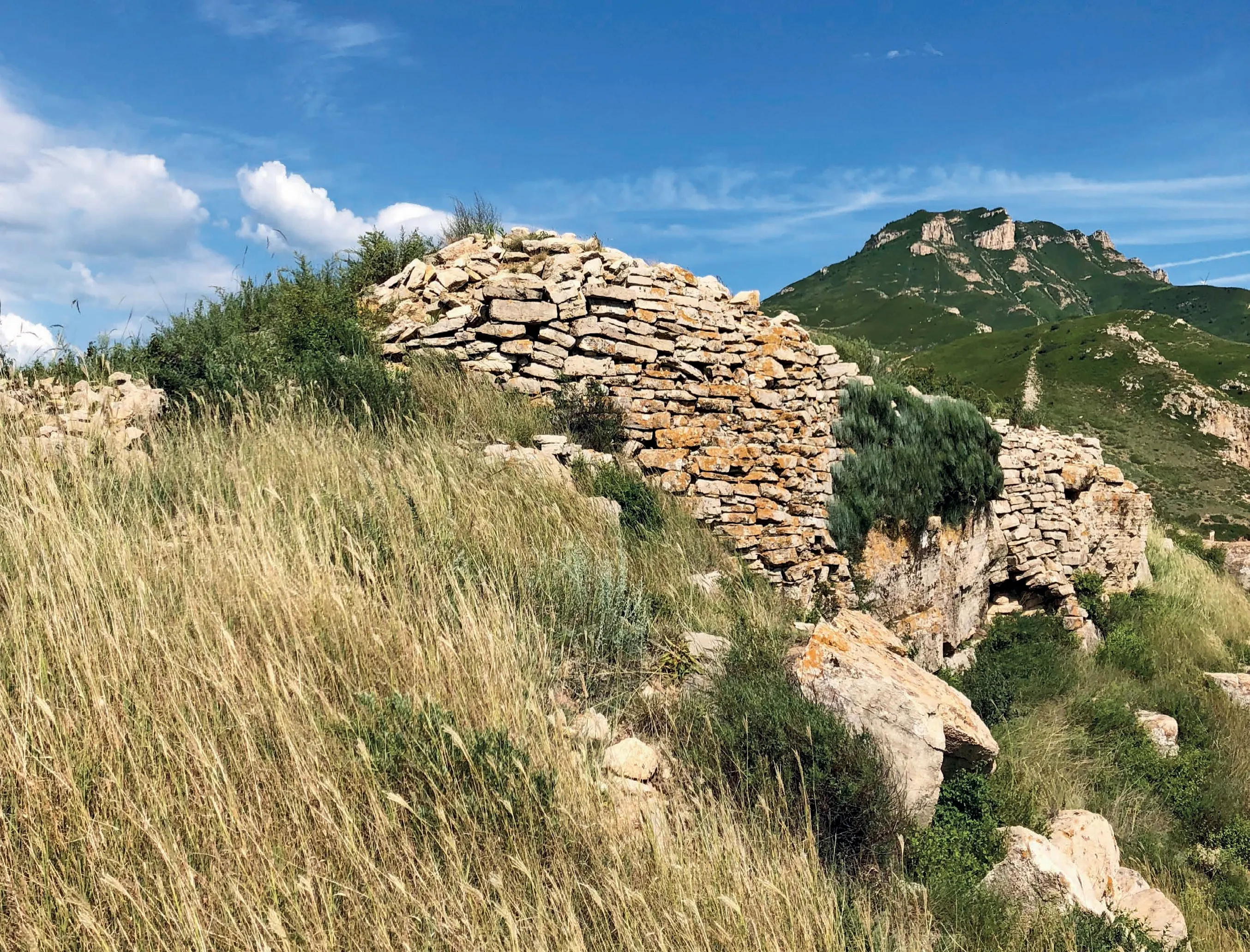
九宫口峪附近的北齐长城The Northern Qi Dynasty Great Wall near the Jiugongkou Pass
俯瞰曾作为横野军城的蔚县城(南朝北)Bird’s eye view of the town of Yu County that was once the Hengye military town (viewed from south to north)
时间来到8 世纪上半叶,正处于鼎盛时期的唐帝国越过北齐长城的藩篱,加强了对蔚县盆地及其以北地区的控制,屯驻的军卒和归降的北人各安其业,和睦相处。今天的蔚县县城,位于“代王城”西南约8 km,最初是由一支番号为“横野”的军队所建,县城附近出土墓志铭的唐墓,大多属于横野军的军官和家属。据记载,横野军城有内外两层城墙,后来在内城(子城)之南增置了分管民政的县衙,就是日后“蔚州”的雏形。唐代蔚州的再开发无疑是来自中原的军事力量主导的,在文化上却充满了异域风情,这从墓葬中出土的一批极具中亚风格的陶瓶就可看出。作为唐帝国北部重镇,横野军也成了高僧一行所组织的天文测量的一站。
In the first half of the 8th century AD, the Tang Dynasty at its heyday was proactively crossing the Northern Qi Dynasty Great Wall to enhance its control on the Yu County Basin and the area to its north. The stationing soldiers and the submitted northern folks were living in harmony. About 8 km southwest of the Dai City’s ruins, today’s Yu County was initially constructed by an army named Hengye. According to historical records, there were two circles of city walls around Hengye. A county office for civic affairs was added south of the inner city, forming the initial layout of Yuzhou (Yu Prefecture). The Tang Dynasty Yu Prefecture’s revival was undoubtedly led by the military power from the Central Plains. Its culture, however, was infused with exotic characteristics, evidenced by thehuping(foreign vases), the Central Asian style vessels for storing the souls of the deceased, found in the tombs of this era. As a strategic northern border town of the Tang Empire, the Hengye Military City naturally became one of the stops in Monk Yixing’s astronomical survey journey.
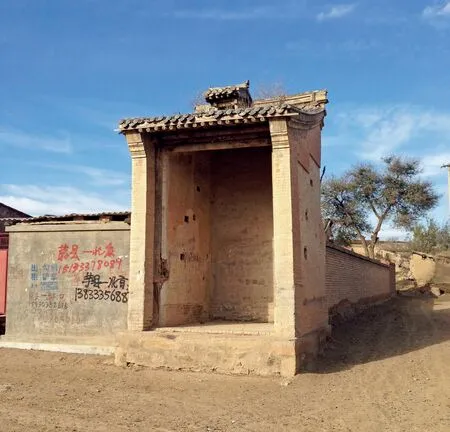
定安县村村口的灯山楼(东南朝西北)The Dengshan Tower at the gate of Ding’anxian Village (viewed from southeast to northwest)
唐代是叙利亚、波斯、印度各种宗教、教派涌入东亚的高峰,随着中唐以后朝廷对外来宗教的打击和西域通道的阻塞,许多宗教仪轨下沉转化为民俗,蔚州社会基本重建于唐,这一点较内地更加明显。例如上元节观灯,蔚县还保留着与敦煌壁画中相似的形式——将成排的油灯摆放为若干层,状如灯山。为此特别建造的“灯山楼”,面阔进深只一间,竖直向高耸,摆放灯盏的梯子倚靠其中,侧壁掏出脚窝以便上下,屋顶设“气楼”排出热气。除了敬拜灯山祈福,上元节那天还会有童子扮演的“灯官”游行娱众。图中的灯山楼竖立在凤凰台下一座辽代县城遗址旁的村落中,可以说是晚唐以来本地民间生活的孑遗。
Tang Dynasty was the prime time when religions from Syria, Persia, and India were introduced into East Asia. After the imperial court suppressed religions and created a blockade along the passages to the West from the mid-Tang Dynasty, many religious rituals were consolidated and transformed as folk customs. Since the community of Yuzhou was reconfigured in the Tang Dynasty, this phenomenon was more apparent than the mainland. For example, the ceremony of light observation at the Lantern Festival is still practised in a similar way as seen on the Dunhuang murals—oil lamps are stacked in layers, forming a mountain of lights. A Dengshan Tower was built for this purpose, a tall building with only one bay’s width and depth. The ladder for putting up the lamps rests in the middle, and putlog holes were placed on the sidewalls for climbing. Aqilou(air tower) is set on the roof to exhaust the heat. Besides praying to the lamp mountain for blessing, there is also a parade of children dressed as the ‘officials of light’ on the day of the Lantern Festival. The Dengshan Tower in figure 13 is in a village next to the archaeological site of a Liao Dynasty town at the foot of the Fenghuang Platform, a historical trace of the local everyday life since the late Tang Dynasty.
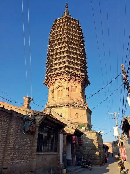
蔚县城内的南安寺塔(西朝东)The Pagoda of Nan’an Temple inside the town of Yu County (viewed from west to east)
唐王朝覆灭以后,经过来自西北的沙陀人、东北的契丹人、本土藩镇汉人三方的角力,包括蔚州在内,燕云地区的十六个州最终被契丹人收入大辽版图。辽在很大程度上是唐文化的继承者,这种继承突出表现在佛教和艺术上,小五台山上的“金河十寺”,在辽代达到极盛,学术造诣极高的《显密圆通成佛心要集》正由道㲀法师在金河寺著成。哲学的圆融归一也推动了艺术的极致绽放,且看那矗立在蔚州城里的南安寺塔吧!
After the Tang Dynasty’s doom, the Shatuo people from the northwest, the Khitan people from the northeast, and the Han people from the military towns clashed into chaos. 16 prefectures in the Neiyanyun area, including Yuzhou, were eventually included in the Liao Empire map by the Khitans. The Liao Dynasty largely inherited the Tang culture, which manifested in its promotion of Buddhism. The 10 temples of Jin River on the Minor Wutai Mountain were at their prime times during the Liao Dynasty. The advanced Buddhist sutraXianmi Yuantong Chengfo Xinyao Ji(Collection of the perfect and complete Buddha’s mind essentials according to the manifest and esoteric Buddhist traditions) was authored by Monk Daochen at Jinhe Temple. The philosophical accomplishment also inspired the blooming prosperity of arts. Just look at the towering Pagoda of Nan'an Temple inside the town of Yu County!
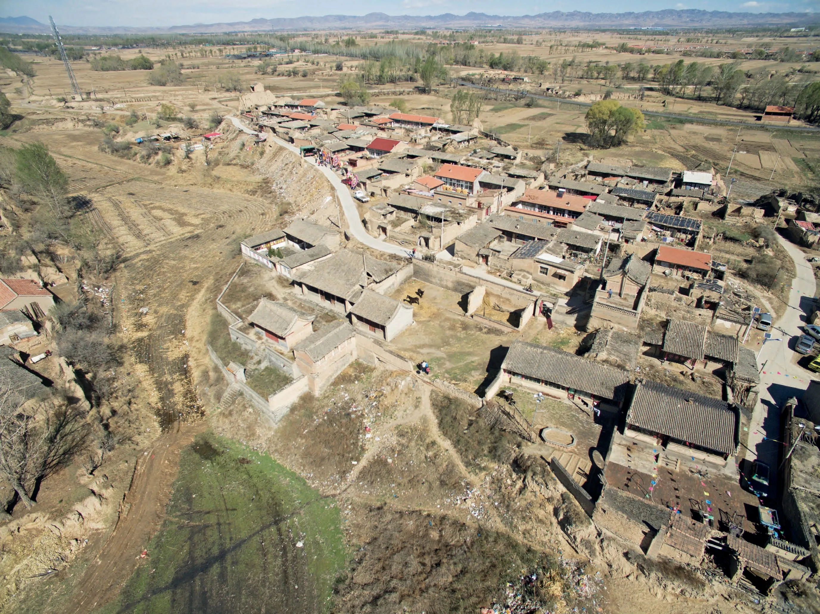
俯瞰卜北堡(东南朝西北)Bird’s eye view of Bobeibu Village (viewed from northwest to southeast)
从唐代屯田发展起来的村落,到辽金时代已经完全失去了军事色彩。卜家庄,古称薄家村,位于蔚县城西不远,后分化为为南北两村,各自坐落在一条干涸冲沟的两岸台地上,这条冲沟向东延伸汇入壶流河,曾经横跨河上的木桥(薄庄桥)是出城朝西北方向前往大同所必经的,因此夹在两村之间,已被淤泥掩埋的大路享有“燕云古道”的美誉,这或许也是薄家村在金代载入正史(《金史 · 地理志》)的原因。北村今称“卜北堡”,平面随形就势而呈鱼形,这样自由的格局可能是辽金时代当地村落的典型。
Villages developed due to the Tuntian System during the Tang Dynasty lost their military characteristics during the Liao and Jin dynasties. The Bujiazhuang Village, formerly called Bojia Village, is located not for west of the Yu County’s township. It is divided into the north and south villages, setting on the two banks separated by a dry riverbed. This river used to extend east and flow into Huliu River. The wooden Bozhuang Bridge that used to sit across the river was a necessary path from Yu County to Datong. The road that went between the two villages, now buried under silt, was once called the Yanyun Ancient Path. It is possibly why Bojia Village was recorded in the Jin Dynasty’s official history (History of Jin Dynasty – Geography). The north village is now called Pubei Fortress. Its layout follows the terrain and is shaped like a fish. Such a free form could be a typical feature of the local villages during the Liao and Jin dynasties.
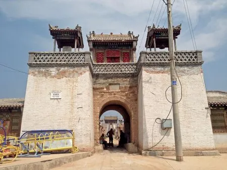
石家庄堡堡门和远端的真武庙(南向北)The gate of Shijiazhuangbu Village and the Zhenwu Temple at the far end (viewed from south to north)
14 世纪下半叶正值明初,蔚州社会经历了又一次重建,部分居民被迁走,为军人和新移民腾出空间。面对来自北方蒙古部落的威胁,卜北堡也建起了环绕村落的堡墙。到16世纪的明代中期,或许受到军事化城堡的影响,蔚县开始流行一种兵营式,强调中轴对称的村堡平面。位于蔚县城东6.3 km 的石家庄堡建于1520 年,是较早的一个例子。从它的堡门外向里望去,整条中轴线一览无余,最北端的高台下并不开门,而是托起天宫般的真武庙。
The second half of the 14th century was the beginning of the Ming Dynasty. The society of Yu Prefecture experienced another reshuffling. Some of the residents were moved out to provide land for the military and new immigrants. Confronted by the threat of the Mongolian tribes in the north, the Bubeibao village erected an enclosing fortress wall. Since the 16th century (mid-Ming Dynasty), perhaps under the influence of the military fortresses, a symmetric layout that reflected the form of a military camp became common among the village fortresses in Yu County. The Shijiazhuang Fortress, 6.3 km east of Yu County’s township and built in 1520, is one of the earliest examples. Looking in from outside of its fortress gate, one can see through its central axis. There is no gate under the high platform at the north end of the axis. As the base of the Zhenwu Temple, the platform sets off the temple like a heavenly palace.
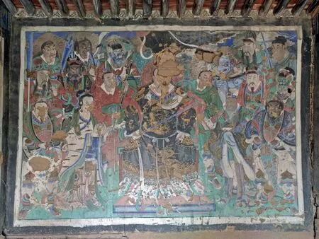
西户庄堡真武庙壁画(南朝北)The murals of Zhenwu Temple in Xihuzhuangbu Village (viewed from south to north)
就像中国北方很多村落一样,蔚县每一个村堡内外都点缀着各式各样的庙宇,除了佛寺和道观,还有很多由和尚或者道士代为打理,甚至无人看管的小庙,比如负责风调雨顺的龙王庙、负责子孙满堂的奶奶庙、负责安然归西的五道庙、负责平安富贵的关帝庙、负责牲畜滋生的马王庙、负责驱除蝗群的梓潼庙、负责考试中榜(意味着官运)的文昌庙等等。最具本地特色的,当数镇护北方的真武庙,它在蒙古人侵扰最严重的16 世纪随着“石家庄堡式”的村堡建设流行起来。庙中一般用壁画描绘真武大帝的形象——一位披发跣足,脚踩灵物,一手持剑的战神——人们相信他的神威可以令北方的不速之客惧而退却。
Like northern villages in China, various types of temples adorn within and without every village fortress in Yu County. Besides those nominally belonging to Buddhism and Taoism, many others are small temples of local deities managed by Buddhist monks or Taoist priests. Some examples include the Longwang Temple (Temple of the Dragon King) for rain praying, the Nainai Temple (Temple of the Goddess of Fertility), the Wudao Temple (Temple of the General Wudao) for the afterlife, the Guandi Temple (Temple of Marshall Guanyu) for fortune, the Mawang Temple (Temple of the Lord of Horses) for the prosperity of livestock, the Zitong Temple (Temple of Zitong Deity) for avoiding locust plague, and the Wenchang Temple (Temple of the Wenchang Deity) for exemplary performance in state examinations (which usually means a promising career in the imperial court). The Zhenwu Temple (Temple of the Zhenwu Deity) which guards the north, is one with the most characteristics of the area. During the 16th century, when the area was most heavily invaded by the Mongolians, Zhenwu Temples became popular along with the construction of the Shijiazhuang style village fortresses. There are usually murals depicting the Zhenwu Deity’s image in the temples—a deity of war with long hair and stomping feet, stepping on mystical creatures and holding a sword—people believed that its majestic magic power could scare off any unexpected intruders.
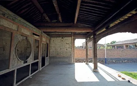
小饮马泉村的戏台(西朝东)The Opera Stage of Xiaoyinmaquan Village (viewed from west to east)
与战争时代产物真武庙的森严凝重形成鲜明对比的是和平降临以后兴起的村庄剧场。得益于贸易的繁荣,清代中期的蔚县平和而富足,人们开始用各种方式装点已失去实际效用的城堡,戏台建筑就是最有代表性的一种,他们大多建于18 世纪以后,位置也多在毫无防备的堡门之外或庙宇之前,戏曲上演时,村民和他们崇拜的神祇共享这一份欢乐。
让人叹息的是,近五十年随着民间文艺的凋落和传播媒介的变革,蔚县的几百座戏台已经许久无人问津了。与此同时,古堡、古庙、古宅也因不同的缘故,面临着相似的被遗忘的命运,在这里,历史的力量因缺席而被感知。很多戏台内墙上还可以看到百年前演员们的涂画、诗作和留念题记,他们可曾想到,前台那雄浑的腔调,竟是一个时代的绝唱?
The openness and liveliness of the village opera stages that sprouted after the arrival of peace are in stark contrast with the sternness and seriousness of the Zhenwu Temples born out of wartime. Benefited from the prosperity of trade, Yu County was peaceful and affluent during the mid-Qing Dynasty. People started to decorate the difunctional fortresses in various ways, one of which was through building stages. Most stages were built after the 18th century and are usually located in non-defensive space outside the fortress gates or in front of temples. When the opera was on, villages and the deities that they worship share the joy.
Unfortunately, with the withering folk performance arts and the revolutionary transformation of media in the last 50 years, the several hundred village stages in Yu County have been hardly visited or used for some time. In the meantime, the ancient fortresses, temples, and mansions face a similar fate of obsolescence for various reasons. Here, the power of history is sensed precisely due to its absence. On the inner walls of many stages, one can still see the graffiti, poems, and inscriptions left by the performers from over a century ago. Would they have thought that the melancholy melody on the front stage would have been the last act of an era?
