基于GPS电子浮标的水文应急测流系统
2023-06-21朱永红刘沂轩刘昱宋梦雨
朱永红 刘沂轩 刘昱 宋梦雨
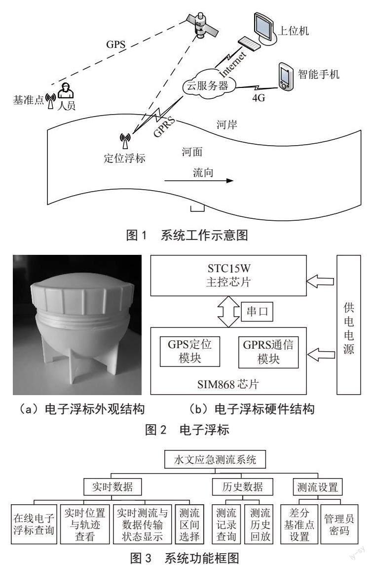
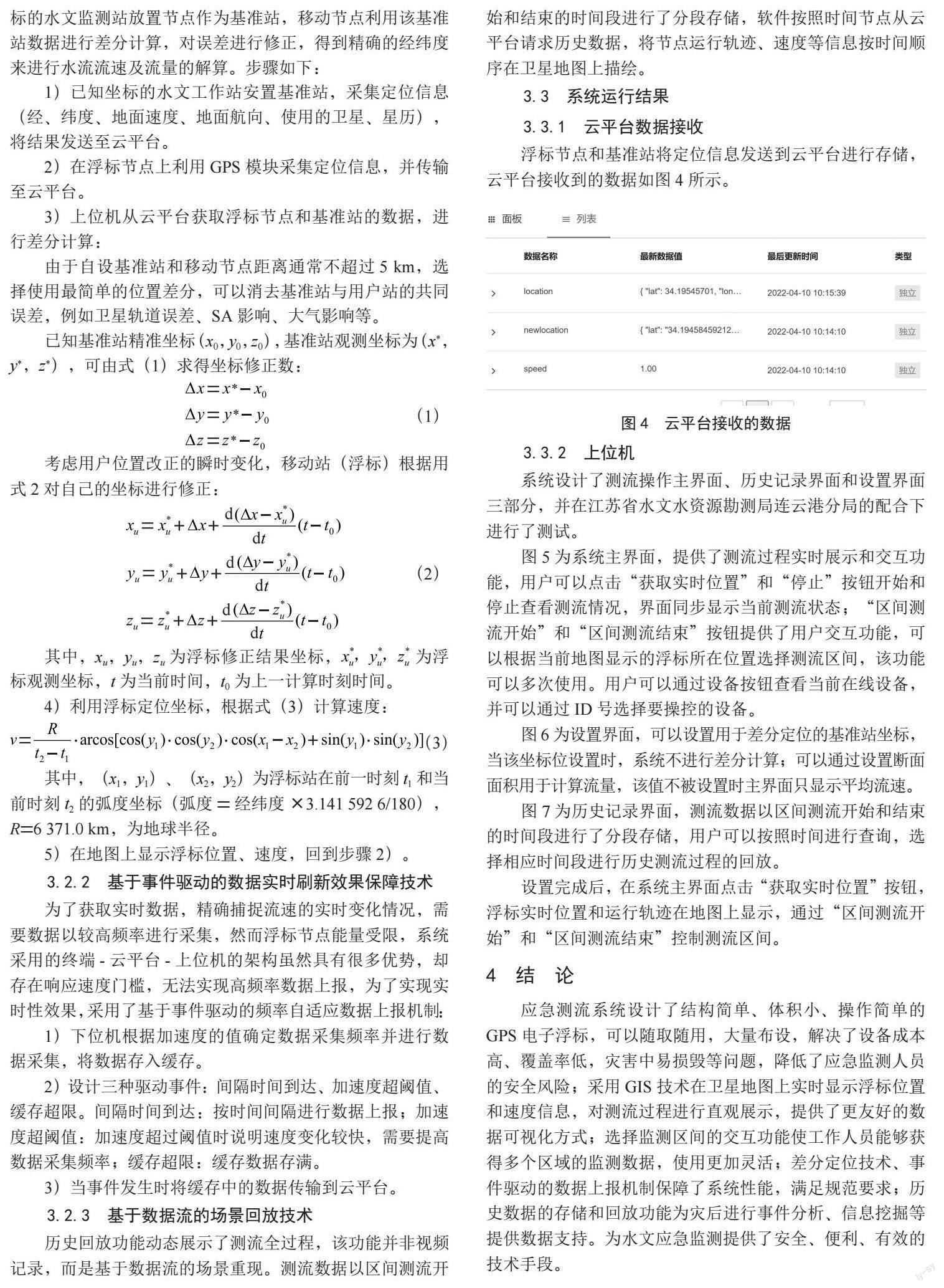
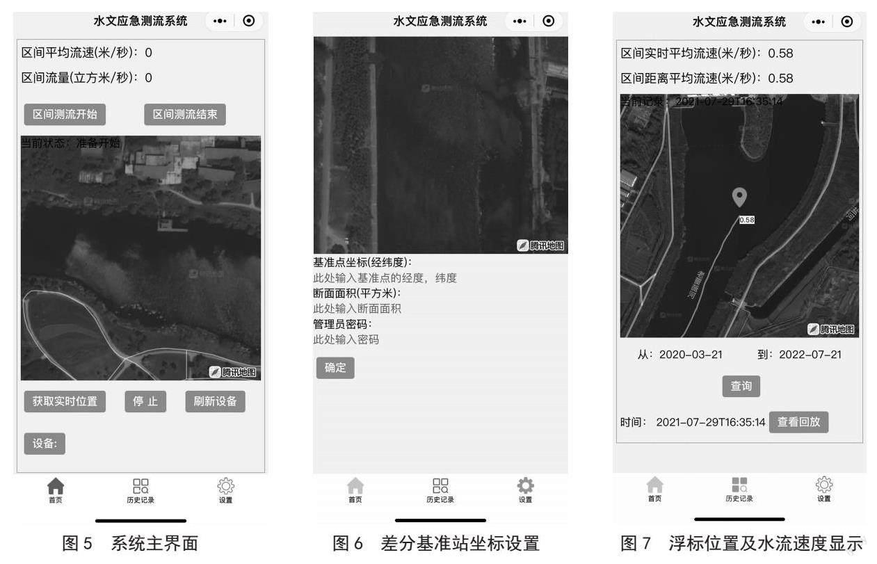
摘 要:针对灾害应急场景设计了水文应急测流系统。系统利用随水流运动的GPS电子浮标实时位置信息计算水流速度,结合GIS技术对浮标位置、轨迹、当前状态、实时流速等数据进行测流过程展示;介绍了系统架构、电子浮标外观结构和硬件设计、上位机功能模块设计,并介绍了上位机软件中针对电子浮标的精确定位问题、数据刷新的实时性问题、历史数据的存储方式问题的解决方案;实验表明浮标能够顺利采集定位信息并传输至云平台,上位机基于浮标数据能够进行流速流量的估算并显示,完成流速流量的测量。
关键词:水文;应急监测;浮标测流;GPS
中图分类号:TP311.5;TP393 文献标识码:A 文章编号:2096-4706(2023)09-0038-04
Abstract: The hydrological emergency flow measurement system is designed for disaster emergency scenarios. The system uses the real-time position information of the GPS electronic buoy that moves with the flow to calculate the flow velocity, and combines GIS technology to display the flow measurement process data of buoy position, trajectory, current state, real-time flow velocity and so on. The system architecture, electronic buoy appearance structure and hardware design, upper computer function module design are introduced. And it introduces the solutions of accuracy positioning problem for electronic buoy, real-time problem of data refresh, store method problem of historical data in the upper computer software. The experiments show that the buoy can successfully collect positioning information and transmit it to the cloud platform, and the upper computer can estimate and display the flow velocity and flow rate based on the buoy data to complete the measurement of flow velocity and flow rate.
Keywords: hydrology; emergency monitoring; flow measurement by buoy; GPS
0 引 言
水環境突发事件是世界上危害性最大的灾害之一,灾害过程中的水文数据能够为制定合理的抗灾抢险方案、指挥救援等提供有力的支撑[1]。但是灾害的恶劣环境中传统监测手段通常无法完成监测任务[2]。为了完成应急测流任务,文献[3]提出操作无人机携带测流装置到达测流地点进行远程测流,但是该方法在恶劣天气和不利地形下无法使用;文献[4]提出了利用互联网技术实现远程控制平台,但是没有给出数据感知方案;文献[5]研制了多功能智能测流航标,将测流装置和其他水文数据采集装置集成在大型航标上,该装备性能较强,但是成本较高;文献[6,7]中使用的浮标测流法是近年来灾害应急工作中有效的测流手段,随着技术的发展,电子浮标的出现更是使应急测流工作的自动化程度、数据精确度、操作安全性等大大提高。……
