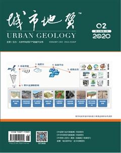
奥维地图在野外地质调查工作中的应用
2020-07-07彭振涂晓方
彭振 涂晓方


摘 要:随着科技进步与智能手机的普及,以奥维地图为代表的地图软件在野外地质调查工作中得到广泛应用,成为地质工作者的常用工具。奥维地图融合了谷歌卫星图,GPS功能,支持导入多种格式的地质信息数据,实现了3S技术融合应用,对比常规区域地质调查工作需要随身携带地质图、地形图与GPS等多种图件与设备,大幅提高了工作效率。主要功能如下:在陌生道路导航方面可以实现非矢量化的道路上根据遥感影像进行导航;野外地质救援方面可以分享自己的实时位置及周围地形地物及行驶轨迹;高程数据获取方面可以实现获取任意位置的高程数据,导出地形图的操作;遥感图的解译方面主要根据卫星影像分析地质构造、地层岩性、地形地貌及其他地质信息;地质信息的交互化方面可以将收集的地质图、构造图等平面图直接套合在谷歌影像上,指导野外调查,同时可以在野外调查记录数据,室内直接转换到其他制图软件上。
关键词:奥维地图;地质调查;地形图;3S技术
Abstract: With the development of science and technology and the popularization of smart phones, the mapping software represented by OvitalMap has been widely used in the field geological survey and become a common tool for geologists. OvitalMap integrates the satellite map of Google and the GPS function, supports the import of geological information data in various formats, and realizes the application of 3S integrated technology. Compared with conventional regional geological survey work, it is necessary to carry geological map, topographic map, GPS and other maps and equipment, which greatly improves the working efficiency. The main functions are as follows: in the navigation of unfamiliar roads, navigation can be realized according to remote sensing images on non-vectorization roads; during the field geological rescuing process it can share its real-time location and surrounding terrain features and driving track; in the aspect of elevation data acquisition, the operation of obtaining elevation data at any location and exporting topographic map can be realized; the interpretation of remote sensing map is mainly based on the analysis of geological structure, lithology, topography and other geological information; in terms of interactive geological information, geological maps and tectonic maps can be directly integrated into Google images to guide field survey. Meanwhile, data can be recorded in field survey and directly transferred to other mapping software indoors.
Keywords: OvitalMap; Geological survey; Topographic map; 3S technology
0 前言
地質工作是一个实践性很强的学科,需要在野外做大量的基础调查工作。如果能把室内整理的资料精确的应用到野外实际工作中,将会大大提高工作的效率及精确性。奥维地图的应用使此得以实现。它集成了Google地图、Google卫星图、Bing卫星图、等高线地图、百度地图、位置分享、轨迹记录、指南针、全球地图离线下载与语音导航等功能,分为手机版和电脑版(百度百科,2020)。……