Effectsof Surface Flux Parameterization on the Numerically Simulated Intensity and Structureof Typhoon Morakot(2009)
2016-08-12JieMINGandJunZHANG
JieMINGand Jun A.ZHANG
1Key Laboratory ofMesoscale SevereWeather/MOE and SchoolofAtmospheric Sciences,Nanjing University,Nanjing 210023
2Hurricane Research Division,Atlantic Oceanographic and Meteorological Laboratory, NationalOceanographic and Atmospheric Administration,Miami,FL,USA
3Rosenstiel SchoolofMarine and Atmospheric Science,University ofMiami,Miami,FL,USA
Effectsof Surface Flux Parameterization on the Numerically Simulated Intensity and Structureof Typhoon Morakot(2009)
JieMING∗1and Jun A.ZHANG2,3
1Key Laboratory ofMesoscale SevereWeather/MOE and SchoolofAtmospheric Sciences,Nanjing University,Nanjing 210023
2Hurricane Research Division,Atlantic Oceanographic and Meteorological Laboratory, NationalOceanographic and Atmospheric Administration,Miami,FL,USA
3Rosenstiel SchoolofMarine and Atmospheric Science,University ofMiami,Miami,FL,USA
The effects of surface flux parameterizationson tropical cyclone(TC)intensity and structure are investigated using the Advanced Research Weather Research and Forecasting(WRF-ARW)modeling system w ith high-resolution simulations of Typhoon Morakot(2009).Numerical experiments are designed to simulate Typhoon Morakot(2009)w ith different formulations of surface exchange coefficients for enthalpy(CK)and momentum(CD)transfers,including those from recent observationalstudiesbased on in situ aircraftdata collected in Atlantic hurricanes.The resultsshow that the simulated intensity and structure are sensitive to CKand CD,but the simulated track isnot.Consistentw ith previous studies,the simulated storm intensity is found to bemore sensitive to the ratio of CK/CDthan to CKor CDalone.The pressure–w ind relationship isalso found to be influenced by the exchange coefficients,consistentw ith recentnumericalstudies.This paperemphasizes the importanceof CDand CKon TC structuresimulations.The resultssuggest that CDand CKhavea large impacton surface w ind and flux distributions,boundary layer heights,thewarm core,and precipitation.Compared to available observations, theexperimentw ith observed CDand CKgenerally simulated better intensity and structure than theotherexperiments,especially over the ocean.The reasons for the structuraldifferencesamong the experimentsw ith different CDand CKsetups are discussed in the contextof TC dynam icsand thermodynam ics.
Typhoon Morakot,surface flux parameterization,exchange coefficients,boundary layer
1. Introduction
Tropical cyclones(TCs)obtain heat and moisture from the ocean and transfermomentum back to the ocean at the air–sea interface.Thus,surface fluxesof sensible and latent heatplay a very important role in the developmentandmaintenance of TCs.Malkus and Riehl(1960)found that strong surface fluxes can increase the equivalent potential temperature in the TC eyewall,which is linked to the decrease in m inimum sea levelpressure at the TC center(i.e.,increase in TC intensity).Early theoretical studies found that the TC intensity is sensitive to the selection of exchange coefficients for air–sea momentum and heat transfers(Ooyama,1969; Rosenthal,1971;Emanuel,1986).Rotunno and Emanuel (1987)showed that the increase in the exchange coefficient for enthalpy transfer(CK)and the decrease in the drag coefficient(CD)caused the increase in TC intensity in idealized numericalmodels.Based on comparisons ofmodel predictionsw ith observations fora number of hurricanes,Emanuel (1995)concluded that the TC intensity ismost sensitive to the ratio of CKover CD,and this ratiomust lie in the range 0.75–1.5 to achieve consistentmodelsimulationsw ith observations.Full-physical numericalmodel simulations of TCs also suggest that the TC intensity is sensitive to CDand CK(e.g.,Braun and Tao,2000;Nolan etal.,2009).
Early observationalstudies(e.g.,Smith,1980;Largeand Pond,1981;Geernaertetal.,1988)investigated CDin weak tomoderatew ind conditionsw ith 10m w ind speed(U10)<25 m s−1in theopen ocean.They found that CDincreasesalmost linearly w ith U10.The relationship between CDand U10has the form 1000CD=0.063U10+0.61,whereboth CDand U10have been adjusted to neutral stability(Sm ith,1980).However,results from the Coupled Boundary Layer and Air–Sea Transfer(CBLAST)experiment indicate that CDdoesnot increasew ith U10with no limitation(Black etal.,2007;French et al.,2007).Donelan et al.(2004)estimated CDin awave tank and found that CDreaches amaximum for U10at~33 m s−1and then levels off at higher w ind speeds.They attributed this leveling-off of CDto the increasing shelteringof w inds behind steeperwaves at higherw ind speeds.The above-mentioned studies support the result of Powell et al. (2003),who estimated CDusing the profi lemethod by fi tting hundreds of GPS dropsonde w ind profi les collected in hurricanes to a logarithmic relationshipw ith height.Ming et al.(2012)showed that CDestimated based on observational data in typhoonsalso behavessim ilarly as in the Powelletal. (2003)study.
Due to instrumentation limitations associated w ith sea saltand/orseaspray,directmeasurementsofsurfaceenthalpy fluxeshavebeen very difficultover theocean.Theonly available in situ observations over the past30 years(DeCosmo et al.,1996;Drennan etal.,2007)show that the exchange coefficient for latentheat transfer(CE)doesnotdepend on the w ind speed.Sim ilarly,the bulk sensible heat exchange coefficient(CH),or Stanton number,has also been found to be independent of wind speed.Note that CKis generally assumed to be equal to CEand CH,which is supported by the CBLAST result(Zhang et al.,2008).Wave tank observations also support the result from the CBLAST experiment, that CKis nearly constantw ith U10up to~40m s−1(Haus etal.,2010).Belletal.(2012)also found thatvaluesof CKestimated based on budget analyses of dropsonde and radar data in theboundary layerof theeyewall regionwere close to those reported by Zhang etal.(2008).
Most previous numerical studies on the impact of surface exchange coefficients on TC intensity and structure focused on Atlantic hurricanes or used idealized simulations (e.g.,Montgomery etal.,2010;Bryan,2012;Baoetal.,2012; Green and Zhang,2013).How sensitive the simulated intensity and structure inWestPacific typhoonsare to CDand CKis notwell documented.The objective of this study is to investigate theeffectsof CDand CKon the simulated intensity and structureof Typhoon Morakot(2009).Emphasisisplaced on simulations of structure,such as boundary layer heights,the warm core,and precipitation.Typhoon Morakot(2009)possessed unusual structures,including a large eye and strong outer circulation;thus,this storm was atypical compared to most hurricanes in the Atlantic basin.Thismotivates us to evaluate the choice of CDand CKin the numerical simulations to reproduce theunusualstructuresof TyphoonMorakot (2009).
2. Typhoon Morakot(2009)
Typhoon Morakot(2009)generated from a tropical depression over the Philippine Sea on 2 August2009.Itgradually intensified to a tropical storm and was assigned the name Morakot on 3 August.A fter that,itmoved westward towards Taiwan.Morakot(2009)intensified to typhoon intensity at1800 UTC 5 August,w ith the location of its center at(23.1°N and 129.3°E)and amaximum w ind speed of 33.4 m s−1.Morakot(2009)continued to move westward and made landfall in central Taiwan at 1200 UTC 7 August.One day later,Morakot(2009)turned tomove northwestward and went back over water into the Taiwan Strait. Subsequently,Morakot(2009)weakened to a severe tropical storm andmade itssecond landfallin Xiapu,Fujian Province, on the east coast of China at0820 UTC 9 August(Fig.1a). It gradually weakened as itmoved northward.Roughly 24 hours later,itweakened to adepression during the landfall in Zhejiang Province,China.

Fig.1.The(a)tracksand time seriesofsimulated(b)maximum surfacew ind speed and(c)minimum central pressure(hPa)of Morakot(2009)from 0000UTC 5August to 0000UTC 10August 2009 from the three experiments and the corresponding best-track analysisby JMA.
TyphoonMorakot(2009)broughtrecord-breaking torrential rainfallover Taiwan(Chien and Kuo,2011).This catastrophic storm sadly claimedmore than 600 livesand causedmore than 200 people to be classed asm issing,creating a total cost of damage estimated at US$3.3 billion(Zhang et al.,2010).It also affected more than 11 m illion people throughouteastern China and damaged thousandsof homes. Asa result,Typhoon Morakot(2009)has received attention in severalnumericalstudies.
Schwartz et al.(2012)studied Typhoon Morakot(2009) using the Advanced Research Weather Research and Forecasting(WRF-ARW)modeling system w ith dataassimilation of them icrowave radiances using a cyclic,limited-area ensemble adjustment Kalman fi lter.They found that the track, intensity,and precipitation forecastswere improved after assim ilatingmicrowave radiances.Xie and Zhang(2012)performed ensemble simulations using WRF-ARW to investigate the dynam ics and predictability of the record-breaking rainfall and flooding event in Taiwan induced by Typhoon Morakot(2009).They found that the large typhoon circulation and the southwesterly monsoon flow transported abundantmoisture into southern Taiwan,which,along w ith the influence of the complex high terrain,produced the heavy rainfall.
Wang etal.(2012)used theCloud-Resolving Storm Simulator(CReSS)to study the dynam ics related to themotion of Typhoon Morakot(2009)over Taiwan.Their simulations showed that the reduced moisture content induced the decrease in the rainfalland the increase in thestorm translation speed.They also pointed out that the asymmetric precipitation in Typhoon Morakot(2009)played an important role in itsvery slow motion upon leaving Taiwan,the lengthening of theheavy-rainfallperiod,and the increaseof the total rainfall amount.Furthermore,their results emphasized the potential contribution of asymmetric heating to the slowdown of the typhoon motion in the presence of complex terrain or in a monsoon environment.Wang etal.(2013)demonstrated that CReSS successfully simulated and reproduced both the distribution and tim ing of theheavy rainfall in Taiwanw ith high accuracywhen TyphoonMorakot(2009)passed by.The realtime forecast integrations of the CReSSmodelalso showed high-quality quantitative precipitation forecasts.
Hall et al.(2013)used the Advanced Regional Prediction System to simulate Typhoon Morakot(2009)when it made landfallover Taiwan.They investigated themesoscale structure ofMorakot(2009)and emphasized the roleof deep convection on the rainfall simulation.They identified that relatively large-amplitude wave structures developed in the outereyewall,known asvortex Rossbywaves(VRWs).They found that the strong asymmetry of the convection was associated w ith wavenumber1(WN1)VRWs,while theWN2 and WN3 VRWs were associated w ith the development of the deep convective band in Morakot’s(2009)southwestern quadrant.Huang et al.(2014)used the WRFmodel to explicitly simulate Typhoon Morakot(2009)and found that the simulated rain rateand precipitation efficiency(PE)over the CentralMountain Range(CMR)were highly correlated. They found also that the PE and the processesof vapor condensation and raindrop evaporation were strongly influenced by orographic lift.They also found that the increase in PE over the CMR comparedw ith thatover theoceanwasdue to an increase in the ice-phase deposition ratiowhen the liquidphase condensation reduced as theairon the leesidesubsided andmoved downstream.They emphasized the effects of the terrain on the simulationsof precipitation.
3. Experimentaldesign
Asmentioned above,the objective of this paper is to investigate the sensitivity of the simulated track,intensity and structureof TyphoonMorakot(2009)to thesurfaceexchange coefficients.We used the ARW modeling system(version 3.2;Skamarock et al.,2008)to conduct numerical experiments.Three experiments were performed using the ARW modelw ith twomodel domains.Themodelhorizontalgrid resolution was 4.5 km for the parent domain(D1)and 1.5 km for the nested domain(D2).The two domains covered 600×400 and 421×421 grid points,respectively(Fig.1a). D2 was an automatic vortex-follow ingmoving nestand the center of the domain was always located at the center of the storm.In all theexperiments,35 vertical(σ)levelswereused from the surface to themodel top at50 hPa.
D1 was initialized at0000 UTC 4 August2009 and was run for 6 days.D2 was started at 0000 UTC 5 August after a one-day spin-up.The outer domain was run in a fourdimensional data assim ilation(FDDA)mode to provide the bestpossible large-scaleconditions for the innerdomain.The innernested domainwas runwithout FDDA.The Japan Meteorological Agency(JMA)6-hourly gridded regionalanalysesat20×20 km horizontal resolution w ith 20 pressure levelswere used as the initial and boundary conditions for the ARW model.The JMA analyseswereproduced using amultivariate three-dimensionaloptimum interpolationmethod to combine the fi rst-guess fields from JMA’s regional spectral model(RSM)with observations from a variety of platforms (JMA,2007;Hosomi,2005).Note that the JMA analysesdid notcapture the realstructureand intensity ofMorakot(2009). Compared to the best track,the error of them inimum sealevelpressurewas13.7hPa,and thatof themaximum surface w ind speedwas10m s−1.The track of the storm in the JMA analyses also has a northwestward bias.Follow ing Ming et al.(2009),we appended a good vortex w ith the appropriate intensity(close to the best track)into the initial conditions. We ran D01 only from 0000UTC to 1600UTC 4 August,to make the storm intensity sim ilar to the best track.The threedimensional vortex was extracted and inserted back into the initial condition using the position of the best track,which corrected the biasof the storm centerat the initial time.Under the new initial condition,the error of them inimum sea level pressurewas 0.6 hPa and thatof themaximum surface w ind speedwas5.6m s−1.
The physics schemes used in the numericalexperiments included the Purdue Lin m icrophysics scheme(Lin et al., 1983;Chen and Sun,2002),the Yonsei University boundary layer scheme(Noh etal.,2003;Hong et al.,2006),the Rapid Radiative TransferModel longwave radiation scheme (Mlawer et al.,1997),and the Dudhia shortwave radiationscheme(Dudhia,1989).Cumulus parameterization schemes werenotused forboth domains.

Table 1.Thedifferentroughness lengths(z0)and thermal roughness lengths(z0q)in the three experiments.
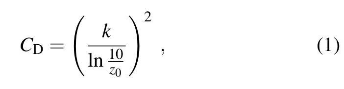
In this study,three experiments(see Table 1)were designed to exam ine the impactof CDand CKon the typhoon intensity and structuresimulations.Asmentioned earlier,surface fluxes were parameterized through CDand CK.In the surface-layer schemes of WRF-ARW,CDand CKwere parameterized using surfacemomentum(z0)and thermal(z0q) roughness lengths.The drag coefficient in the neutral conditionwas defined as:
where k is the von K´arm´an constant.The enthalpy exchange coefficientwasdefined as:

In the control experiment(referred to as CTL hereafter),z0depended on thew ind speed using the Charnock(1955)relationship,in the form of:

where u∗is the friction velocity,g is the gravitationalacceleration.This formula causes z0to increase continuously w ith the w ind speed,w ith no limit.For z0qthe Carlson–Boland scheme(Carlson and Boland,1978)wasused:

where xkais a constant that equals 2.4×10⁻⁵.Since z0qvariesmore slow ly w ith the friction velocity than z0,CKincreasesmore slow lyw ith thew ind speed than CD(Dudhiaet al.,2008).
In the second experiment(referred to as TC1 hereafter), an alternate CDformulation based on the high-wind laboratory experimentof Donelan etal.(2004)was adopted.The roughness lengthwas defined as:

where 1.27×10⁻⁷z02.85×10−3(units:m).Values of CDbased on Eqs.(1)and(5)are smaller than those from the Charnok relationship.CDincreases almost linearly with the 10 m w ind speed,up to a maximum of 0.0024 at 35 m s−1(Davis et al.,2008).In addition,the thermal roughness lengthwascalculated using the ramped formula(Dudhia etal.,2008)as follows:

Thissetup of z0and z0qcauses CKto increasealmost linearly w ith w ind speed,and CKbecomes larger than CDatw ind speedsof>50m s−1.Note that the ratio CK/CDexceeds1 as thew ind speed becomes larger than 50m s−1,although the condition for themaximum surfacew ind speed of>50m s−1wasnevermet in oursimulations(Fig.1b).
In the third experiment(referred to as TC2 hereafter),the drag formulationwasstillbased on the resultofDonelan etal. (2004),but the thermal roughness length was adopted based on theGarratt formula(Garratt,1992,p.102)as follows:

where T is air temperature at the surface,γis the kinematic viscosity of air(units:m2s−1).In this setup,CKis related to u∗and T.CKdecreasesw ith increasingw ind speed in smooth flow,while it isa constant in rough flow orhigh-wind conditions(Garratt,1992,p.102).Note that CKusing the Garratt formula is closer to recent observations from CBLAST and thewave tank experimentmentioned in the introduction.
All simulations in the three experimentswere run from 0000 UTC 5 August to 0000 UTC 10 August 2009,which covered almost the entire lifecycle of Typhoon Morakot (2009),from the intensifying stage to the landfalling stage. A ll experiments were conducted w ith the same initial vortex and boundary conditions,so the differences in the experiments were solely related to the different formulas of the exchange coefficientsused in theWRF-ARW model.
The exchange coefficients and ratio of CK/CDas a function of the surfacewind speed are shown in Fig.2.In CTL, the Charnok relationship wasused such that CDincreased almost linearly w ith the 10 m w ind speed,because of the increasing surface roughness.CKalso increased slow ly w ith the w ind speed.In TC1 and TC2,when the Charnok relationship was changed to the new formulation of CDbased on Donelan etal.(2004),CDincreasedw ith thew ind speed up to~33m s−1,then levelled off.In CTL,CKwas based on the Carlson–Boland formula and was larger than that based on the ramped formula used in TC1 forw ind speeds of<30m s−1.On the other hand,the CKquantities produced by these two formulaswere close to one another for w ind speeds of>30m s−1.The Garratt formula for the thermal roughness lengthwasused in TC2,where the CKwas smaller than thatin CTL and TC1 forw ind speedsof>20m s−1.In TC2,the ratioof CK/CDwas larger than thatin CTL forw ind speedsof<20m s−1,andmarginally smaller forwind speeds of>20 m s−1.Note that the ratio of CK/CDin TC1 was larger than that in the other two experiments forallw ind speeds.

Fig.2.The simulated(a)drag coefficient(CD),(b)enthalpy exchange coefficient(CK)and(c)exchange coefficient ratio (CK/CD)as a function of 10 m w ind speed in the whole of domain 2 from the three experiments at 1800 UTC 6 August 2009.
4. Results
4.1. Track and intensity
Thesimulated track of Typhoon Morakot(2009)from the threeexperiments from 0000UTC 5August to 0000UTC 10 Augustare comparedw ith the JMA best track in Fig.1a.As mentioned earlier,TyphoonMorakot(2009)movedwestward in the fi rst two days,and turned northwestward aftermaking landfall in Taiwan.It then continued tomovenorthward,and made a second landfall in Fujian Province.The simulated storm tracks in the three experimentswere quite sim ilar,although they deviated from the best track.A ll three experiments reproduced the observed west-northwestward storm motion.Overall,the simulated tracksare notsensitive to the different formulasof exchange coefficients.
The simulatedmaximum surfacew ind andm inimum sea levelpressure from the threeexperimentsare comparedw ith the best track from JMA in Figs.1b and 1c.Although all threeexperimentswere initializedw ith thesame initialcondition,the intensity forecastsweredifferent,especially after the maximum w ind speed reached 30m s−1at the forecast time of 0000 UTC 6 August.In the next two days,all three experiments simulated maximum surface w ind speed thatwas larger than observed.Themaximum surfacew ind speed simulated in CTL and TC2 were closer to the best track.The difference in the simulated m inimum sea level pressure,on the other hand,was clearer than that in themaximum surfacew ind speed among the threeexperiments.The simulated m inimum sea level pressure in TC2 was closest to the best track among the threeexperiments.
Figure 3 plots the relationship between the maximum w ind speed and m inimum sea level pressure from the three experiments and the best track of JMA.It appears that the pressure–w ind relationship is sensitive to CDand CK.The result is consistentw ith a recentnumerical study carried out by Green and Zhang(2013),who found that the pressure–w ind relationship was sensitive to the selection of different surface layer schemes inWRF simulationsof Hurricane Katrina(2005).Our result is also consistent w ith Bao et al. (2012),who ran different surface-layer physics in idealized simulationsof theHurricaneWeatherand Research Forecasting(HWRF)modeland confi rmed that thepressure–w ind relationship was sensitive to CDand CK.
The simulated storm intensity and pressure–w ind relationship in TC2 were closest to the best track among the threeexperiments,especially forw ind speedsof>30m s−1. This resultisencouraging because the CDand CKused in TC2 were closer to recentobservations than those in theother two experiments.Our resultgenerally indicates thatwhen CKis larger,the storm obtainsmoresensibleand latent fluxes from the underlying ocean,resulting in larger surfacew ind speed and lower central pressure.On the other hand,when CDis larger,surface friction is larger,which tends to reduce the surfacew ind speed.Itwas pointed outby(Montgomery et al.,2010)that larger surface friction can also lead to a larger gradientw ind imbalance in the boundary layer,which couldlower the central pressure.Thisexplainswhy the simulated m inimum sea level pressure in CTL was lower than that in TC2 but themaximum wind speed in CTL was smaller than that in TC2.

Fig.3.Scatterplotofm inimum sea levelpressure vsmaximum surface w ind speed.The blue diamonds represent CTL,the red circles represent TC1,and the green crosses represent TC2. Theopen squares representthepressure–w ind relationship from JMA.
4.2. Evolution ofprimaryand secondary circulationsand thewarm core
Time–radius Hovm¨oller diagrams of azimuthally averaged tangentialw ind velocity(Vt)at the altitude of 2 km and radialwind velocity(Vr)at the altitude of 250m,from 0000 UTC 6August to 1200UTC 7August,aredisplayed in Figs. 4a–c and 4d–f,respectively.As can be seen,the evolution of theaxisymmetric Vtand Vrin the three experimentswassimilar.In the fi rst6 h of the simulations,Morakot(2009)wasa weak storm thathad amaximum Vtof25m s−1andminimum Vrof−10 m s−1,located at the radius of~170 km.Later, Vtincreased gradually w ith time and the radiusofmaximum tangentialw ind speed(RMW)became smaller.Themagnitude of Vrdoubled from−10 to−20m s−1in the next24 h and the radiusof the peak inflow also contracted(Figs.4d–f) in response to the intensification of the storm.Inward from the RMW,the radial velocity decelerated rapidly ata larger rate thanoutside theRMW.Afteranother16 h,thestorm centerwas close to Taiwan such that themagnitudes of both Vtand Vrdecreased.Among the three experiments,the peak Vtand Vrin TC1 were the largest,mainly because the ratio of CK/CDused in TC1was larger than that in CTL and TC2.

Fig.4.Time–radius Hovm¨oller plots of azimuthally averaged tangentialw ind(units:m s−1)at2 km altitude from(a) CTL,(b)TC1 and(c)TC2,and radialw ind(units:m s−1)at250m altitude from(d)CTL,(e)TC1 and(f)TC2.The thick lines depict the RMW at2 km altitudeand themaximum inflow at0.25 km altitude.
The time–height evolution of the mean temperature anomalies(referred to as warm-core anomalies hereafter) from 0000 UTC 6 August to 1200 UTC 7 August is plotted in Fig.5 for CTL,TC1 and TC2.Follow ing Liu etal.(1999) and Lietal.(2013),we fi rstcalculated themean temperature w ithin the region of 630×630 km from the typhoon’sm inimum surface pressure centerateach vertical level.Then,the temperature anomaly was obtained by subtracting themean temperature from the temperatureateach grid pointand each level.Thewarm-coreanomaly was then defined as the average value of the temperature anomaliesw ithin the region of 300×300 km from the storm centerateach level.Theheight of the peakmean temperature anomaly represents thewarm core height.It is evident from Fig.5 that the peak warm coreanomaly in CTL and TC2wassmaller than thatin TC1, indicating that the warm-core anomaly was correlated w ith the storm intensity.According to thehydrostatic balance,the lower theminimum sea level pressure the larger thewarmcoreanomaly(Zhang and Chen,2012).Thus,thewarm-core anomaly in TC2 was the smallest among the three experiments as the storm intensity in TC2 was the lowest.On the otherhand,thewarm-coreheightwasnotcorrelatedw ith the storm intensity,because thewarm-coreheightwas located at 8–12 km for the three experiments.
4.3. Surface wind,surface flux and boundary layer heights
The horizontal distributions of 10 m w ind speed valid at 1800 UTC 6 August 2009 are shown in Figs.6a–c for CTL,TC1 and TC2,respectively.It isevident that themaximum surfacew ind speed in TC1was larger than that in the other two experiments.The eyewall region,which covered themaximum w ind speed,was broader in TC1 than in CTL and TC2.Comparing TC1 and TC2,the resultsuggests that increasing CKalone would increase the storm intensity in termsof themaximum w ind speed in theeyewall region.The surfacew ind distribution in TC2 was sim ilar to that in CTL, but themaximum w ind speed in the right-rear quadrantwas slightly larger in TC2 than in CTL.Although CKin TC1was close to that in CTL,themaximum surface w ind speed in TC1 was larger than that in CTL,especially forw ind speeds of>25m s−1.Thisdifferencewasmainly due to the fact that the CDused in TC1wassmaller than that in CTL.
Large values of latent fluxes were found in the eyewall and primary rain band regions where surface w ind speeds were also large(Figs.6d–f).Themaximum latentheat flux in TC2 wasmuch smaller than that in the other two experiments,mainly because the CKused in TC2 was smaller than that in CTL and TC1(Fig.2).The difference in the sensibleheat fluxesamong the threeexperiments(Figs.6g–i)was much smaller than the difference in the latent heat fluxes, although the same formulawasused for calculating both the latentand sensible heat fluxes.Itappears that the simulated maximum sensibleheatflux in TC1wasthe largestamong the three experiments,while that in TC2 was the smallest.The asymmetric distribution of the sensible heat fl ux in TC2 was closer to that in CTL than in TC1.Overall,the result(Fig. 6)implies that CKand CDalonehaveoppositeeffectson surface enthalpy flux,and CKinfluences the enthalpy fluxmore than CD.A larger CKinducesmoresensibleand latent fluxes, which supportmore energy for a storm to intensify.On the otherhand,a larger CDinduces largersurface friction,which reduces the surfacew ind speed and in turn reduces the sensi-ble and latent fluxes because these fluxes are also a function of thew ind speed.

Fig.5.Time–height diagrams of temperature deviation(units: K)from the three experiments:(a)CTL;(b)TC1;(c)TC2. The average was computed w ithin the area of 300×300 km from the surfaceminimum pressure center for simulations.The anomalieswere obtained by subtracting the averaged temperaturew ithin the region atevery height level.

Fig.6.Themodel-simulated 10m w ind speed(colorscale;units:m s−1)andwind vectors(arrows;units:m s−1)from (a)CTL,(b)TC1 and(c)TC2;latentheat flux(color scale;units:W m−2)and w ind vectors(arrows;units:m s−1) from(d)CTL,(e)TC1 and(f)TC2;and sensibleheat flux(colorscale;units:W m−2)and w ind vectors(arrows;units: m s−1)from(g)CTL,(h)TC1 and(i)TC2 at1800UTC 6 August2009.The large vector indicates themotion of the storm,and the thin crosses divide the storm into fourquadrants.
Figure7 shows the radius–heightplotsof theazimuthally averaged tangentialand radialvelocities forall three experiments at 1800 UTC 6 August 2009.Themagnitudes of the tangentialand radial velocities in TC1 were generally larger than those in the other two experiments,consistentw ith the simulated storm intensities.However,the peak tangential w ind speed in TC2was smaller than that in CTL,which was notconsistentw ith the intensity differencebetween these two experiments in terms of themaximum surfacew ind,as TC2 had a largermaximum surfacewind speed.Thisdiscrepancy can be explained by the role of CDin regulating the boundary layer dynam ics.Montgomery et al.(2010)pointed out thatan increase in CDleads to an increase in storm intensity in terms ofmaximum tangentialw ind speed in the boundary layer,although it reduces the surfacew ind speed through surface friction.Our result is consistentw ith that of Montgomery etal.(2010),indicating that surface flux parameterization affects the vertical structure ofw ind velocitiesabove the surface layer.
In many PBL schemes used in full-physics numerical models,one of the crucial elements is the boundary layer height,because it is coupled w ith the energy transport from the surface layer to the boundary layer and above(e.g.,Beljaars and Viterbo,1998;Noh et al.,2003).The boundary layer height is also a key variable that regulates the verticaldistribution of turbulent fluxesand helpsdeterm inewhere turbulent fluxes tend to become negligible(Stull,1988).Follow ing Zhang et al.(2011),the kinematic boundary layer height is defined by the heightofmaximum tangentialw ind speed(hvtm).Inflow layer depth(hinf),defined as the height where the inflow reduces to 10%of the peak value,also represents the kinematic boundary layer height.In all three experiments,hvtmdecreased with decreasing radius toward the storm center(Figs.7a–c).Thisbehavior isconsistentw ith the resultgiven by Zhang etal.(2011),who composited hundreds of dropsondes data collected from 13 hurricanes to study thecharacteristics of hurricane boundary layer heights.Within the radiusof125 km,hvtmin TC2wassmaller than thatin the other two experiments,andwascloser to observations(Zhang etal.,2011,Fig.5a).

Fig.7.Azimuthally averaged radius–heightcrosssectionsof tangentialw ind(units:m s−1)from(a)CTL,(b)TC1 and (c)TC2;radialw ind(units:m s−1)from(d)CTL,(e)TC1 and(f)TC2;and the gradient force imbalance(FPEC,units: m s−1h−1)from(g)CTL,(h)TC1 and(i)TC2 at1800UTC 6 August2009.The thick lines in(a–c)depict the height of themaximum w ind speed varying w ith radius,and the thick dashed lines in(d–f)depict the inflow layer height, defined as the heightwhere the radialw ind speed is10%of the peak inflow.
The difference in the inflow layer depth(hinf)among the three experiments wasmuch larger than that in hvtm(Figs. 7d–f).Itappears that hinfin TC1 was the highest.A ll three experiments captured the decrease of hinfw ith deceasing radius,consistent w ith observations.Furthermore,hvtmwas smaller than hinfin all three experiments,which was also consistentw ith observations.Overall,themagnitude of hinfin TC2 was closest to observations(Zhang etal.,2011,Fig. 5b).The above results indicate that boundary layer heights are tied to the surface flux parameterization.
According to Zhang et al.(2001),themomentum equation of the radialw ind velocity in the cylindrical coordinates system can bew ritten as


Fig.8.(a)U.S.Air Force DefenseMeteorological Satellite Program(DMSP)polar-orbiting satellite F-17microwave imagery of polarization corrected temperaturew ith horizontal polarization w ith 91 GHz at2112 UTC 6 August,and simulated composite radar reflectivity(units:dB Z)at2100UTC 6 August2009 from(b)CTL,(c)TC1 and(d)TC2. (e)The observed composite reflectivity and simulated composite reflectivity from experiment(f)CTL,(g)TC1 and(h) TC2 at1200 UTC 7 August2009.(i)The observed composite reflectivity and simulated composite reflectivity from experiment(j)CTL,(k)TC1 and(l)TC2 at0000UTC 8August2009.
where w is verticalw ind velocity;Ωis the angular velocity andφis the latitude;r is the radius from the center;λis the azimuthal angle.Equation 11 states that the radial acceleration isdetermined by the radial pressuregradient force (FP;fi rst term on the right-hand side of the equation),the centrifugal force(FE;second term),the Coriolis force(FC; third and fourth terms),and diffusion(Ud;last term).Thedegreeofgradient force imbalanceornetagradient force(FPEC) is evaluated by adding FP,FE,and FCtogether(Figs.7g–i). Firstly,FPECwas larger in TC1 than in the other two exper-iments,supporting the fact that the simulated storm in TC1 wasstronger,because thestorm tended to spin-up fasterwhen FPECwas larger(Sm ith et al.,2009).A lthough the CK/CDwas alike in CTL and TC2,FPECwas larger in CTL than that in TC2.Thiswasmainly due to the different CDused in those two experiments.Follow ing the dynamicalexplanation of Montgomery et al.(2010),the agradient tendencies near thesurface caused the inflow ing ringsofboundary-layer air to converge farther inwards in the storm centerbefore rising outof the boundary layerand ascending into theeyewall updraught,resulting in enhanced maximum tangentialw ind speed.Our result is consistentw ith this argument(Fig.7). Italso suggests that intense positive supergradientacceleration occurs in the vicinity of themaximum tangentialw ind speed and isassociated w ith the outflow jetabove the boundary layer.
4.4. Radarreflectivityand precipitation
Next,we investigate the simulated radar reflectivity and precipitation in the three experiments.Figure 8a shows the observed U.S.Air Force Defense Meteorological Satellite Program polar-orbiting satellite F-17microwave imagery of polarization corrected temperature w ith a horizontal polarization at 91 GHz valid at 2112 UTC 6 August.The simulated composite radar reflectivity valid at 2100 UTC 6 August from CTL,TC1 and TC2 are shown in Figs.8b–d,respectively.Due to the interaction of the typhoon circulation w ith themonsoon flow and verticalw ind shear(Wang etal., 2012),the storm became asymmetric.All three experiments captured theasymmetric distribution of radar reflectivity and reproduced the unclosed eyewall in the southern part of the storm.The simulated reflectivity in TC2 was only slightly closer to observations than in the other two experiments,as it captured broaderhigh reflectivity area in the southern eyewall.Otherw ise,the overall rainfall structurewas sim ilar in allexperiments.
Theobserved and simulated radar reflectivity composites at1200UTC 7Augustand 0000UTC 8Augustareshown in Figs.8e–h and Figs.8i–l,respectively.At1200 UTC 7 August,Typhoon Morakot(2009)was located on the east side of Taiwan before landfall.It is evident from the observation(Fig.8e)that thestrongest reflectivitywas located on the southwestside of the storm.Thisasymmetric rainfallpattern wascaptured by all theexperiments.The simulated reflectivity in the eyewall region was stronger in CTL and TC1 than in TC2(Figs.8f–h).The simulated reflectivity in TC2 was slightly closer to observations than in the other two experimentsbecause the unclosed eyewall,w ith the principal rainband located in the southern partof the storm and the strong echoover Taiwan,werecaptured in TC2.At0000UTC 8August,the observed precipitation pattern becamemore asymmetric than in earlier periods.The strong echoes were observed on the south side of Taiwan(Fig.8i).In CTL and TC1,the simulated reflectivity wasstillstronger than that in TC2(Figs.8j–l).Again,TC2 performed slightly better than in the other two experiments.
Overall,the total precipitation was strongest in TC1 and weakest in CTL,especially after 1200 UTC 6 August(Fig. 9a).Note that theaccumulation period of precipitation is1 h. As TC1 simulated the strongest storm while CTL simulated theweakeststorm,this resultsuggests that the totalprecipitation iscorrelatedw ith thestorm intensity.The10m domain–averaged divergencesofmoisture flux(note thatnegativevalues representconvergence of themoisture flux)are shown in Fig.9b.It is evident that the convergence ofmoisture flux was correlated w ith the total precipitation.This result isnot surprising,as the low-levelmoisturewas themain source of the rainfall.Nonetheless,the resultsuggests thatsurface flux parameterizations have a substantial impacton precipitation simulations.
Although the simulated rainfall over the ocean was strongly tied to surface flux parameterization,interestingly, we found that the rainfall over land(i.e.,Taiwan)wasmuch less sensitive to the surface flux parameterization.Figure 10 compares the 12 h accumulated precipitation from CTL, TC1 and TC2 togetherw ith the objective analysesof rainfall measured by automaticweatherstationsover Taiwan,valid at 0600UTC and 1800 UTC 7 August.Prior to the landfallof Morakot(2009)in Taiwan(1800UTC 6Augustto 0600UTC 7 August),the observation(Fig.10a)shows two regions of strong precipitation across the island:oneon thenorth sideofTaiwan and the other on the south side over highmountains. A ll three experiments simulated these two regions of strong rainfall,although the simulated rainfall wasmuch stronger than the observed valued.In particular,all three simulations over-predicted the precipitation from central to southern Taiwan.However,the difference in the precipitation distribution in the threeexperimentswasvery smallover thewhole island.

Fig.9.Averaged(a)accumulated rainfall and(b)10 m divergence ofmoisture flux from experiment CTL,TC1 and TC2. The average was computed w ithin the area of 300×300 km from the surfacem inimum pressure center.

Fig.10.12 h accumulated precipitation(units:mm)valid at 0600 UTC 7 August 2009 from(a)automatic weatherstation hourly observations,(b)CTL,(c)TC1 and(d)TC2 over Taiwan;and 12 h accumulated precipitation valid at1800 UTC 7 August2009 from(e)automaticweather station hourly observations,(f)CTL,(g) TC1 and(h)TC2 over Taiwan.
The above result suggests that the precipitation was lesssensitive to the exchange coefficients over land than over the ocean in Morakot(2009).Over the ocean,the role of the exchange coefficient in precipitation wasan indirectone, through influencing the(horizontal)moisture flux convergence(and ultimately rainfall)and through affecting the intensity of thestorm.For theprecipitationover land,themoisture came from the ocean,even though the end precipitation fellover land.In Typhoon Morakot(2009),the effectof terrain(i.e.,forced uplift)played adom inantrole in thedistribution of theprecipitation over Taiwan(Halletal.,2013;Wang etal.,2013),which is likely themain reason for the sim ilar rainfallsimulationsamong the threeexperiments.
5. Summary and discussion
In this study,three numerical experiments were performed w ith the WRF-ARW model to study the impact of surface flux parameterizations on the structure and intensity of Typhoon Morakot(2009).The initial conditions of the threeexperimentswereall from the JMA RSManalysis field. The simulated track and intensity of Morakot(2009)were verified against thebest track.Different formulasofmomentum and heat roughness lengthswere tested in sensitivity experiments thatgoverned thebehaviorof the surfaceexchange coefficients formomentum and heat transfers.The results showed that the simulated track was notsensitive to the exchange coefficients,but the simulated intensity and structure were.
Our results indicate that the surfaceexchange coefficients are key factors for the simulation of surfacew ind speed and fluxes.The effect of CKon the surface enthalpy flux is straightforward because of the linear relationship between these two parameters.On the other hand,the effect of CDon the enthalpy flux takes place via the surfacew ind speed. When the CDissmall,themaximum surfacew ind speed tends to be larger due to reduced surface friction.In turn,the enthalpy flux becomes larger because of the largerw ind speed. Overall,we found CKhad a larger impacton theenthalpy flux simulation than CD.
Consistentw ith previous studies(e.g.,Emanuel,1995), the simulated storm intensity was found to bemore sensitive to the ratio of CK/CDthan to CKor CDalone.According to the idealized numerical simulation given by Montgomery et al.(2010),CK/CDshould havea criticalvalue for the intensification of storm.If CDis too large,the storm w illnot intensify.When CK/CDis larger,the simulated storm is stronger and vice versa.In the CTL experiment,the intensity simulation is comparable to that in TC2,because a sim ilar CK/CDwasused in these two experiments.
Thepressure–w ind relationshipwasalso found to besensitive to CDand CK,consistentw ith recentnumericalstudies of Atlantic hurricanes(Bao et al.,2012;Green and Zhang, 2013).Overall,the simulated intensity and pressure–w ind relationship in TC2wasclosest to thebest track than those in CTL and TC1.This resultisencouraging because the CKand CDused in TC2 were close to recent field and wave tank observations.This resultisalso consistentw ith thatof Zhang et al.(2012),who showed thatobservation-based surface layer and boundary layer physics led to improvements in the operationalHWRFmodeland better intensity forecasts.
Our resultsalso indicate thatsimulated structures,such as the surfacew ind distribution,boundary layerheights,warmcore anomaly and height,and precipitation are affected by CDand CK.Compared to the dropsonde observations from Zhang etal.(2011),the simulated kinematic boundary layer heights in TC2 are closer to observations than the other two experiments.Thewarm-coreanomaly is tied to the storm intensity but not the warm-core height,consistentw ith Stern and Nolan(2012).The difference in the rainfall over the ocean is consistent w ith the difference in storm intensity, which can be explained by the difference in the convergence ofmoisture flux in the boundary layer.Over land,the simulated rainfall ismuch less sensitive to CDand CKthan over the ocean,which we attribute to the dominance of the terrain effect on the precipitation in Typhoon Morakot(2009), aspointed outbyWang etal.(2013)and Halletal.(2013).
Wealso conducted dynamicalanalyses to investigatewhy CDand CKaffect the vertical structure of w ind velocities in the boundary layer.Consistentw ith Montgomery et al. (2010),we found thata larger drag coefficient can lead to a largergradientw ind imbalance in theboundary layer(Fig.7). Asa resultof the largeragradient forcing,theboundary-layer air converged farther inward near the storm centerbefore rising outof the boundary layer and ascending into the eyewall updraft.The end resultwas enhanced maximum tangential w ind speed,despite the loss of absolute angularmomentum en route.
In this study,we focused on investigating the sensitivity of the simulated intensity and structure of Typhoon Morakot (2009)to the surfaceexchange coefficientsonly,while keeping the restof themodelphysics the same.Wenote thatother partsof themodelphysics(e.g.,planetary boundary layerparameterization and radiation parameterization)may also be important for TC simulations.Futurework w illevaluate the impactof otheraspectsofmodelphysicson numericalsimulationsof TC structure and intensity change.
Acknow ledgements.Jie MING was primarily supported by the National Fundamental Research 973 Program of China(Grant Nos.2015CB452801 and 2013CB430100),the National Natural Science Foundation of China(Grant No.41105035),and the Fundamental Research Funds for the Central Universities(Grant Nos.20620140054 and 20620140347).Jun ZHANG was supported by NOAA’s Hurricane Forecast and Improvement Project(HFIP), GrantNos.NA14NWS4680028 and NASA GrantNNX14AM69G. Wearegrateful to theHigh PerformanceComputing Centerof Nanjing University for carrying out the numerical calculations in this paperon its IBMBlade cluster system.
REFERENCES
Bao,J.-W.,S.G.Gopalakrishnan,S.A.Michelson,F.D.Marks, and M.T.Montgomery,2012:Impact of physics repre-sentations in the HWRFX on simulated hurricane structure and pressure-w ind relationships.Mon.Wea.Rev.,140,3278–3299.
Beljaars,A.C.M.,and P.Viterbo,1998:Role of the boundary layer in a numerical weather prediction model.Clear and Cloudy Boundary Layers,A.A.M.Holtslag,and P.G. Duynkerke,Eds.,Royal Netherlands Academy of Arts and Sciences,Amsterdam,287–304.
Bell,M.M.,M.T.Montgomery,and K.A.Emanuel,2012:Air-sea enthalpy and momentum exchange atmajor hurricane w ind speeds observed during CBLAST.J.Atmos.Sci.,69,3197–3222.
Black,P.G.,and Coauthors,2007:Air-seaexchange in hurricanes: Synthesis of observations from the coupled boundary layer air-sea transferexperiment.Bull.Amer.Meteor.Soc.,88,357–374.
Braun,S.A.,and W.-K.,Tao,2000:Sensitivity of high-resolution simulations of hurricane Bob(1991)to planetary boundary layer parameterizations.Mon.Wea.Rev.,128,3941–3961.
Bryan,G.H.,2012:Effects of surface exchange coefficients and turbulence length scales on the intensity and structure of numerically simulated Hurricanes.Mon.Wea.Rev.,140,1125–1143.
Carlson,T.N.,and F.E.Boland,1978:Analysis of urban-rural canopy using a surface heat flux/temperaturemodel.J.Appl. Meteor.,17,998–1013.
Charnock,H.,1955:Wind stresson awatersurface.Quart.J.Roy. Meteor.Soc.,81,639–640.
Chen,S.H.,andW.-Y.Sun,2002:A one-dimensional time dependentcloudmodel.J.Meteor.Soc.Japan,80(1),99–118.
Chien,F.-C.,and H.-C.Kuo,2011:On the extreme rainfallof Typhoon Morakot(2009).J.Geophys.Res.,116,D05104,doi: 10.1029/2010JD015092.
Davis,C.,and Coauthors,2008:Prediction of landfalling hurricanes w ith the advanced hurricane WRFmodel.Mon.Wea. Rev.,136,1990–2005.
DeCosmo,J.,K.B.Katsaros,S.D.Smith,R.J.Anderson,W.A. Oost,K.Bumke,and H.Chadw ick,1996:Air-sea exchange of water vapor and sensible heat:The Humidity Exchange over the Sea(HEXOS)results.J.Geophys.Res.,101,12 001–12 016.
Donelan,M.A.,B.K.Haus,N.Reul,W.J.Plant,M.Stiassnie,H. C.Graber,O.B.Brown,and E.S.Saltzman,2004:On the lim iting aerodynam ic roughness of the ocean in very strong w ind.Geophys.Res.Lett.,31,L18306,doi:10.1029/2004GL 019460.
Drennan,W.M.,J.A.Zhang,J.R.French,C.McCormick,and P. G.Black,2007:Turbulent fluxes in the hurricane boundary layer.Part II:Latentheat flux.J.Atmos.Sci.,64,1103–1115.
Dudhia,J.,1989:Numerical study of convection observed during the w intermonsoon experiment using amesoscale two dimensionalmodel.J.Atmos.Sci.,46,3077–3107.
Dudhia,J.,and Coauthors,2008:Prediction of Atlantic tropical cyclonesw ith the Advanced HurricaneWRF(AHW)model. 28th Conf.on Hurricanes and Tropical Meteorology,Orlando,Florida,Preprint18A.2.
Emanuel,K.A.,1986:An air-sea interaction theory for tropical cyclones.Part I:Steady-statemaintenance.J.Atmos.Sci.,43, 585–605.
Emanuel,K.A.,1995:Sensitivity of tropical cyclones to surface exchange coefficients and a revised steady-statemodel incorporating eye dynamics.J.Atmos.Sci.,52,3969–3976.
French,J.R.,W.M.Drennan,J.A.Zhang,and P.G.Black,2007: Turbulent fluxes in the hurricane boundary layer.Part I:Momentum flux.J.Atmos.Sci.,64,1089–1102.
Garratt,J.R.,1992:The Atmospheric Boundary Layer.Cambridge University Press,316 pp.
Geernaert,G.L.,K.L.Davidson,S.E.Larsen,and T.Mikkelsen, 1988:Wind stressmeasurements during the Tower Ocean Wave and Radar Dependence Experiment.J.Geophys.Res., 93,13 913–13 923.
Green,B.W.,and F.Q.Zhang,2013:Impacts of air-sea flux parameterizations on the intensity and structure of tropical cyclones.Mon.Wea.Rev.,141,2308–2324.
Hall,J.D.,M.Xue,L.K.Ran,L.M.Leslie,2013:High-resolution modeling of Typhoon Morakot(2009):Vortex Rossbywaves and their role in extreme precipitation over Taiwan.J.Atmos. Sci.,70,163–186.
Haus,B.K.,D.Jeong,M.A.Donelan,J.A.Zhang,and I. Savelyev,2010:Relative rates of sea-air heat transfer and frictional drag in very high w inds.Geophys.Res.Lett.37, L07802,doi:10.1029/2009GL042206.
Hong,S.Y.,Y.Noh,and J.Dudhia,2006:A new verticaldiffusion packagew ith an explicit treatmentof entrainmentprocesses. Mon.Wea.Rev.,134(9),2318–2341.
Hosomi,T.,2005:Implementation of targeted moisture diffusion for the JMA Regional SpectralModel(RSM).CAS/JSC WGNE Research Activities in Atmospheric and Oceanic Modelling/WMO.,35,7–8.
Huang,H.-L.,M.-J.Yang,and C.-H.Sui,2014:Waterbudgetand precipitationefficiency of TyphoonMorakot(2009).J.Atmos. Sci.,71,112–129.
JMA,2007:Outline of the operational numericalweather prediction at the Japan Meteorological Agency.Appendix toWMO NumericalWeather Prediction Progress Report,Japan MeteorologicalAgency,Tokyo,194 pp.
Large,W.G.,and S.Pond,1981:Open ocean momentum flux measurements in moderate to strong w inds.J.Phys. Oceanogr.,11,324–336.
Li,X.,J.Ming,Y.Wang,K.Zhao,and M.Xue,2013:Assim ilation of T-TREC-retrieved w ind data w ith WRF 3DVAR for the short-term forecasting of typhoon Meranti(2010)near landfall.J.Geophys.Res.,118,10 361–10 375.
Lin,Y.-L.,R.D.Farley,and H.D.Orville,1983:Bulk parameterization of the snow field in a cloud model.J.Climate Appl. Meteor.,22(6),1065–1092.
Liu,Y.B.,D.-L.Zhang,and M.K.Yau,1999:Amultiscalenumerical study of Hurricane Andrew(1992).Part II:Kinematics and inner-core structures.Mon.Wea.Rev.,127,2597–2616.
Malkus,J.S.,and H.Riehl,1960:On the dynam ics and energy transformations in steady-state hurricanes.Tellus,12,1–20.
Ming,J.,Y.Q.Ni,and X.Y.Shen,2009:The dynam ical characteristicsand wave structureof typhoon Rananim(2004).Adv. Atmos.Sci.,26,523–542,doi:10.1007/s00376-009-0523-0.
Ming,J.,J.J.Song,B.J.Chen,and K.F.Wang,2012:Boundary layer structure in typhoon Saomai(2006):Understanding the effects of exchange coefficient.J.Trop.Meteor.,18(2),195–206.
Mlawer,E.J.,S.J.Taubman,P.D.Brown,M.J.Iacono,and S.A. Clough,1997:Radiative transfer for inhomogeneous atmosphere:RRTM,a validated correlated-k model for the longwave.J.Geophys.Res.,102,16 663–16 682.
Montgomery,M.T.,R.K.Sm ith,and S.V.Nguyen,2010:Sensitivity of tropical-cyclonemodels to the surface drag coef-ficient.Quart.J.Roy.Meteor.Soc.,136,1945–1953,doi: 10.1002/qj.702.
Noh,Y.,W.G.Cheon,S.Y.Hong,and S.Raasch,2003:Improvementof the K-profi lemodel for the planetary boundary layer based on large eddy simulation data.Bound.-LayerMeteor., 107(2),401–427.
Nolan,D.S.,J.A.Zhang,and D.P.Stern,2009:Evaluation of planetary boundary layer parameterizations in tropical cyclonesby comparison of in situ dataand high-resolution simulationsofHurricane Isabel(2003).Part I:Initialization,maximum w inds,and the outer-core boundary layer structure. Mon.Wea.Rev.,137,3651–3674.
Ooyama,K.,1969:Numericalsimulation of the life cycle of tropicalcyclones.J.Atmos.Sci.,26,3–40.
Powell,M.D.,P.J.Vickery,and T.A.Reinhold,2003:Reduced drag coefficient forhighw ind speedsin tropicalcyclones.Nature,422,279–283.
Rosenthal,S.L.,1971:The response of a tropical cyclonemodel to variations in boundary layer parameters,initial conditions, lateralboundary conditionsand domain size.Mon.Wea.Rev., 99,767–777.
Rotunno,R.,and K.A.Emanuel,1987:An air-sea interaction theory for tropical cyclones.Part II:Evolutionary study using a nonhydrostaticaxisymmetricnumericalmodel.J.Atmos.Sci., 44,542–561.
Schwartz,C.S.,Z.Q.Liu,Y.S.Chen,and X.Y.Huang,2012:Impactof assimilatingmicrowave radiancesw ith a limited-area ensemble data assim ilation system on forecasts of Typhoon Morakot.Wea.Forecasting,27,424–437.
Skamarock,W.C.,and Coauthors,2008:Description of the advanced researchWRFversion 3,Rep.NCAR/TN-475++STR, Natl.Cent.for Atmos.Res.,Boulder,Colo.,113 pp.
Sm ith,R.K.,M.T.Montgomery,and N.Van Sang,2009:Tropicalcyclonespin-up revisited.Quart.J.Roy.Meteor.Soc.,135, 1321–1335.
Sm ith,S.D.,1980:Wind stress and heat flux over the ocean in gale forcew inds.J.Phys.Oceanogr.,10,709–726.
Stern,D.P.,and D.S.Nolan,2012:On the height of the warm core in tropical cyclones.J.Atmos.Sci.,69,1657–1680.
Stull,R.B.,1988:An Introduction to Boundary LayerMeteorology.K luwer Academ ic,666 pp.
Wang,C.-C.,H.-C.Kuo,Y.H.Chen,H.-L.Huang,C.-H.Chung, and K.Tsuboki,2012:Effects of asymmetric latent heating on typhoonmovementcrossing Taiwan:The caseofMorakot (2009)w ith extreme rainfall.J.Atmos.Sci.,69,3172–3196.
Wang,C.-C.,H.-C.Kuo,T.-C.Yeh,C.-H.Chung,Y.H.Chen, S.-Y.Huang,Y.W.Wang,and C.-H.Liu,2013:Highresolution quantitative precipitation forecastsand simulations by the Cloud-Resolving Storm Simulator(CReSS)for Typhoon Morakot(2009).J.Hydrol.,506,26–41.
Xie,B.G.,and F.Q.Zhang,2012:Impacts of typhoon track and island topography on theheavy rainfalls in Taiwan associated w ith Morakot(2009).Mon.Wea.Rev.,140,3379–3394.
Zhang,D.L.,Y.B.Liu,and M.K.Yau,2001:Amultiscalenumerical study of Hurricane Andrew(1992).Part IV:Unbalanced flows.Mon.Wea.Rev.,129,92–107.
Zhang,D.L.,and H.Chen,2012:Importance of the upperlevelwarm core in the rapid intensification of a tropical cyclone.Geophys.Res.Lett.,39,L02806,doi:10.1029/2011GL 050578.
Zhang,F.Q.,Y.H.Weng,Y.-H.Kuo,J.S.Whitaker,and B.G. Xie,2010:Predicting Typhoon Morakot’s catastrophic rainfallw ith a convection-perm ittingmesoscaleensemblesystem. Wea.Forecasting,25,1816–1825.
Zhang,J.A.,P.G.Black,J.R.French,andW.M.Drennan,2008: First directmeasurements of enthalpy flux in the hurricane boundary layer:the CBLAST results.Geophys.Res.Lett., 35(14),L14813,doi:10.1029/2008GL034374.
Zhang,J.A.,R.F.Rogers,D.S.Nolan,and F.D.Marks,2011: On the characteristic heightscalesof the hurricane boundary layer.Mon.Wea.Rev.,139,2523–2535.
Zhang,J.A.,S.Gopalakrishnan,F.D.Marks,R.F.Rogers,and V. Tallapragada,2012:A developmental framework for improving hurricane model physical parameterizations using aircraftobservations.Trop.Cycl.Res.Rev.,1(4),419–429,doi: 10.6057/2012TCRR04.01.
2April2015;revised 2 June2015;accepted 16 June2015)
:Ming,J.,and J.A.Zhang,2015:Effects of surface flux parameterization on the numerically simulated intensity and structureof Typhoon Morakot(2009).Adv.Atmos.Sci.,33(1),58–72,
10.1007/s00376-015-4202-z.
∗Corresponding author:JieMING
Email:jming@nju.edu.cn
杂志排行

Advances in Atmospheric Sciences的其它文章
- Variation in Summer Surface Air Tem perature over Northeast Asia and Its Associated Circulation Anomalies
- Ensemble Transform Sensitivity Method for AdaptiveObservations
- Dynam ic and Thermodynam ic Featuresof Low and Midd le Clouds Derived from Atmospheric Radiation Measurement Program Mobile Facility Radiosonde Data at Shouxian,China
- Observational FactsRegarding the Joint Activitiesof the Southwest Vortex and Plateau Vortex after ItsDeparture from the Tibetan Plateau
- Teleconnected Influenceof the BorealW inter Antarctic Oscillation on the Somali Jet:Bridging Role of Sea Surface Tem perature in Southern High and Midd le Latitudes
- Verification and Correction of Cloud Base and Top Height Retrievals from Ka–band Cloud Radar in Boseong,Korea