基于QDM方法的江淮流域极端降水模拟能力评估
2021-07-28姚壹壹艾力亚尔·艾海提朱连华
姚壹壹 艾力亚尔·艾海提 朱连华
DOI:10.16660/j.cnki.1674-098x.2012-5640-3391
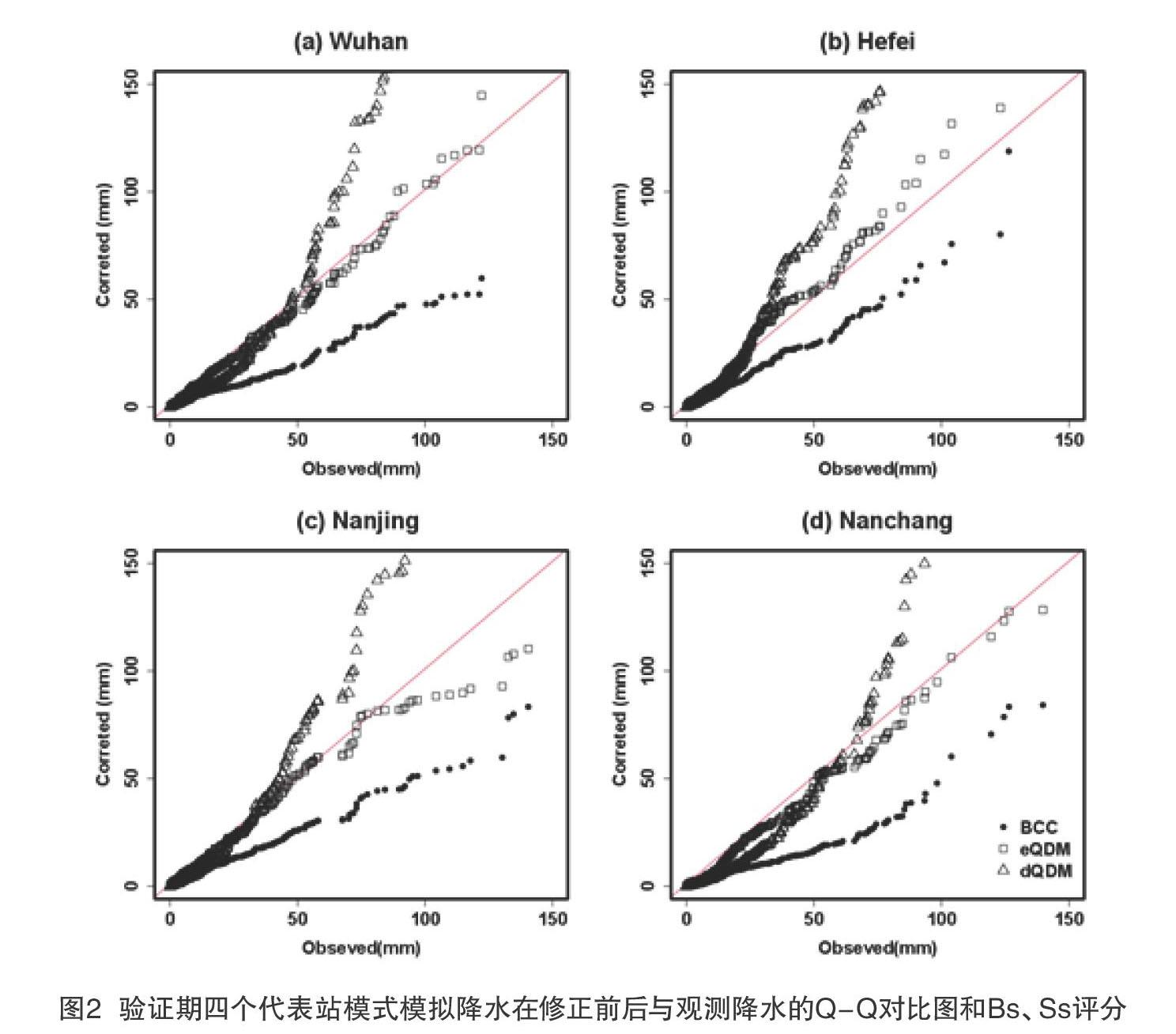
摘 要:本文利用江淮流域1961—2005年76站夏季逐日降水观测资料和BCC-CSM1.1(m)模式模拟数据,构建基于经验和理论分布函数的分位数增量映射(Quantile Delta Mapping, QDM)偏差订正模型eQDM、dQDM,并评估其对江淮流域逐日降水及极端降水的订正效果。研究结果表明:相较于理论分布,基于经验分布的eQDM方法显著改善模式对观测降水的概率分布和空间分布特征的模拟能力;除连续干日订正效果欠佳外,其余四个极端降水指数的均方根误差明显降低,其气候态基本与观测一致,大部分站点的相对误差保持在-20%~20%。
关键词:偏差订正 分位数增量映射 极端降水 江淮流域
中图分类号:P45 文献标识码:A 文章编号:1674-098X(2021)01(c)-0027-06
Performance Evaluation of Quantile Delta Mapping for Extreme Precipitation Simulation Over the Yangtze-Huaihe River Basin
YAO Yiyi1* AIHAITI Ailiyaer1 ZHU Lianhua1,2
(1.School of Mathematics and Statistics, Nanjing University of Information Science & Technology, Nanjing, Jiangsu Province, 210044 China; 2. Key Laboratory of Meteorological Disaster of Ministry of Education, Joint International Research Laboratory of Climate and Environment Change, Collaborative Innovation Center on Forecast and Evaluation of Meteorological Disaster, Nanjing University of Information Science & Technology, Nanjing , Jiangsu Province, 210044 China)
Abstract: The observed summer daily precipitation in 76 stations over the Yangtze-Huaihe River Basin (1961-2005) and the simulation results of BCC-CSM1.1(m) model in the same period are used. Quantile delta mapping (QDM) bias correction method based on empirical and theoretical distribution functions (expressed as eQDM and dQDM) are introduced to evaluate their correction effects on daily precipitation, especially extreme precipitation over the Yangtze-Huaihe River Basin. The results showed that compared with the dQDM, the eQDM significantly improved the model's capacity to simulate the probability distribution and spatial distribution characteristics of observed precipitation. In addition to the poor performance for the continuous dry days, the root-mean-square error (RMSE) of the other four extreme precipitation indexes were significantly reduced, and the climate state were basically consistent with observation with the relative error from -20% to 20% at most of stations.
Key Words: Bias correction; Quantile delta mapping; Extreme precipitation; The Yangtze-Huaihe River Basin
目前,長期气候变化的规划依赖于对未来气候的合理预测。因此,全球气候模式(Global Climate Model, GCM)在气候影响、适应和预测中发挥着关键的作用[1]。然而,尽管其物理过程不断改进,模式依然存在着系统偏差[2]。为弥补数值模拟存在的局限性,目前多采用偏差订正方法[3-4]。如周莉等[5]使用转移累积概率分布法(CDF-t),评估其对湖南省逐日降水模拟能力的改善效果。Guo等[6]针对LMDZ4日气温数据,运用等距离累积分布函数匹配法(EDCDFm)和CDF-t法对模式模拟中国中部和东部极端温度的能力进行评价。Tong等和杨浩等指出分位数映射偏差订正法方法简单,但订正效果良好,目前得到广泛采用[7-8]。
江淮流域是东亚季风降水的中心区域,具有复杂气候特征,模式模拟该区域降水特征时普遍存在较大的偏差。因此,本文……