无人机航测在滑坡快速调查与分析中的应用研究
2021-03-03杜朋召齐菊梅罗延婷牛贝贝
杜朋召 齐菊梅 罗延婷 牛贝贝

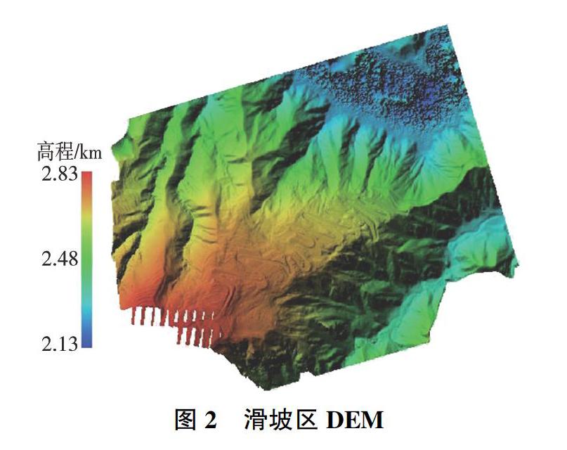

摘 要:为实现滑坡的快速调查与应急影响评价,以某水电站库岸1#滑坡为例,利用无人机航空摄影测量技术,获取滑坡体的高清影像,通过影像处理和地质解译,得到滑坡体的地形与地质数据,进而通过Itascad与Catia三维建模平台构建滑坡体的地质模型和计算模型,最后采用有限元强度折减法对1#滑坡进行了稳定性分析计算。结果表明:基于无人机影像获取的滑坡地形、地质数据是合理的,有限元稳定性分析计算结果与滑坡现场实际变形情况基本一致,无人机航测能够为滑坡灾害的快速调查与应急分析决策提供科学依据。
关键词:无人机;摄影测量;地质灾害;滑坡
中图分类号:P642.2;TU457文献标志码:A
doi:10.3969/j.issn.1000-1379.2021.01.033
引用格式:杜朋召,齊菊梅,罗延婷,等.无人机航测在滑坡快速调查与分析中的应用研究[J].人民黄河,2021,43(1):161-164.
Landslide Geological Survey and Stability Analysis Based on UAV Photogrammetry
DU Pengzhao, QI Jumei, LUO Yanting, NIU Beibei
(Yellow River Engineering Consulting Co., Ltd., Zhengzhou 450003, China)
Abstract:In order to realize the rapid investigation and emergency impact assessment of landslides, taking No.1 landslide on the bank of a hydropower station as an example, using drone aerial photogrammetry technology, the high-definition images of the landslide were obtained, and the terrain and geological data of the landslide were obtained through image processing and geological interpretation. Then, through the three-dimensional modeling platform of Itascad and Catia, the geological model and calculation model of the landslide were constructed. Finally, the stability of the No.1 landslide was analyzed and calculated by using the finite element strength reduction method. The results show that it is reasonable to obtain landslide terrain and geological data based on UAV images, and the finite element stability analysis results are basically the same as the actual deformation situation on the landslide. UAV aerial survey can provide scientific basis for the rapid investigation and emergency analysis of landslide disasters.
Key words: unmanned aerial vehicle; photogrammetry; geological hazard; landslide
1 引 言
无人机航测通过无人机搭载高分辨率摄影相机,快速获取作业区域的高清影像,通过影像处理和信息提取,得到测区地形与地物数据。无人机航测具有机动灵活、快速高效、作业成本低、使用范围广、操作维护简单等特点,在获取小区域高分辨率影像方面具有明显优势。
随着轻型低空无人机技术的不断发展,利用无人机进行地质调查的研究和应用逐渐增加。其中:高姣姣[1]开展了高精度无人机遥感地质灾害调查应用研究,初步建立了无人机航测遥感数据“获取—处理—应用”的完整作业流程;杨力龙[2]开展了基于轻小型……