近30年岱海湖泊面积变化遥感监测及驱动力分析
2021-01-13孟庆吉高战武吴海曼耿忌非范春燕刘金霖鄢上钦
孟庆吉 高战武 吴海曼 耿忌非 范春燕 刘金霖 鄢上钦
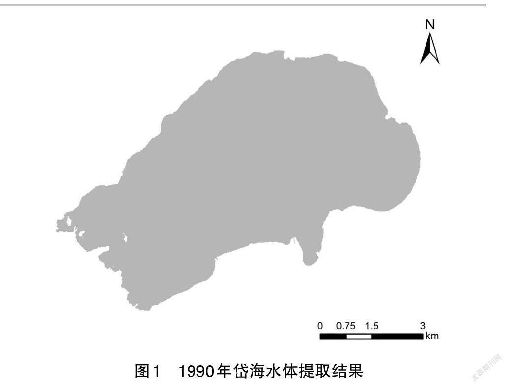
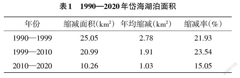
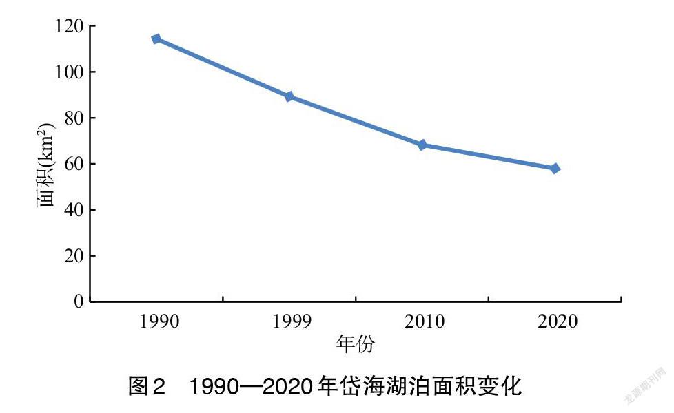
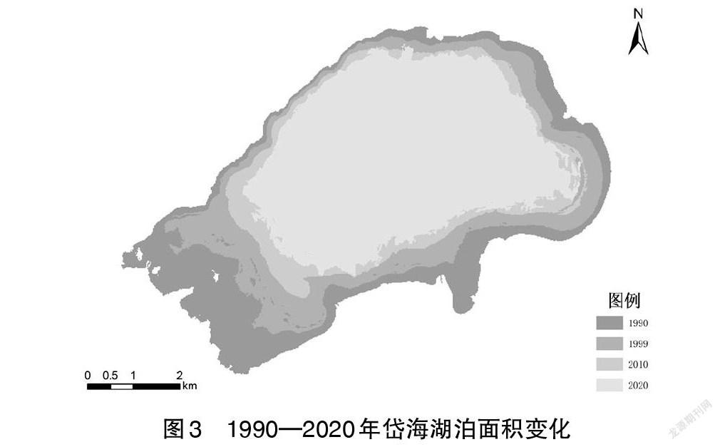
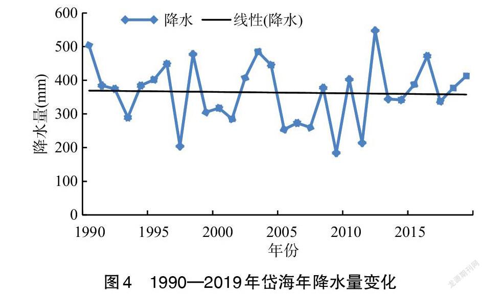


摘 要:岱海处于农牧交错地带,生态环境较为脆弱,湖泊的变化易受自然和人为因素的影响。该研究以Landsat遥感影像为数据源,以岱海为研究区,运用归一化水体指数,分析了1990—2020年岱海湖泊面积的变化状况,并探讨了产生变化的驱动力因素。结果表明,1990—2020年岱海湖泊面积呈持续减小态势,其中1990—1999年湖泊面积萎缩最为显著,缩减面积达25.05km2。岱海湖泊面积缩减的自然因素为多年来降水量减少和气温升高导致的蒸发量增大,致使入湖水量不断减少;人为因素为人类活动对自然环境干扰程度的加深,以及经济的发展使得需水量增加,对湖泊面积造成了巨大影响。
关键词:岱海;湖泊;归一化水体指数;遥感;监测
中图分类号 S127 文献标识码 A 文章编号 1007-7731(2021)24-0106-04
Remote Sensing Monitoring and Driving Force Analysis of Daihai Lake Area Change in the Past 30 Years
MENG Qingji1 et al.
(1Baicheng Teachers College, Baicheng 137000, China)
Abstract: Daihai is located in the agricultural and pastoral transition zone, the ecological environment is relatively fragile, and the changes of the lake are easily affected by natural and human factors. Therefore, this paper uses Landsat remote sensing image as the data source, Daihai as the research area, and uses the normalized water body Index to analyze the changes in the area of Daihai Lake from 1990 to 2020, and explore the driving forces for the changes. Studies have shown that the area of Daihai lakes has continued to decrease from 1990 to 2020. The area of lakes has shrunk most significantly from 1990 to 1999, with a reduced area of 25.05 km2. The natural factors for the reduction in the area of Daihai Lake are the increase in evaporation caused by the decrease in precipitation and the increase in temperature over the years, resulting in the continuous decrease of the amount of water entering the lake; the human factors are the deepening of the interference of human activities on the natural environment, and the economic Development has increased water demand and has had a huge impact on the area of the lake.
Key words: Daihai; Lake; Normalized water index; Remote sensing; Monitoring
湖泊作为地表水生生态系统的重要组成部分,在调节河川径流、发展灌溉、提供工业和饮用的水源等方面发挥着重要的作用[1]。对湖泊的开发和利用需要持有可持续发展的理念,尤其是对于处于农牧交错地带的湖泊,更加需要关注对其合理利用。
近些年来,学者们应用遥感技术对湖泊的变化进行了大量的研究。研究表明,2000—2018年期间,岱海湖泊面积持续缩减且多转化为内陆滩涂和沼泽草地[2];运用人工目视解译方法,分析得出1976—2015年岱海湖面持续萎缩,其中1995—2000年湖面萎缩最显著[3];通过对近50年数据进行分析得出,岱海湖泊面积不断缩小且矿化度升高较快[4];受自然和人为因素的影响,2002—2012年岱海面积持续减小,其重心逐渐向偏北方向移动[5];1989—2018年期间岱海湖面面积呈现为递减趋势,其中人类活动是其变化的主要原因[6]。……