基于北斗的跨境运输管理与服务信息系统设计
2020-08-13康茜姜萍陈为沛
康茜 姜萍 陈为沛
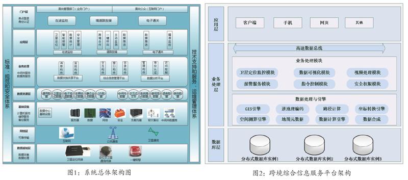
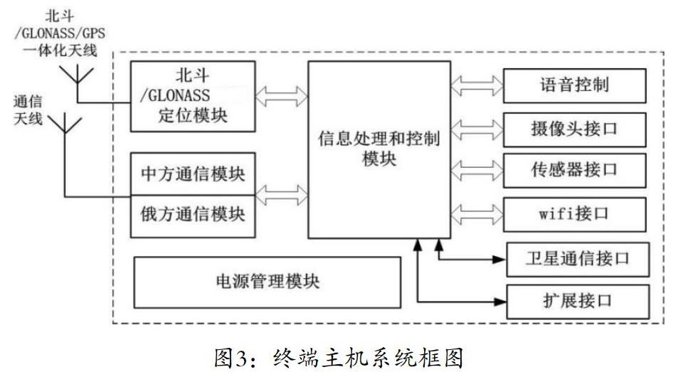
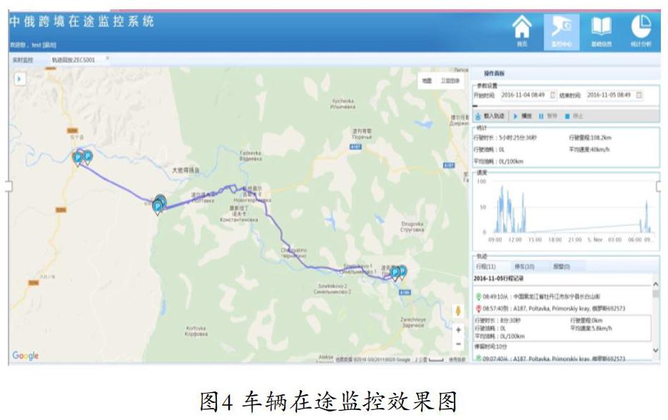
【摘要】本文综合利用北斗卫星导航系统,GLONASS系统和GPS系统,探索研究建立国际道路运输管理与服务系统,通过出入境车辆数据交换,实现国际道路运输车辆行驶状态实时监管,统计分析电子化等功能,平台基于java-web系统,Spirng MVC+My Batis的架构,采用双围栏进出逻辑判断方式,结合车辆设备的定位数据判断车辆出入境状态。终端设计以ATMEL ARM9芯片为核心,内置自适应算法判断跨境车辆所处位置自动切换通讯模块。系统适用于跨境车辆在途监控、道路救援等应用。
【关键词】国际道路运输;在途监控;出入境数据交换;北斗/GLONASS/GPS多模定位
【作者简介】康茜,硕士研究生,工程师,研究方向,北斗卫星导航系统应用技术总体设计、北斗高精度技术研究与应用。
中图分类号:TN94 文献标识码:A 文章编号:1673-0348(2020)012-127-03
Abstract:This paper makes comprehensive use of Beidou satellite navigation system, GLONASS system and GPS system, explores and studies the establishment of international road transport management and service system, and realizes the real-time supervision of international road transport vehicles' driving status and electronic statistical analysis through data exchange of entry and exit vehicles. The platform is based on java-web system, Spirng MVC+My Batis architecture, adopts double fence entry and exit logic judgment mode, and combines the positioning data of vehicle equipment to judge the entry and exit status of vehicles. The terminal design takes ATMEL ARM9 chip as the core, and has built-in adaptive algorithm to judge the location of cross-border vehicles and automatically switch communication modules. The system is suitable for in-transit monitoring of cross-border vehicles, road rescue and other applications.
Keywords:International road transport; In-transit monitoring; Entry and exit data exchange; Beidou /GLONASS/GPS multi-mode positioning
北斗衛星导航系统是继GPS、GLONASS之后第三个成熟的卫星导航系统,该系统可为全球用户提供定位、导航、授时和短报文通信服务。本文综合利用北斗卫星导航系统,GLONASS系统和GPS系统,探索研究建立基于北斗的国际道路运输管理与服务系统,为行业监管部门提供车辆、人员出入境实时数据,开展跨境运输车辆在途监控,道路救援、电子通关等方面应用,可提高我国国际道路运输的管理和技术水平,推动北斗系统与其他导航系统的兼容应用及互操作,提升北斗系统在交通行业应用市场竞争力,推进其在中俄及周边国家的规模化应用。
1. 需求分析
我国的国际道路运输始于20世纪90年代初期,受益于对外开放政策和不断增长的对外贸易,经过20多年来的发展,国际道路运输的重要作用日益显现。……