基于多旋翼无人机GPS坐标计算的树障面积快速测定法
2019-08-13袁文俊郑武略贺敏恒方博廖江雨廖鹏
袁文俊 郑武略 贺敏恒 方博 廖江雨 廖鹏
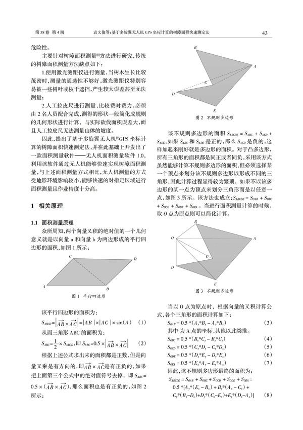
摘 要:为了快速测定树障环境下的任意多边形的面积,提出了基于多旋翼无人机GPS坐标计算的树障面积快速测定法。该方法通过无人机定位取点并选取待测区域外任意一点与多边形各顶点相连接形成多个三角形来计算任意多边形的面积,并在此基础上开发出了一款面积测量软件——无人机面积测量软件1.0。实地面积测量结果表明,该方法能够快速的对指定区域进行面积测量且相对误差精度可达到95%以上。
关键词:多旋翼无人机;GPS;取点;面积测量;
中图分类号:TP39 文獻标识码:A
Rapid Measurement of Tree Barrier Area Based
on GPS Coordinates Calculation of Multi-rotor UAV
YUAN Wen-jun?覮,ZHENG Wu-lue,HE Min-heng,FANG Bo,LIAO Jiang-yu,LIAO Peng
(Super High Voltage Guangzhou Bureau ,China Southern Power Grid,GuangZhou,Guangdong 510000,China)
Abstract:In order to quickly measure the area of any polygon in the tree barrier environment,this paper proposes a rapid measurement method of tree barrier area based on GPS coordinates of multi-rotor UAV. The method calculates the area of an arbitrary polygon by taking the points and selecting a discretionary point outside the area to be measured to connect with the vertices of the polygon to form triangles. Based on this,an area measurement software -- UAV area measurement software 1.0 is developed. Field area measurement results show that the method can quickly measure the area of the specified area and the relative error precision can reach95% or above.
Key words:multi-rotor UAV;GPS;take points;area measurement